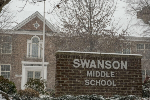
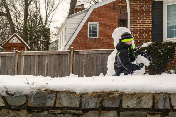
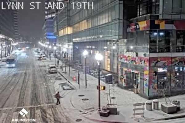
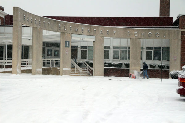
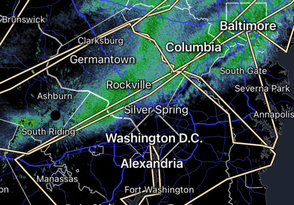
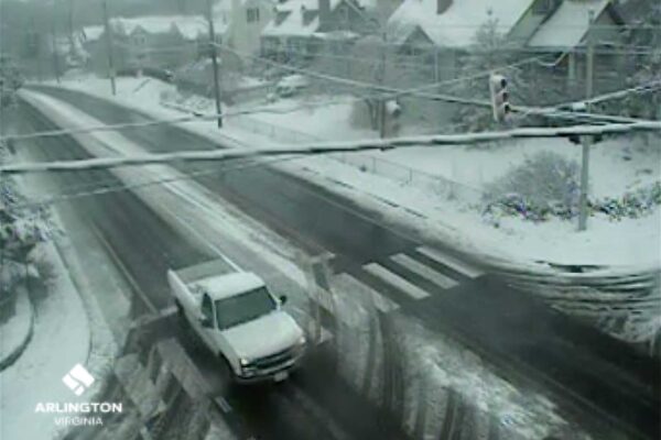
Photos: Spring Snow in Arlington
A spring storm system dropped some 1-4 inches of snow on Arlington this morning.
The snowfall made for some pretty scenery but caused a few problems around town.
We asked readers to send their photos of the snow to us via Twitter and Flickr. Check out some of their submissions, and a few photos taken by us, in the gallery above.
Snowy Conditions Lead to Accidents
(Updated at 9:20 a.m.) Arlington commuters woke up to something of a surprise this morning: accumulated snowfall.
Arlington County says local roads are “slushy,” and its snow removal crews are in the “Phase 2” of snow removal — working to treat heavily-travelled roads.
“Commuters will encounter slushy conditions on area roads,” the county said in an Arlington Alert. “Use caution when approaching intersections and on/off ramps.”
Arlington Public Schools are not impacted by the snowfall; students are currently on spring break. But snow-covered roads perhaps played a factor led in a number of accidents in and around Arlington this morning.
Accidents have been reported on the northbound GW Parkway near Spout Run and Route 123. The second accident involved an overturned car and northbound traffic is reportedly blocked.
Meanwhile, a rollover accident happened earlier at Reagan National Airport.
A vehicle flipped over on the departures roadway, beyond Terminals B and C on the “return to the airport” ramp.
“[The] driver of the vehicle was transported to a local hospital,” said airport spokesman Robert Yingling. “No other occupants [and] no other vehicles [were] involved.”
The vehicle has since been removed and the road reopened.
Federal Gov’t, APS Closed
The federal government and Arlington Public Schools are both closed today due to the “Snowquester” or “Saturn” snow storm.
Although the ground in parts of Arlington has yet to become snow-covered, forecasters say the storm is intensifying and should soon start accumulating here.
Winter Storm Warning Issued
Despite sunny skies and relatively mild temperatures this afternoon, forecasters have issued another reminder that the D.C. area will be blanketed with snow tomorrow.
The National Weather Service has issued a Winter Storm Warning, upgrading the previous Winter Storm Watch. Forecasters say we’re likely to get 4-8 inches of snow tomorrow (Wednesday).
… WINTER STORM WARNING IN EFFECT FROM MIDNIGHT TONIGHT TO 3 AM EST THURSDAY…
THE NATIONAL WEATHER SERVICE IN BALTIMORE MD/WASHINGTON HAS ISSUED A WINTER STORM WARNING FOR SNOW… WHICH IS IN EFFECT FROM MIDNIGHT TONIGHT TO 3 AM EST THURSDAY. THE WINTER STORM WATCH IS NO LONGER IN EFFECT.
* PRECIPITATION TYPE… SNOW.
* ACCUMULATIONS… 4 TO 8 INCHES WITH THE HIGHER AMOUNTS WEST OF INTERSTATE 95.
* TIMING… RAIN MIXING WITH AND CHANGING TO WET SNOW FROM SOUTHWEST TO NORTHEAST TONIGHT AND WEDNESDAY MORNING. SNOW MAY BE MODERATE TO HEAVY AT TIMES WEDNESDAY. SNOW TAPERS OFF WEDNESDAY NIGHT.
* TEMPERATURES… IN THE MID 30S.
* WINDS… NORTHEAST 15 TO 25 MPH. GUSTS UP TO 35 MPH WEDNESDAY AFTERNOON AND NIGHT.
* IMPACTS… SNOW COVERED ROADS WILL MAKE TRAVEL DIFFICULT. HEAVY WET SNOW AND GUSTY WINDS COULD LEAD TO POWER OUTAGES WEDNESDAY AFTERNOON AND NIGHT.
PRECAUTIONARY/PREPAREDNESS ACTIONS…
A WINTER STORM WARNING FOR HEAVY SNOW MEANS SEVERE WINTER WEATHER CONDITIONS ARE EXPECTED OR OCCURRING. SIGNIFICANT AMOUNTS OF SNOW ARE FORECAST THAT WILL MAKE TRAVEL DANGEROUS. ONLY TRAVEL IN AN EMERGENCY. IF YOU MUST TRAVEL… KEEP AN EXTRA FLASHLIGHT… FOOD… AND WATER IN YOUR VEHICLE IN CASE OF AN EMERGENCY.
Meanwhile, the Metropolitan Washington Airports Authority says travelers should expect delays and cancellations over the next 36 hours or so.
Reagan National and Dulles International Airports are operating normally. An approaching winter storm is affecting flights to and from Chicago today. We anticipate winter weather will affect flight operations here on Wednesday, March 6. Check with directly with your airline to monitor the status of your flight and determine if flight rebooking is necessary.
Our airport snow removal personnel and equipment are prepared for the storm. We will update this page with further information when the winter weather arrives.
Winter Storm Watch Issued
Arlington and the rest of the region is under a Winter Storm Watch for Tuesday and Wednesday.
Forecasters say chances are increasing that we’ll get a significant late-season snowstorm starting Tuesday night. The storm could dump more than 5 inches of snow, though the precipitation could be mostly rain if the temperature stays too warm.
From the National Weather Service:
…WINTER STORM WATCH REMAINS IN EFFECT FROM TUESDAY EVENING THROUGH WEDNESDAY EVENING…
* PRECIPITATION TYPE…SNOW.
* ACCUMULATIONS…MORE THAN 5 INCHES POSSIBLE…WITH THE POTENTIAL FOR SIGNIFICANT SNOWFALL SOMEWHERE WITHIN THE WATCH AREA.
* TIMING…PRECIPITATION MIXING WITH AND CHANGING TO SNOW TUESDAY NIGHT. SNOW CONTINUING INTO WEDNESDAY EVENING.
* TEMPERATURES…IN THE LOWER AND MID 30S.
* WINDS…NORTHEAST 10 TO 20 MPH WITH GUSTS UP TO 30 MPH.
* IMPACTS…DIFFICULT DRIVING CONDITIONS. HEAVY WET SNOW AND GUSTY WINDS COULD LEAD TO POWER OUTAGES.
PRECAUTIONARY/PREPAREDNESS ACTIONS…
A WINTER STORM WATCH MEANS THERE IS A POTENTIAL FOR SIGNIFICANT SNOW…SLEET…OR ICE ACCUMULATIONS THAT MAY IMPACT TRAVEL. CONTINUE TO MONITOR THE LATEST FORECASTS.
A STRONG LOW PRESSURE SYSTEM IS EXPECTED TO IMPACT THE AREA TUESDAY NIGHT THROUGH WEDNESDAY NIGHT…BRINGING THE POTENTIAL FOR HEAVY WET SNOW…GUSTY WINDS…AND POSSIBLY COASTAL FLOODING. A WINTER
STORM WATCH HAS BEEN POSTED TUESDAY NIGHT THROUGH WEDNESDAY EVENING FOR THE BALTIMORE AND WASHINGTON DC METROPOLITAN AREAS. UNCERTAINTY REMAINS WITH THE TRACK OF THE LOW AND LOCATION OF THE RAIN-SNOW LINE…WHICH ULTIMATELY WILL DETERMINE SNOWFALL TOTALS. PLEASE MONITOR THE LATEST FORECASTS FOR UPDATES.
NWS Issues Flood Watch
Update at 3:35 p.m. — Although the weather remains rainy and windy, the National Weather Service has canceled the flood watch.
A flood watch has been issued for Arlington and the surrounding areas in light of the heavy rains that are predicted for this afternoon.
The National Weather Service issued the watch, which begins at 3:00 p.m. and remains in effect through the evening.
* A PERIOD OF MODERATE TO LOCALLY HEAVY RAINFALL IS EXPECTED
TUESDAY AFTERNOON AND EVENING. RAINFALL TOTALS BETWEEN ONE AND
TWO INCHES ARE EXPECTED.* LOCALLY HEAVY RAINFALL MAY CAUSE SMALL STREAMS AND CREEKS TO
RISE OUT OF THEIR BANKS…OVERFLOWING LOW LYING AND URBAN
AREAS. DO NOT EVER DRIVE INTO FLOOD WATERS.PRECAUTIONARY/PREPAREDNESS ACTIONS…
A FLOOD WATCH MEANS THERE IS A POTENTIAL FOR FLOODING BASED ON
CURRENT FORECASTS.YOU SHOULD MONITOR LATER FORECASTS AND BE ALERT FOR POSSIBLE
FLOOD WARNINGS. THOSE LIVING IN AREAS PRONE TO FLOODING SHOULD BE
PREPARED TO TAKE ACTION SHOULD FLOODING DEVELOP.
Although the rains should stop by tonight, the effects could be felt for several days. The NWS has also issued a Hazardous Weather Outlook for the area.
.DAY ONE…TODAY AND TONIGHT
HEAVY RAIN THIS AFTERNOON AND EVENING HAS THE POTENTIAL TO CAUSE
FLOODING OF STREAMS AND LOW AREAS IN THE WASHINGTON AND BALTIMORE
METRO AREAS. A FLOOD WATCH HAS BEEN ISSUED FOR THESE AREAS.OVER THE WATERS…GUSTY WINDS ARE EXPECTED TODAY AND TONIGHT AND
A SMALL CRAFT ADVISORY HAS BEEN ISSUED.TIDES WILL BE HIGHER THAN NORMAL DUE TO ONSHORE WINDS. FOR THOSE
ALONG THE WESTERN SHORE OF THE MARYLAND CHESAPEAKE BAY AND THE
SHORELINE OF THE TIDAL POTOMAC RIVER…MINOR TIDAL FLOODING IS
POSSIBLE DURING THE TIMES OF HIGH TIDE BETWEEN THIS AFTERNOON AND
WEDNESDAY MORNING..DAYS TWO THROUGH SEVEN…WEDNESDAY THROUGH MONDAY
OVER THE WATERS…GUSTY WINDS MAY REMAIN STRONG ENOUGH TO NEED A
SMALL CRAFT ADVISORY THROUGH WEDNESDAY NIGHT.TIDES WILL BE HIGHER THAN NORMAL DUE TO ONSHORE WINDS. FOR THOSE
ALONG THE WESTERN SHORE OF THE MARYLAND CHESAPEAKE BAY AND THE
SHORELINE OF THE TIDAL POTOMAC RIVER…MINOR TIDAL FLOODING IS
POSSIBLE DURING THE TIMES OF HIGH TIDE WEDNESDAY MORNING.RAIN OR SNOW SHOWERS ARE POSSIBLE WEDNESDAY NIGHT AND THURSDAY.
Arlington Under Tornado Watch
Arlington and the surrounding D.C. region is now under a Tornado Watch.
The warning of possible tornadic activity comes as a strong storm front approaches the area. We’re also under a Flash Flood Watch and a Wind Advisory. From the National Weather Service:
… WIND ADVISORY IN EFFECT UNTIL 6 AM EST THURSDAY…
THE NATIONAL WEATHER SERVICE IN BALTIMORE MD/WASHINGTON HAS ISSUED A WIND ADVISORY… WHICH IS IN EFFECT UNTIL 6 AM EST THURSDAY.
* TIMING… THE STRONGEST WINDS ARE EXPECTED AHEAD OF A COLD FRONT LATE THIS AFTERNOON AND EVENING.
* WINDS… SOUTH 25 TO 35 MPH WITH GUSTS 45 TO 50 MPH. WINDS WILL SHIFT TO THE WEST BEHIND THE COLD FRONT OVERNIGHT.
* IMPACTS… THE STRONG WINDS COULD BRING DOWN TREE LIMBS AND CAUSE SCATTERED POWER OUTAGES. UNSECURED OBJECTS MAY BE BLOWN ABOUT… AND HIGH PROFILE VEHICLES MAY BECOME DIFFICULT TO MANEUVER.
PRECAUTIONARY/PREPAREDNESS ACTIONS…
A WIND ADVISORY MEANS THAT WIND GUSTS OF 45 TO 55 MPH ARE EXPECTED. WINDS THIS STRONG CAN MAKE DRIVING DIFFICULT… ESPECIALLY FOR HIGH PROFILE VEHICLES
Very Heavy Rain, Thunderstorms Possible Tonight
A cold front will bring high winds, heavy rain and possible thunderstorms tonight.
A Flash Flood Watch is in effect for Arlington and the D.C. region and Arlington County just issued the following alert.
The National Weather Service (NWS) reports they are monitoring 3 weather related threats to the metropolitan DC area starting this afternoon and into the night; high winds, a line of thunderstorms, and rainfall accumulations.
The NWS predicts wind gusts around 35-40 MPH starting in the early afternoon hours. The NWS is also monitoring threats of a line of thunderstorms approaching from the west which is expected to reach the area between 7 and 10 PM. The storms have the potential to produce heavy rainfall and wind gusts up to 70 MPH. The National Weather Service reports this line of thunderstorms is fast moving and will last around 15 to 20 minutes with residual rainfall immediately following. The area should expect up to 2 inches of rainfall.
APS Closed; Traffic Volume Light
Arlington Public Schools are closed today thanks to the threat of freezing rain and icy roads this morning.
Arlington was one of the only local school systems to not close early on Friday due to the threat of snow. It’s now the only school system inside the Beltway to close today; D.C., Montgomery County, Prince George’s County and Alexandria are all on a two-hour delay.
Meanwhile, with the federal government on a delayed opening, traffic volume on local roads and highways is very light.
No major accidents have been reported so far in Arlington.
Winter Weather Advisory: Slippery Morning Commute
Update at 10:40 p.m. — The Office of Personnel Management is telling federal employees to stay off the road until 10:00 a.m. Federal offices will open to the public at noon.
The National Weather Service has issued a Winter Weather Advisory for Arlington and the D.C. region.
Forecasters warn that sleet and freezing rain might make for a slippery commute tomorrow (Monday) morning. The following advisory was updated at 7:45 p.m.
… WINTER WEATHER ADVISORY NOW IN EFFECT FROM 3 AM TO 10 AM EST MONDAY…
* PRECIPITATION TYPE… FREEZING RAIN… POSSIBLY MIXED WITH SLEET AT THE ONSET.
* ACCUMULATIONS… A FEW HUNDREDTHS OF AN INCH OF ICE FROM FREEZING RAIN. LITTLE OR NO SLEET ACCUMULATION.
* TIMING… DEVELOPING IN THE VERY EARLY HOURS MONDAY MORNING… AND CONTINUING THROUGH MID MORNING ON MONDAY. TEMPERATURES WILL RISE ABOVE FREEZING BY 10 AM MONDAY MORNING… CHANGING THE PRECIPITATION TO RAIN.
* TEMPERATURES… IN THE UPPER 20S TO NEAR 30.
* WINDS… SOUTH 5 TO 10 MPH.
* IMPACTS… ICING WILL PRODUCE SLIPPERY CONDITIONS ON UNTREATED ROADS… BRIDGES AND SIDEWALKS… PARTICULARLY DURING THE MONDAY MORNING COMMUTE.
PRECAUTIONARY/PREPAREDNESS ACTIONS…
A WINTER WEATHER ADVISORY MEANS THAT PERIODS OF SNOW… SLEET… OR FREEZING RAIN WILL CAUSE TRAVEL DIFFICULTIES. BE PREPARED FOR SLIPPERY ROADS AND LIMITED VISIBILITIES… AND USE CAUTION WHILE DRIVING.
As Snow Falls, A Reminder About Snow Removal
With snow falling and the evening rush hour beginning, Arlington County snow removal crews are gearing up to keep primary and secondary arterial streets clear.
According to the Arlington County website, the county is currently in a Phase 1 snow alert. Soon, crews will likely move into Phase 2, clearing accumulated snow from arterial streets.
“Our crews are on alert and scheduled to work through the evening as needed,” said county spokeswoman Laura G. Smith. “The public [can] check the snow status on our website.”
The video above, released by the county on Wednesday, explains Arlington’s snow removal process and its four phases.
The video also reminds residents that, by ordinance, all Arlington property owners are required to clear snow and ice from public sidewalks adjacent to their property within 24 hours after snow stops falling. In the event of snowfall over six inches, that timeframe is increased to 36 hours.
Property owners are also prohibited from depositing snow onto roads and other public property.
Snow Could Snarl Commute, But APS to Dismiss on Time
Arlington Public Schools students will be dismissed on-time from school today, despite a predicted evening snowfall.
A Winter Weather Advisory has been issued for Arlington and the D.C. region, warning of the potential for about an inch of snow between 2:00 and 9:00 p.m. Though relatively light, the snow could wreak havoc with traffic during the evening rush hour.
(On January 26, 2011, a much heavier snowfall during the evening rush hour resulted in motorists abandoning their cars on the GW Parkway.)
While Montgomery, Fairfax, Prince George’s and Loudoun County schools have announced early dismissals, Arlington Public Schools announced at 11:20 a.m. that students would not enjoy the same abbreviated school day. All APS after-school and evening activities, however, have been canceled.
“Arlington Public Schools will dismiss on time,” the school system said. “All APS after-school and evening activities are canceled, including extracurricular activities, interscholastic contests, team practices, field trips, adult and community education classes, and recreation programs in schools and on school grounds. Extended Day will remain open until 6 p.m. but those parents are encouraged to pick up their children earlier if possible.”
From the National Weather Service:
… WINTER WEATHER ADVISORY IN EFFECT FROM 2 PM THIS AFTERNOON TO 9 PM EST THIS EVENING…
THE NATIONAL WEATHER SERVICE IN BALTIMORE MD/WASHINGTON HAS ISSUED A WINTER WEATHER ADVISORY FOR SNOW… WHICH IS IN EFFECT FROM 2 PM THIS AFTERNOON TO 9 PM EST THIS EVENING.
* PRECIPITATION TYPE… SNOW
* ACCUMULATIONS… AROUND AN INCH.
* TIMING… SNOW WILL BEGIN DURING THE MID AFTERNOON AND TAPER OFF IN THE EVENING. SNOW MAY BE MODERATE TO LOCALLY HEAVY AT TIMES DURING THE LATE AFTERNOON AND EARLY EVENING.
* TEMPERATURES… IN THE LOWER 20S.
* WINDS… SOUTH 5 TO 10 MPH.
* IMPACTS… ROADS WILL BECOME SNOW COVERED AND SLIPPERY… RESULTING IN HAZARDOUS TRAVEL DURING THE AFTERNOON AND EVENING COMMUTE.
PRECAUTIONARY/PREPAREDNESS ACTIONS… A WINTER WEATHER ADVISORY FOR SNOW MEANS THAT PERIODS OF SNOW WILL CAUSE PRIMARILY TRAVEL DIFFICULTIES. BE PREPARED FOR SNOW COVERED ROADS AND LIMITED VISIBILITIES… AND USE CAUTION WHILE DRIVING.
Snow Snarls Commute, Late Start for Schools
(Updated at 8:50 a.m.) Snow and cold weather are causing slick conditions on the roads and making a mess of the morning commute.
In addition to accidents, police scanner traffic indicates dozens of drivers skidding and nearly spinning out on the slippery roads. There are also numerous reports of vehicles getting stuck, particularly in hilly areas. Police report some drivers not paying attention closely enough and running into other vehicles, or even running over flares that are marking existing traffic problems. Drivers are reminded to slow down and use extra caution.
All Arlington Public Schools will open two hours late and the Extended Day program will open two hours late. Morning field trips are canceled. All APS administrative offices and the pools will open on time.
The Office of Personnel Management confirms that federal agencies are open, but employees have the option for unscheduled leave or unscheduled telework. Arlington County government is opening on time, but workers have the option for unscheduled leave or telework, with supervisor approval.
The following closures and schedule alterations are in effect for the Arlington Department of Parks and Recreation:
- All Preschool programs are cancelled.
- All senior centers will open at noon, but lunch programs and transportation service at Walter Reed, Langston-Brown and Arlington Mill at Fairlington are cancelled.
- All Enjoy Arlington classes and nature center programs scheduled to start prior to 11:59 am are cancelled in all buildings. All Enjoy Arlington classes and nature center programs with scheduled start time of noon or later will proceed as scheduled.
- All joint use facilities Drew, Carver, Gunston, Langston, and Thomas Jefferson Community Center will open at 10:00 a.m. Barcroft, Lee, Madison, Dawson Terrace, Lubber Run, Fairlington and Walter Reed center hours and programs will proceed as scheduled.
The Department of Environmental Services reports that crews are currently working to treat all primary (red) and secondary (blue) roads on the snow map, and expect to move into the neighborhoods later in the day. DES offers the following tips:
- Do not drive unless necessary so roads will be open for emergency and snow removal vehicles.
- Help your neighbors clean the sidewalk on the same side of the street as parked cars to increase pedestrian safety.
- Keep snow cleared from fire hydrants, storm drains and downspouts on your home.
The National Weather Service’s Winter Weather Advisory remains in effect until 9:00 a.m.
NWS Issues Winter Weather Advisory
The National Weather Service has issued a Winter Weather Advisory for Arlington and the rest of the D.C. area. The advisory begins at midnight and runs through 9:00 a.m. on Thursday. Although the Capital Weather Gang points out that not much accumulation is expected, if any, temperatures in the 20s will create slick conditions when and if there is precipitation.
…WINTER WEATHER ADVISORY IN EFFECT FROM MIDNIGHT TONIGHT TO
9 AM EST THURSDAY…THE NATIONAL WEATHER SERVICE IN BALTIMORE MD/WASHINGTON HAS
ISSUED A WINTER WEATHER ADVISORY FOR SNOW… WHICH IS IN EFFECT
FROM MIDNIGHT TONIGHT TO 9 AM EST THURSDAY.* PRECIPITATION TYPE…SNOW
* ACCUMULATIONS…AROUND AN INCH.
* TIMING…OVERNIGHT INTO EARLY THURSDAY MORNING.
* TEMPERATURES…UPPER TEENS AND LOWER 20S.
* WINDS…NORTHEAST 5 TO 10 MPH OVERNIGHT BECOMING NORTH 10 TO 20
MPH THURSDAY MORNING.* IMPACTS…ANY UNTREATED SURFACES WILL BECOME SNOW COVERED AND
SLIPPERY. ANY SNOW COVERED SURFACES WILL REMAIN SLIPPERY THROUGH
THE MORNING RUSH.PRECAUTIONARY/PREPAREDNESS ACTIONS…
A WINTER WEATHER ADVISORY MEANS THAT PERIODS OF SNOW WILL CAUSE
TRAVEL DIFFICULTIES. BE PREPARED FOR SLIPPERY ROADS AND LIMITED
VISIBILITIES…AND USE CAUTION WHILE DRIVING.
County Preps for Snow, NWS Issues Advisory
Update at 2:35 p.m. — The National Weather Service has discontinued its Winter Weather Advisory for Arlington the immediate D.C. metro area. Far suburbs remain under an advisory.
(Updated at 9:55 a.m.) Forecasters tweaked their predictions overnight for what intensity of storm they expect to hit the D.C. region today. While there’s still some uncertainty, it appears the impact will be less than originally anticipated.
The latest forecast from the Capital Weather Gang suggests the area could experience drizzle in the morning, changing to light snow in the afternoon, but with little accumulation. It’s expected that areas south of Arlington will get the heaviest snow, but that could change if the storm suddenly surges north.
According to Arlington County Department of Environmental Services spokeswoman Shannon Whalen McDaniel, crews began equipping vehicles with snow removal equipment yesterday. The preparations will continue today, and a crew will be on hand for snow removal this evening if necessary. Should conditions worsen later tonight, another crew will come in and work overnight into Friday morning.
The National Weather Service issued a Winter Weather Advisory this morning for much of the region, including Arlington. It runs today from 2:00-11:00 p.m. The Winter Storm Watch issued by the NWS yesterday has been canceled.
……WINTER WEATHER ADVISORY NOW IN EFFECT FROM 2 PM THIS AFTERNOON
TO 11 PM EST THIS EVENING…* PRECIPITATION TYPE…SNOW.
* ACCUMULATIONS…1 TO 3 INCHES. THE HIGHEST AMOUNTS WILL BE SOUTH
OF WASHINGTON DC.* TIMING…RAIN THIS MORNING WILL MIX WITH AND THEN CHANGE TO SNOW
DURING THE MID AFTERNOON. SNOW MAY BE LOCALLY HEAVY AT TIMES…
ESPECIALLY SOUTH OF WASHINGTON DC. SNOW WILL COME TO AN END
LATE THIS EVENING.* TEMPERATURES…FALLING TO THE MID 30S LATE THIS AFTERNOON.
* WINDS…NORTHWEST 5 TO 10 MPH.
* IMPACTS…ROADS MAY BECOME SNOW COVERED DURING THE EVENING RUSH
HOUR…ESPECIALLY SOUTH OF WASHINGTON DC.PRECAUTIONARY/PREPAREDNESS ACTIONS…
A WINTER WEATHER ADVISORY FOR SNOW MEANS THAT PERIODS OF SNOW
WILL CAUSE PRIMARILY TRAVEL DIFFICULTIES. BE PREPARED FOR SNOW
COVERED ROADS AND LIMITED VISIBILITIES…AND USE CAUTION WHILE
DRIVING.


