")
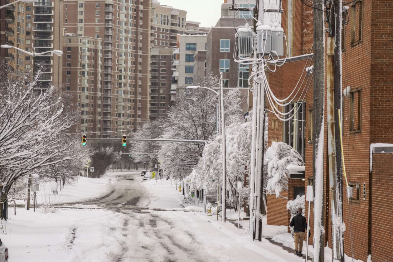
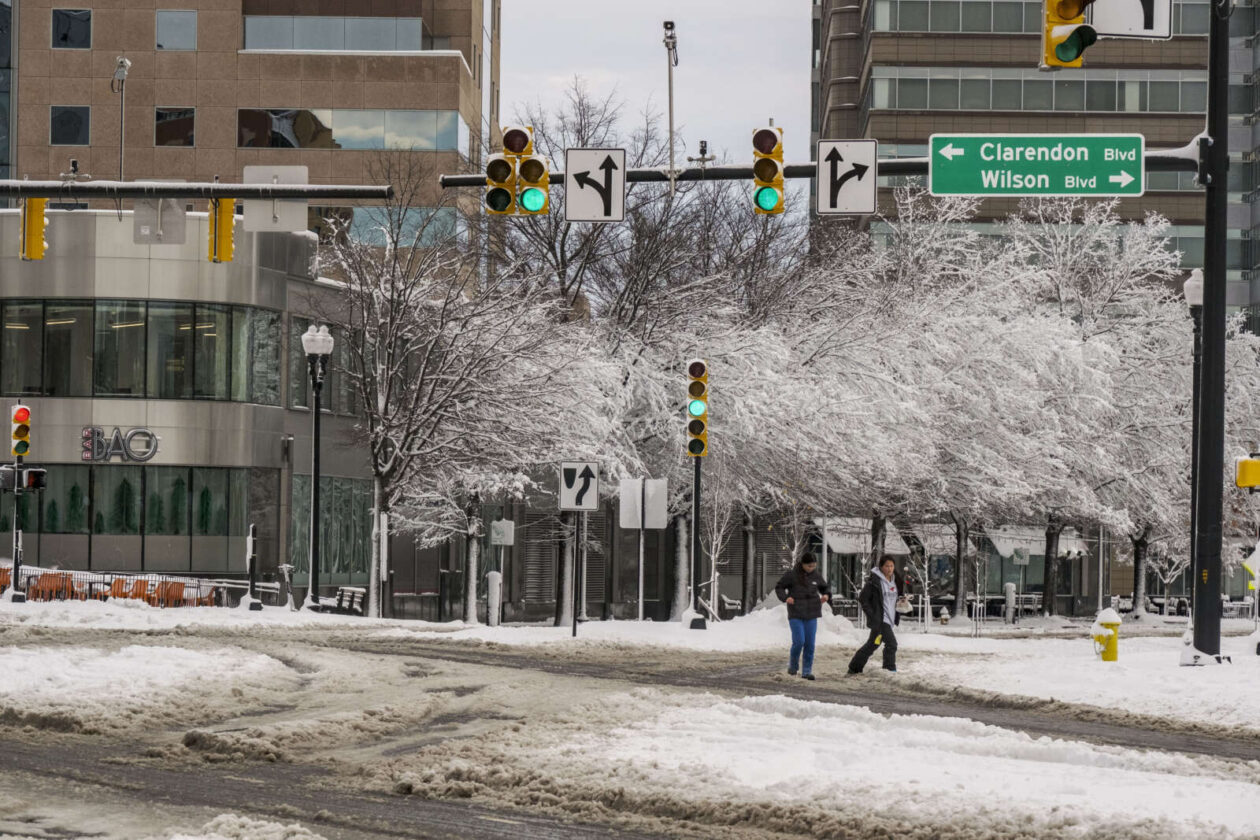
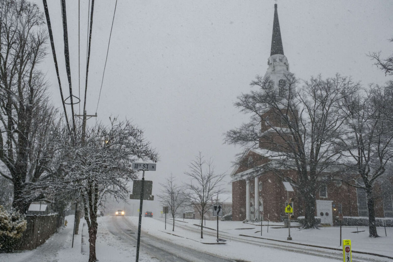
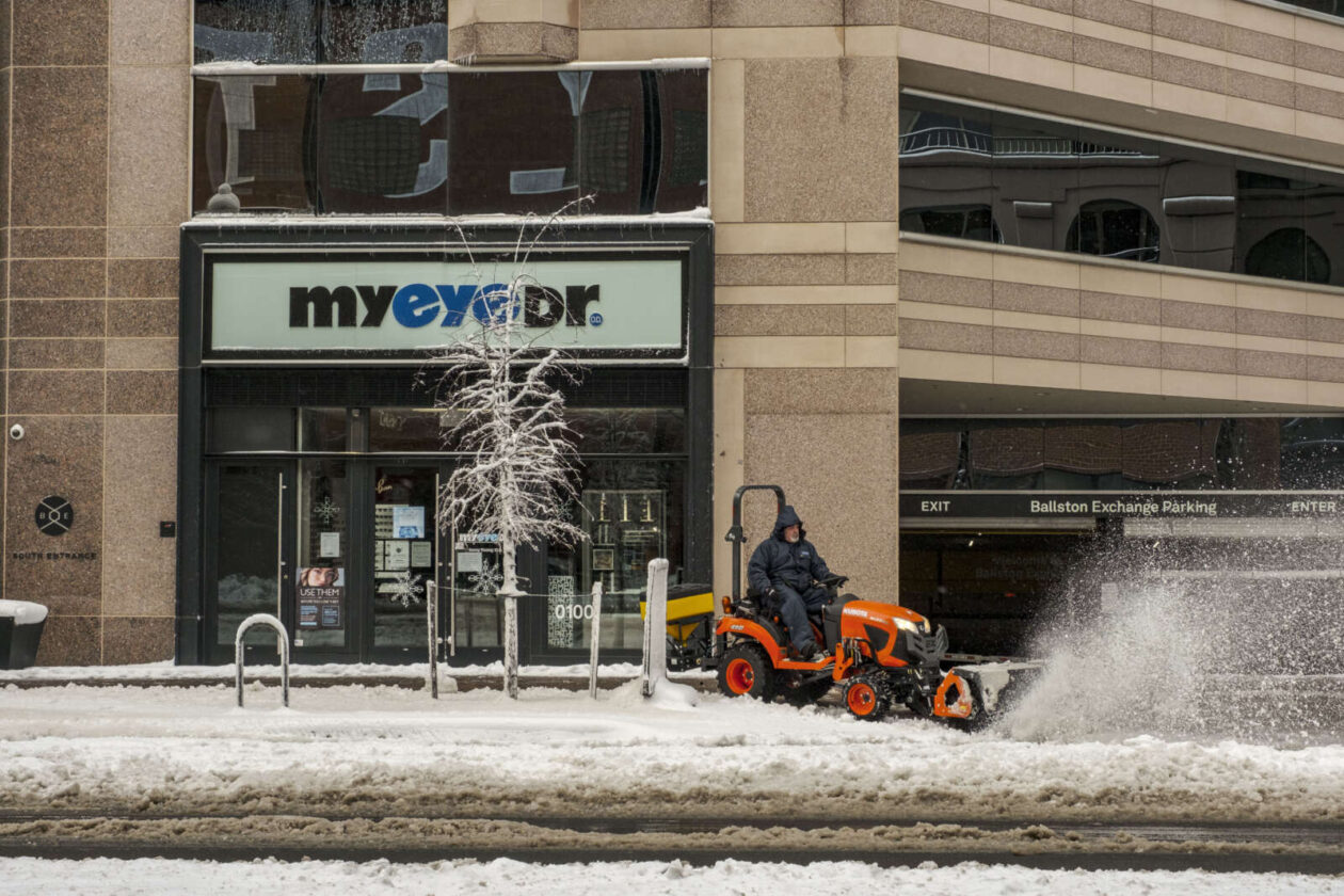
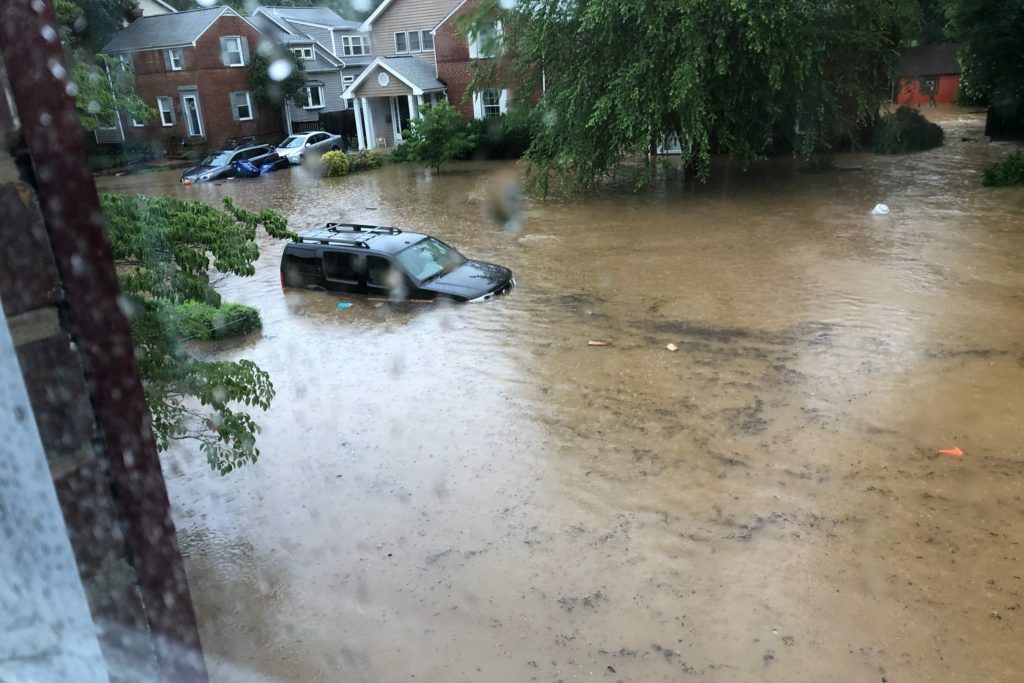
(Updated on 8/18/23) After a late July tempest plunged roughly 35,000 Arlington residents into darkness, ARLnow posed a pressing question to Virginia’s largest electric utility: Why not move all power lines underground?
The short answer is red tape and price.
Local elected officials have been interested in burying power lines since the 1980s, as doing so can reduce power outages and restoration times after storm-induced outages. The trade-offs, however, include cost, customer buy-in and longer repair times.
Historically, cost has been the biggest deterrent. Virginia, Dominion and Arlington County have balked at spearheading efforts at their respective levels, citing costs. This has left the utility company and Arlington County to piece together a patchwork approach prioritizing vulnerable lines, willing property owners and deep-pocketed developers.
Whenever a storm blows through, however, causing power disruptions and requiring maintenance work, the question of a broader effort resurfaces.
Feels like we should maybe consider the possibility of planning how to under ground all of these lines 👀😳 pic.twitter.com/n8FS38DHO4
— Maureen Coffey (she/her) (@maureencoffeyva) July 30, 2023
In an interview, Dominion spokeswoman Peggy Fox underscored two obstacles.
First, the utility company needs permission from property owners, also known as an easement, to access their land. People do not always grant that permission because, Fox said, “not everybody wants the construction that goes along with it.”
“We can’t just come in and do what we want. These are people’s properties, and we want to work with them,” she said in a phone interview.
Second, burying power lines would cost billions of dollars.
After Hurricane Isabel devastated Virginia’s electrical grid in 2003, the Virginia General Assembly tasked the State Corporation Commission — which regulates utilities in Virginia — with studying the feasibility of relocating the state’s overhead distribution power lines underground.
The study says the project aimed to decrease weather-related utility interruptions, reduce maintenance costs and lessen “visual pollution.”
Elected officials scrapped the project after learning it could cost around $83 billion, to be borne by utility customers via higher taxes or rates, and could cause “significant disruptions.”
“The potential benefits, both to the utilities and to the economy, resulting from the elimination of tree trimming maintenance, vehicle accidents, post-storm restoration, and lost sales during outages, do not appear to be sufficient to offset the initial construction costs associated with a comprehensive program to relocate the currently existing overhead utility distribution lines to underground,” the report stated.
Fox said she cannot “pinpoint” how much it would cost to underground all overhead power lines in Arlington, let alone the state. Adjusted for inflation, $83 billion would be roughly $130 billion today.
Arlington County has also shied away from taking on this work over costs. In 2015, then-Arlington County Board Chair Mary Hynes said a local effort to bury electrical and telecommunication wires would cost billions of dollars the county did not have, the Sun Gazette reported at the time.
Nevertheless, Dominion and the county have taken steps to move underground several miles of power lines in Arlington.
In 2014, Dominion embarked on its Strategic Underground Plan (SUP) to bury 4,000 miles of vulnerable overhead lines throughout the state. So far, it has buried around 1,907 miles — nearly the halfway point.
")
(Updated at 3 p.m.) A widespread outbreak of severe weather is expected this evening, prompting a Tornado Watch for Arlington and much of the region.
Forecasters say the threats include “damaging and locally destructive hurricane-force winds, along with the potential for large hail and tornadoes, even strong tornadoes.”
Winds in excess of 70 miles per hour are possible.
")
The Tornado Watch is in effect until 9 p.m.
Arlington Public Schools, meanwhile, is closing facilities early today due to the weather threat. From a School Talk email to families:
Due to forecasted severe weather, Arlington Public Schools will shift to virtual operations today, Aug. 7, at 4 p.m. All APS facilities and programs held after 4 p.m. are canceled unless otherwise stated.
Extracurricular [activities], games, team practices, field trips, adult education classes and programs in schools and on school grounds are canceled this evening. For your safety, we strongly urge the community to stay off the roads between the hours of 4 and 8 p.m.
Federal government and Arlington National Cemetery are also closing early today, at 3 p.m., while Arlington County government offices are closing at 4 p.m.
The expected outbreak follows the storms just over a week ago that toppled trees throughout Arlington and knocked out power to more than 34,000 Dominion customers.
More from the National Weather Service:
…SEVERE WEATHER OUTBREAK EXPECTED OVER THE MID-ATLANTIC REGION BETWEEN 2 PM AND 10 PM TODAY, INCLUDING THE GREATER BALTIMORE/WASHINGTON METROPOLITAN AREAS…
An outbreak of severe storms is expected this afternoon and evening across the greater Baltimore/Washington region, with numerous severe thunderstorms expected. There is a significant threat for damaging and locally destructive hurricane-force winds, along with the potential for large hail and tornadoes, even strong tornadoes.
The timing of this outbreak varies with your location. West of the Blue Ridge Mountains, you can expect the storms to arrive between 12 Noon and 3 PM. East of the Blue Ridge Mountains, timing will be from 4 PM to 8 PM. The greater Baltimore/Washington Metropolitan Areas can expect the storms to arrive between 5 PM and 7 PM.
Now is the time to review your severe weather safety procedures for the possibility of dangerous weather today. Do not be outdoors when the storms arrive. When you hear thunder, go indoors to a sturdy building or structure. While seeking shelter indoors, go to the lowest floor to an interior room. Stay away from windows. Those in mobile homes or weaker structures should plan ahead of time to shelter in a stronger shelter. Be prepared for extended power outages, and the potential for some roads to be blocked by fallen trees.
For the after-event cleanup, do not go outside until 30 minutes after you hear the last thunder, otherwise you will be still susceptible to lightning strikes. Be aware of downed power lines and unstable branches and trees.
Stay tuned to NOAA Weather Radio, weather.gov, or other media for watches and warnings. If a Severe Thunderstorm Warning or Tornado Warning is issued for your area, move to a place of safety, ideally in an interior room on the lowest level of a sturdy building.
A tornado watch has been issued for parts of District of Columbia, Maryland, Pennsylvania, Virginia and West Virginia until 9 PM EDT pic.twitter.com/Z92GYLkeFp
— NWS Tornado (@NWStornado) August 7, 2023
Much of the D.C. area, including Arlington, is under a 4 out of 5 risk of severe weather, a rare designation not seen in the region in more than a decade.
")
Get ready for some wild weather over the next day and a half.
First up are some storms tonight (Sunday) that are likely to be packing torrential rainfall. The heavy rain could cause flash flooding, prompting a Flood Watch to be issued this afternoon, taking effect at 8 p.m.
More from the National Weather Service:
239 PM EDT Sun Aug 6 2023
…FLOOD WATCH IN EFFECT FROM 8 PM THIS EVENING TO 2 AM EDT MONDAY…
* WHAT…Flash flooding caused by excessive rainfall is possible.
* WHERE…Portions of DC, Maryland and northern Virginia, including the following areas: in DC, District of Columbia. In Maryland, Anne Arundel, Central and Southeast Howard, Central and Southeast Montgomery, Prince Georges, Southeast Harford and Southern Baltimore. In northern Virginia, Arlington/Falls Church/Alexandria, Central and Southeast Prince William/Manassas/Manassas Park, Fairfax and Stafford.
* WHEN…From 8 PM this evening to 2 AM EDT Monday.
* IMPACTS…Excessive runoff may result in flooding of rivers, creeks, streams, and other low-lying and flood-prone locations.
* ADDITIONAL DETAILS…
– Heavy rainfall moving through with the potential for 1 to 2 inches of rainfall, locally higher, in a short period of time.
– Please visit www.weather.gov/safety/flood for flood safety and preparedness information
A Flood Watch is in effect from 8PM this evening to 2AM Monday. Showers and thunderstorms are expected to move through the watch area with the potential to produce 1-2 inches of rainfall in a short time frame. Locally higher precipitation totals are possible. #VAwx #DCwx #MDwx pic.twitter.com/T5k7cxvzzP
— NWS Baltimore-Washington (@NWS_BaltWash) August 6, 2023
Monday has the potential for even more active weather.
Arlington, D.C. and other parts of the region are under an “enhanced” risk of severe weather, according to a National Weather Service outlook. Severe winds are likely, according to NWS forecasters, noting the “seriousness” of the threat.
Meanwhile, large hail and even a tornado are also possible in the D.C. area.
")
According to NWS, this is the first time that D.C. has ever had a 45% or greater risk of severe winds on its next-day outlook.
The last instance of such a high probability of severe winds was the same-day outlook on Halloween day 2019.
Monday continues to look like a very busy & significant day across the region. We were upgraded to a level 3 out of 5 risk for severe storms overnight.
All hazards are on the table with even the potential for a couple tornadoes. Stay weather aware! #vawx #mdwx #dcwx #wvwx pic.twitter.com/mmTFL6ibHa
— Washingtonian Weather Geeks (@WashingtonianWx) August 6, 2023
The National Weather Service has placed the DC region under a level 3 out of 5 for severe potential late Monday, which means “numerous severe storms possible.” Damaging winds, hail, an isolated tornado are all possible. More details in our full forecast: https://t.co/zESWh64XVn pic.twitter.com/svM66OY4MX
— Capital Weather Gang (@capitalweather) August 6, 2023
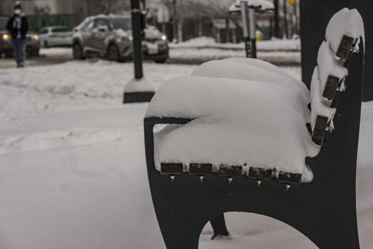
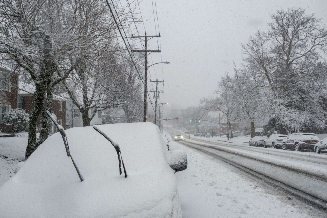
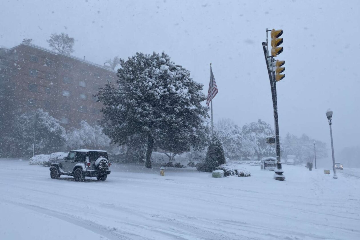
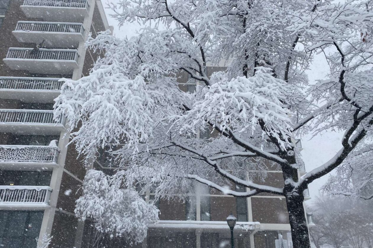
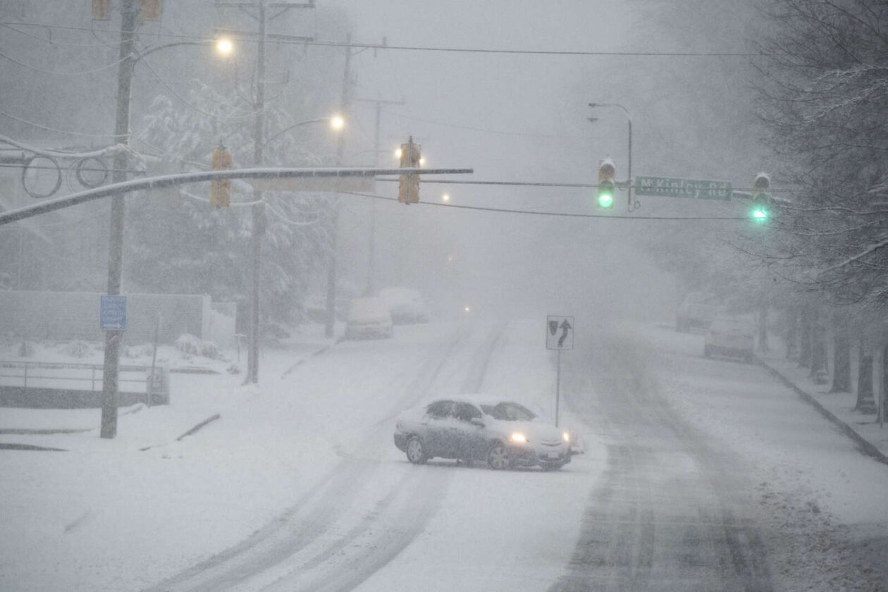
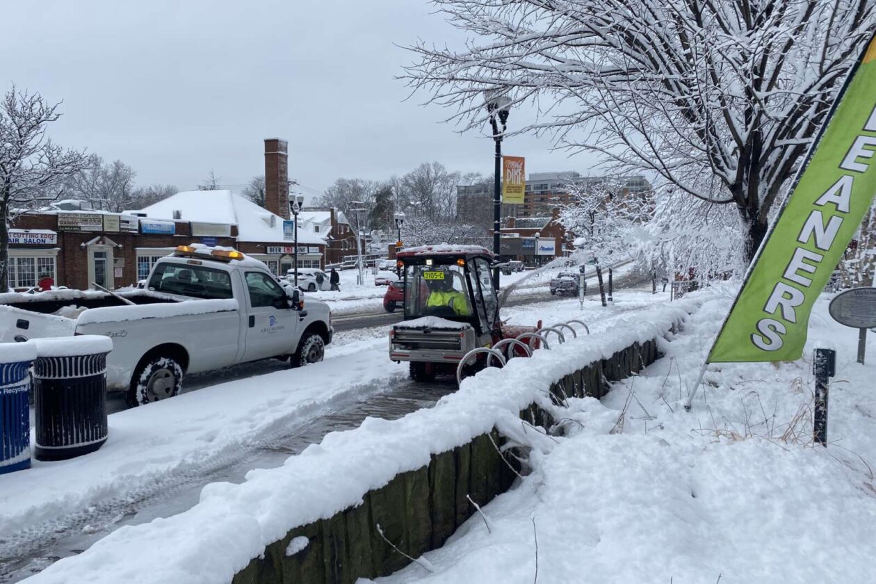
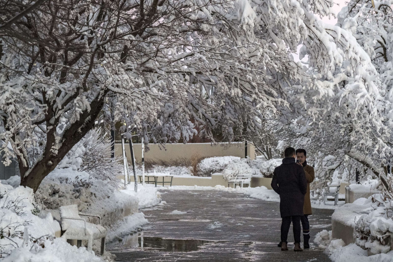
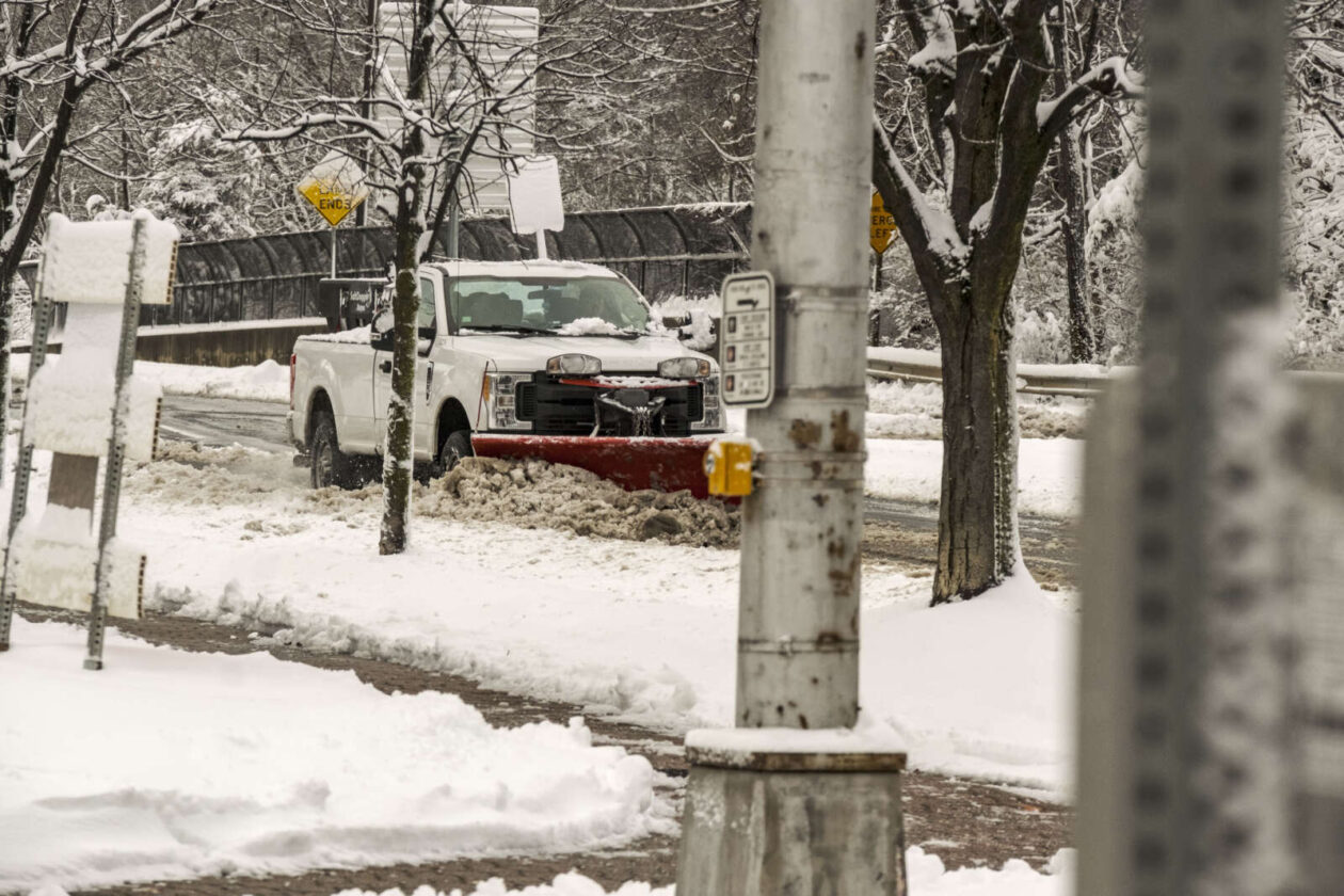
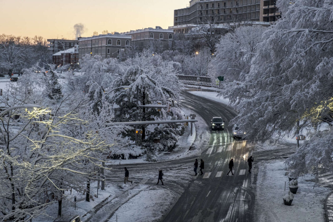
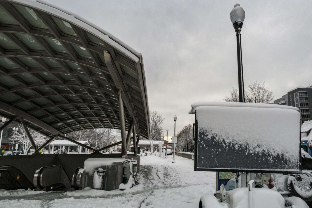
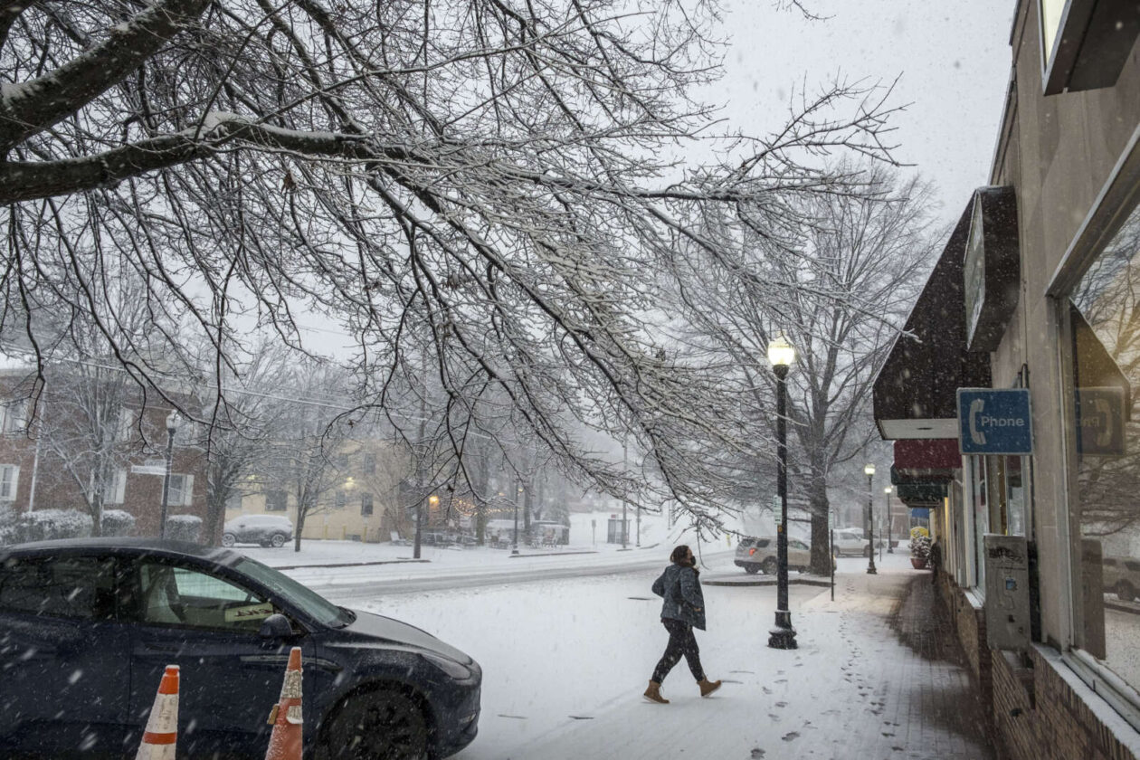
For the first time in nearly three years, Arlington experienced a significant snowfall.
Starting very early yesterday morning and finally tapering off in afternoon, preliminary estimates suggest that the county got close to seven inches of snow.
The storm brought power outages, closures, the suspension of bus service, cancellation of trash pick-up, and numerous skidding cars.
It was a very bad day to be on the roads, with the Arlington and VDOT crews unable to pre-treat the streets because the storm started off as rain.
It's been a hot minute since our area has seen accumulating snow like this, so we wanted to give a little refresher to those who haven't gotten their "snow legs" back just yet… 😉 pic.twitter.com/vwjbPdbxom
— VDOT Northern VA (@VaDOTNOVA) January 3, 2022
As of Tuesday morning, Arlington County snow crews — their ranks thinned by Covid absences — were tackling neighborhood streets after spending most of Monday treating and clearing main roads.
Phase 3 of cleanup will continue throughout the day, particularly on residential streets. A window of afternoon temps above freezing will help. Will be a great opportunity to shovel any sidewalks that weren't cleared yesterday. https://t.co/DuInmAUGlm #ArlWX pic.twitter.com/9GKyL8Rl6X
— Arlington Department of Environmental Services (@ArlingtonDES) January 4, 2022
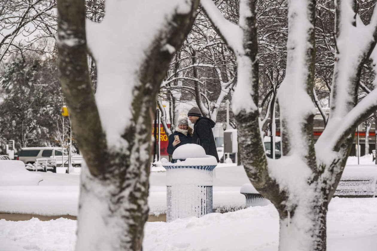
Despite the challenges, with everything that the region has been dealing with lately, the snow also brought a considerable amount of joy to some.
“I love it,” Javed Malik told ARLnow, peering up at the falling flakes at Penrose Square. “It’s a beautiful, gorgeous day.”
In Ballston, kids and adults alike were spotted pulling sleds to the nearest hill. Pedestrians were reclaiming the covered streets as their own, snapping selfies and looking up at the snowy sky.
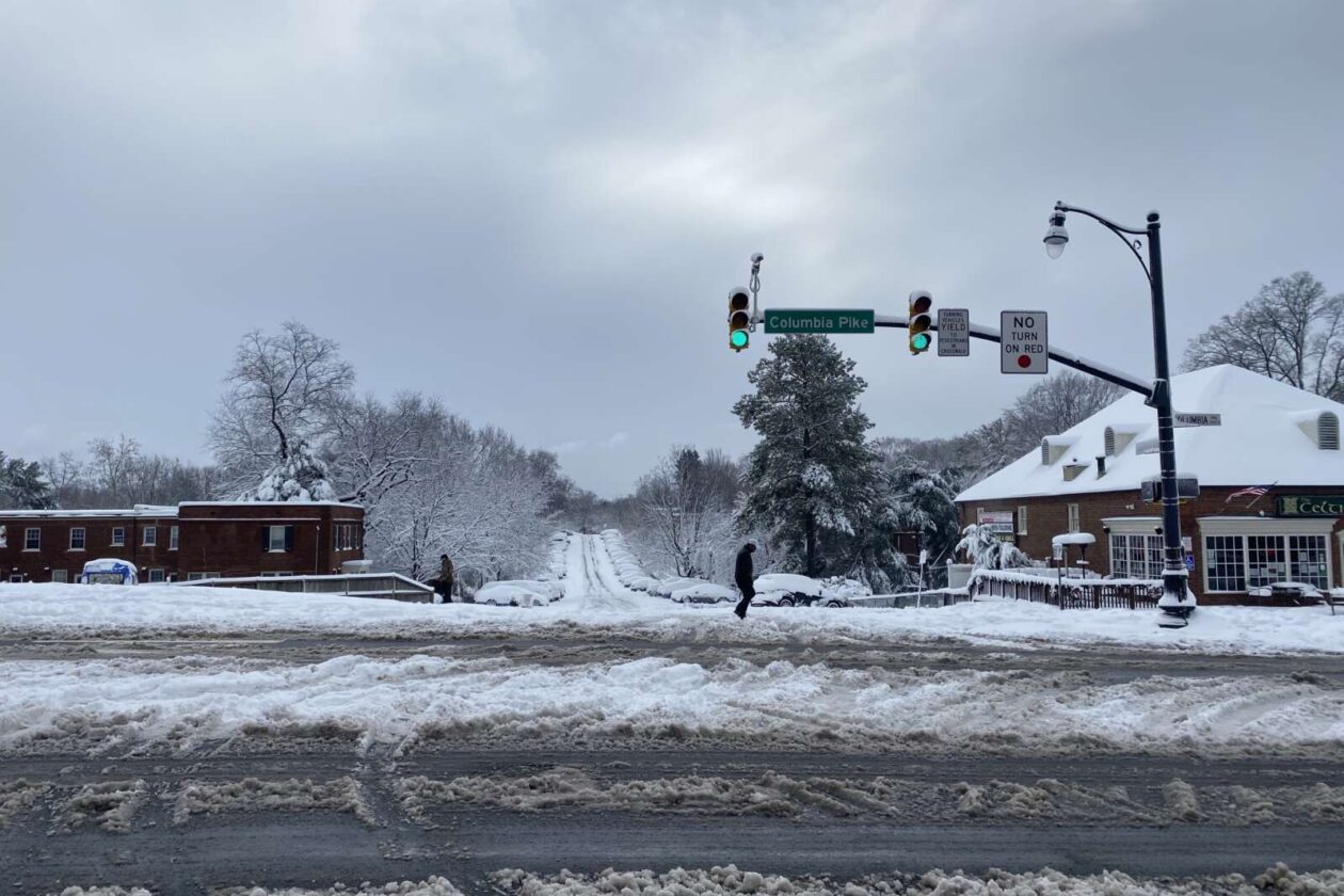
Persi George, from California, had never seen anything like it in person before.
“I’ve seen it before in the movies,” she said with a laugh standing in front of her apartment building along Columbia Pike. It’s a little softer than she expected, but that doesn’t dampen her enthusiasm as she prepares to make her first snow angel. “I’m in love with it.”
Yesterday was also set to be the first day back to school after the long holiday break with Arlington Public Schools continuing to commit to in-person instruction. That didn’t happen because the storm cancelled classes across Arlington and the region. School is cancelled today, too, with an expected refreezing overnight.
At least one teacher is breathing a sigh of relief. With Covid cases on the rise, likely due to holiday gatherings, the two extra days off provides more time for students to get tested.
“This couldn’t have been more well-timed. Coming back from the break, we are all worried about the rising case numbers,” Arlington high school teacher Josh Folb told ARLnow. “Hopefully, this gives people more time to get tested and… isolate, if needed. I haven’t talked to a teacher yet, and I’ve talked to a lot today, that isn’t grateful [about the snow days].”
There remains a chance it will snow again this week, Thursday night to Friday morning, though it’s not expected to dump as much snow as Monday’s storm.
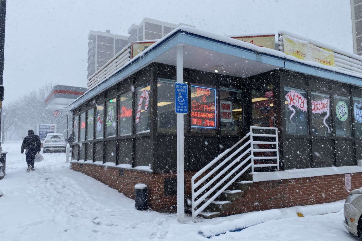
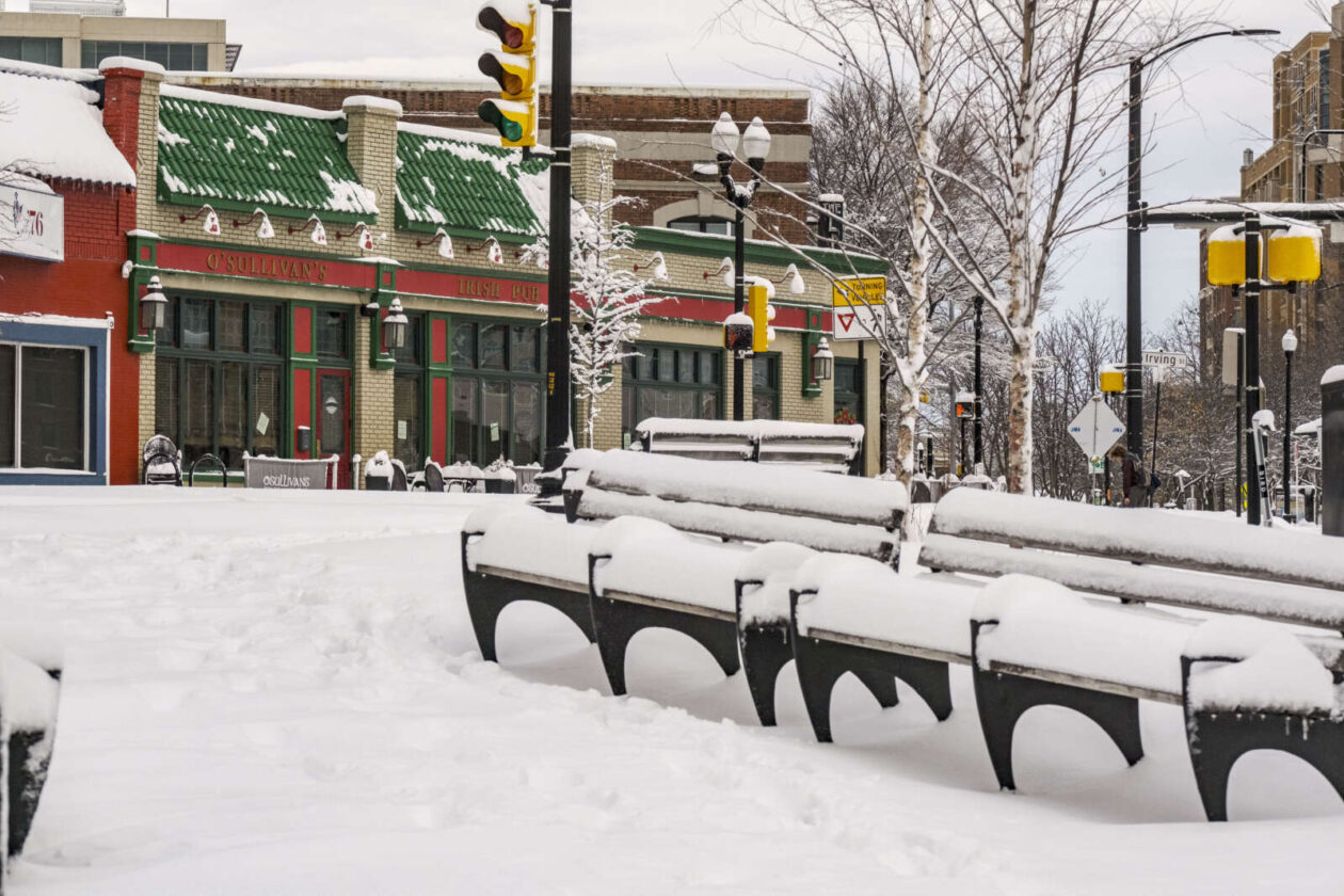
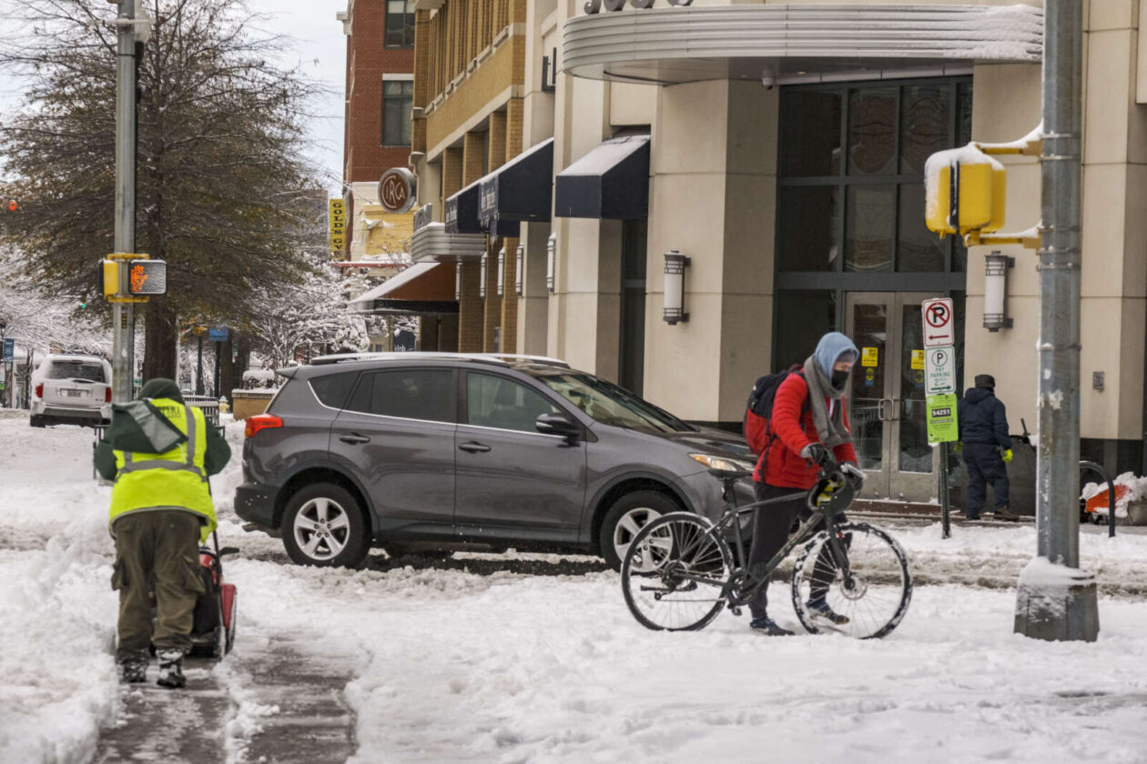
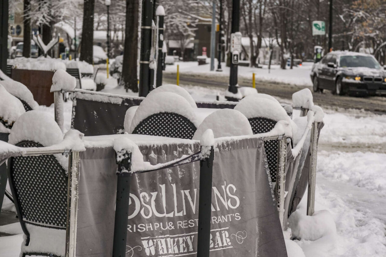
After Arlington’s biggest snowfall since early 2019, the continued winter weather hasn’t been kind to some Columbia Pike businesses already dealing with a pandemic.
Along the Pike, sidewalks remained covered in snow, slush, and salt — as sleet intermediately fell from the sky earlier this afternoon.
A Winter Weather Advisory remains in effect until Tuesday morning and a mixture of sleet, freezing rain, and snow is expected to continue throughout the day and into the evening.
Sofonias Gebretsadick, co-owner of Idido’s Coffee near the intersection of Columbia Pike and Walter Reed Drive, says that the poor weather has impacted his business.
“Sunday… and today, it’s slow,” Gebretsadick tells ARLnow. “When the weather isn’t good, we don’t have much foot traffic.”
This is the coffee shop’s first time experiencing measurable snow. It opened in late February 2019, a week after the last time Arlington had at least two inches of snow.
In general, he says, winter has been his least profitable season, but last year’s warmer winter muted the impact.
Of course this past year, right when the weather turned, the pandemic hit. It was a rough March and April, Gebretsadick says, but summer sales were much better.
This winter, between the cold, continued high number of COVID-19 cases, and now the weather, that hasn’t remained the case, he said.
Down the Pike, Burritos Bros was also seeing a decline in normal business due to the snow and ice.
At about 12:30 p.m., the normal steady stream of lunch customers — which has remained even during the pandemic — were nowhere to be found at the local burrito stand, located in a CVS parking lot.
Co-owner Richard Arnez says that between 11 a.m. and 2 p.m. is when they typically get customers. But not today.
“It’s been a lot slower today because of the weather,” he says pointing out the window.
He lives near Annandale and said the commute to Arlington this morning wasn’t bad, as the roads were clear of both snow and traffic.
Arnez, too, says while his business has adjusted, the pandemic has continued to take a bite out of the restaurant’s business. And winter weather is certainly not helping.
Back at Idido’s, a bag of salt sits at the door. Despite being cleared earlier, Gebretsadick said the continued precipitation all day has built up a layer of ice on the sidewalk that’s hard to remove. He put down salt himself and is already onto bag number two from Costco.
Gebretsadick went outside in the snow for a bit yesterday with his kids at his Maryland home. They had fun, he says, while he sipped coffee.
But, then, it was back to work today.
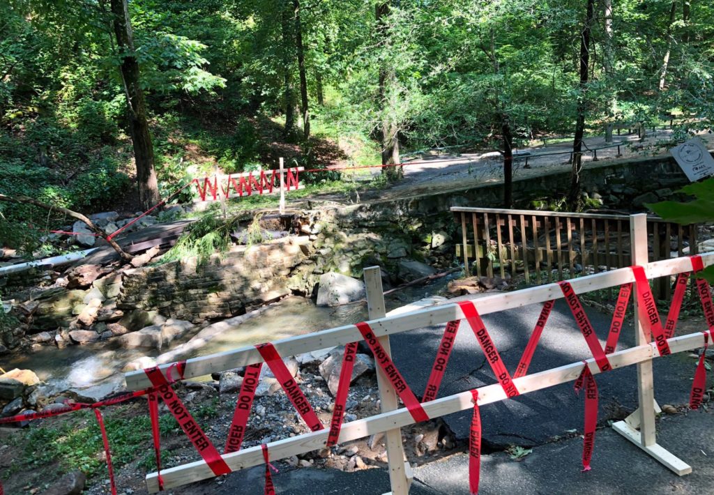
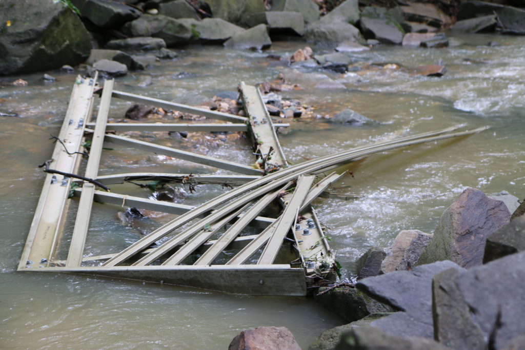
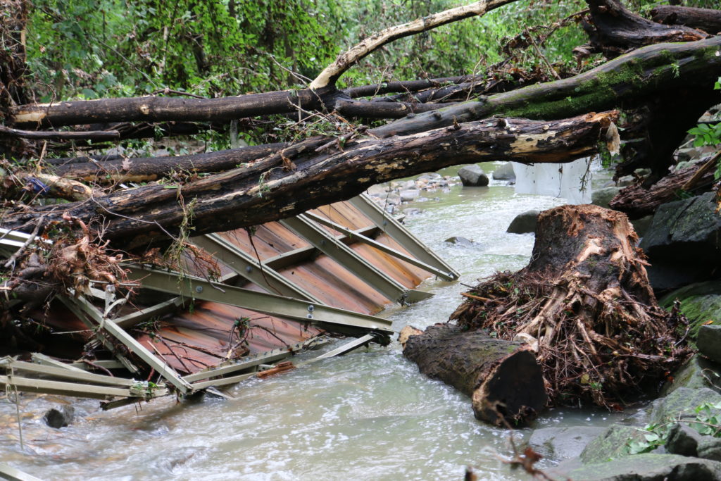
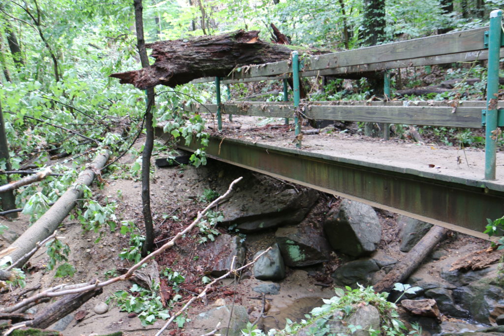
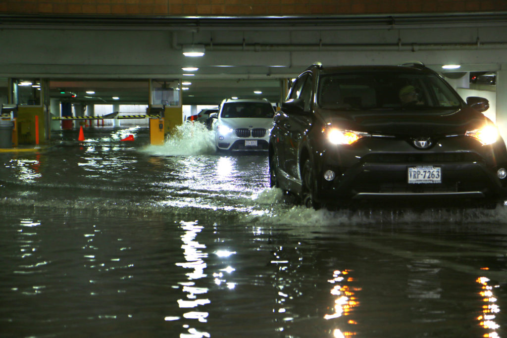
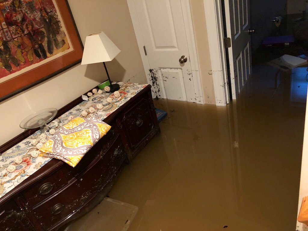
As some Arlingtonians are still struggling to put their lives together after flash flooding in July, the county is continuing to work to repair flood-damaged public property.
Early estimates put damage to the county at $3.5 million, but Hannah Winant, a spokesperson for Arlington County Public Safety Communications and Emergency Management, said estimates for the damage to county property has swelled to $5.8 million. Those costs include debris cleanup, emergency protective measures, and repairs to County facilities like parks and community centers.
Winant said bridges in Lubber Run and Glencarlyn parks suffered the worst damage from the storms. A storage building at Bon Air park was also seriously damaged, as were other pedestrian bridges, playgrounds and more across Arlington. Additionally, the County is assessing the erosion to local waterways that could require long-term fixes.
Arlington has submitted its preliminary assessment to the state, but after the state receives the assessment it must be validated.
“This process can go on for a few weeks, as crews triage the damage and more information becomes available,” Winant said. “This is where we are now.”
Once the state completes its assessment, that information is submitted to the Federal Emergency Management Agency (FEMA), after which the agency portions out funding and technical support for public properties that have been damaged.
“Reimbursement is also being sought through the County’s insurance,” Winant said. “During this time, the County cleans up from the disaster, removing the debris and cleaning right-of-way, and tries to get back to normal operations for the community such as opening parks and other affected facilities. The recovery process can be a long one and we appreciate the community’s patience and support as we navigate the process of requesting aid.”
Going forward, Winant predicted recovery costs will continue to increase as weather changes become more severe.
“Weather is consistently increasing in its severity and frequency,” Winant said “Nationally, both insured and uninsured losses continue to grow — so costs from disasters are rising as disaster frequency also increases.”
For homeowners, businesses, and renters who were affected by the flooding, the Small Business Administration is offering low-interest loans. The filing deadline for physical property damage is Oct. 7, and the deadline for economic injury applications from business owners is May 7, 2020.
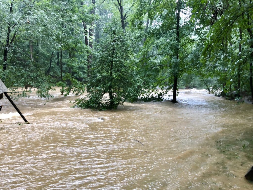
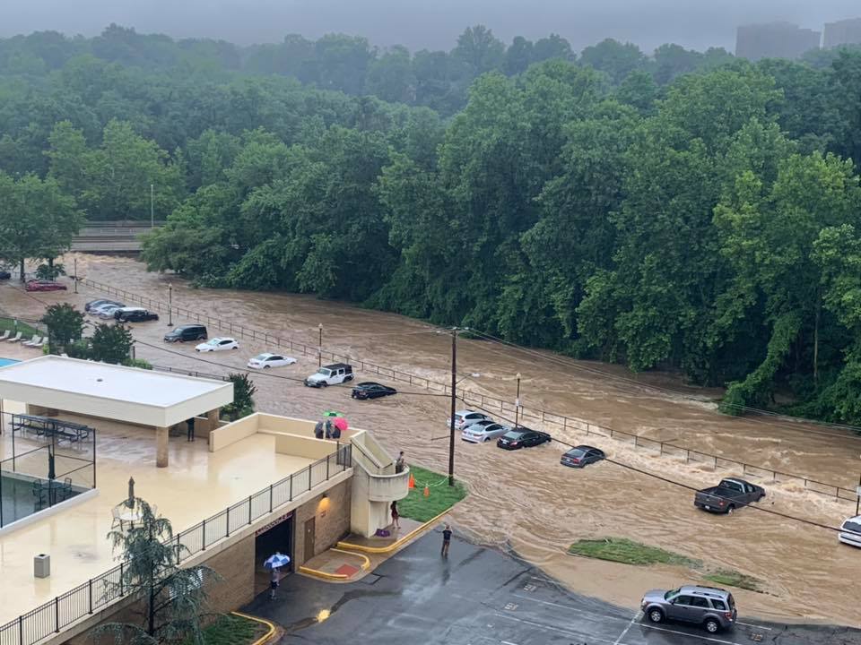
This week’s devastating flash floods may be evidence of a bigger weather pattern shift, some experts say.
The storm that pummeled the Arlington dumped 3.3 inches of rain in one hour Monday morning, breaking the regional record. Some experts say this is part of a larger pattern of wetter weather — and possibly climate change.
The so-called supercell developed in Frederick County, Virginia, where NWS Meteorologist Jason Elliott says cool, dry winds from the north met with warm, wet winds from the south. From there the storm — which was about the side of Montgomery County, Md. — travelled about 20 miles per hour towards southern Maryland.
Unfortunately for Arlington, the heaviest part of the storm travelled down the Potomac River — straight through Fairfax County, Arlington County, Alexandria and D.C. — overwhelming stormwater management systems and filling streets, homes, and businesses with water.
When a rainstorm hits, the runoff water not absorbed into the ground travels into the county’s stormwater pipes. However, too much water can fill the pipes, and flow out of manholes and storm drains.
“Water will then flow underneath of a road or a bridge and a stream will fill up and flow on top of a road or culvert,” said Aileen Winquist, Arlington’s Stormwater Management Program Manager. “That’s where damage can occur.”
Monday’s storm not only turned streams and streets into raging rapids, but also caused sewage backups in homes. Winquist said this is usually caused by water flooding sewer pipes and coming up through the floor drains in basements. It’s a problem residents in Westover and elsewhere face as they continue to recover from the flooding.
The county’s storm and sewer systems are overall in “good condition”, Winquist said, and crews continuing to repair corroded storm pipes and re-line old sewer pipes as needed.
“Typically the storm sewer system is designed for what’s known as a 10 year storm,” she added, referring the federal classification of a storm that has a 10% chance of occurring once every 10 years.
“It was easily raining 5 inches in an an hour, for half an hour,” said Elliot. “And nothing can handle something that heavy in that short a period of time.”
The county keeps a detailed map of every location in Arlington damaged in a flood and uses it prepare for future emergencies and prioritize routine repairs. Winquist declined to share a copy of the map, citing privacy concerns, but noted that Westover was not among the neighborhoods filled with water during Arlington’s last major flood back in 2006.
New flood plains can be caused by a variety of factors, such as problems with the storm water pipes or nearby development projects. But there’s also the issue of storms getting stronger and wetter.
")
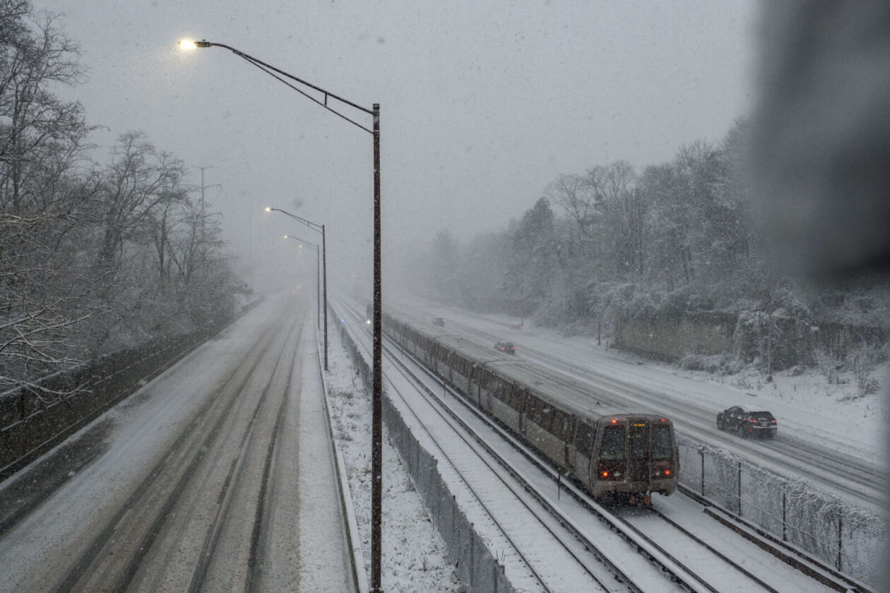
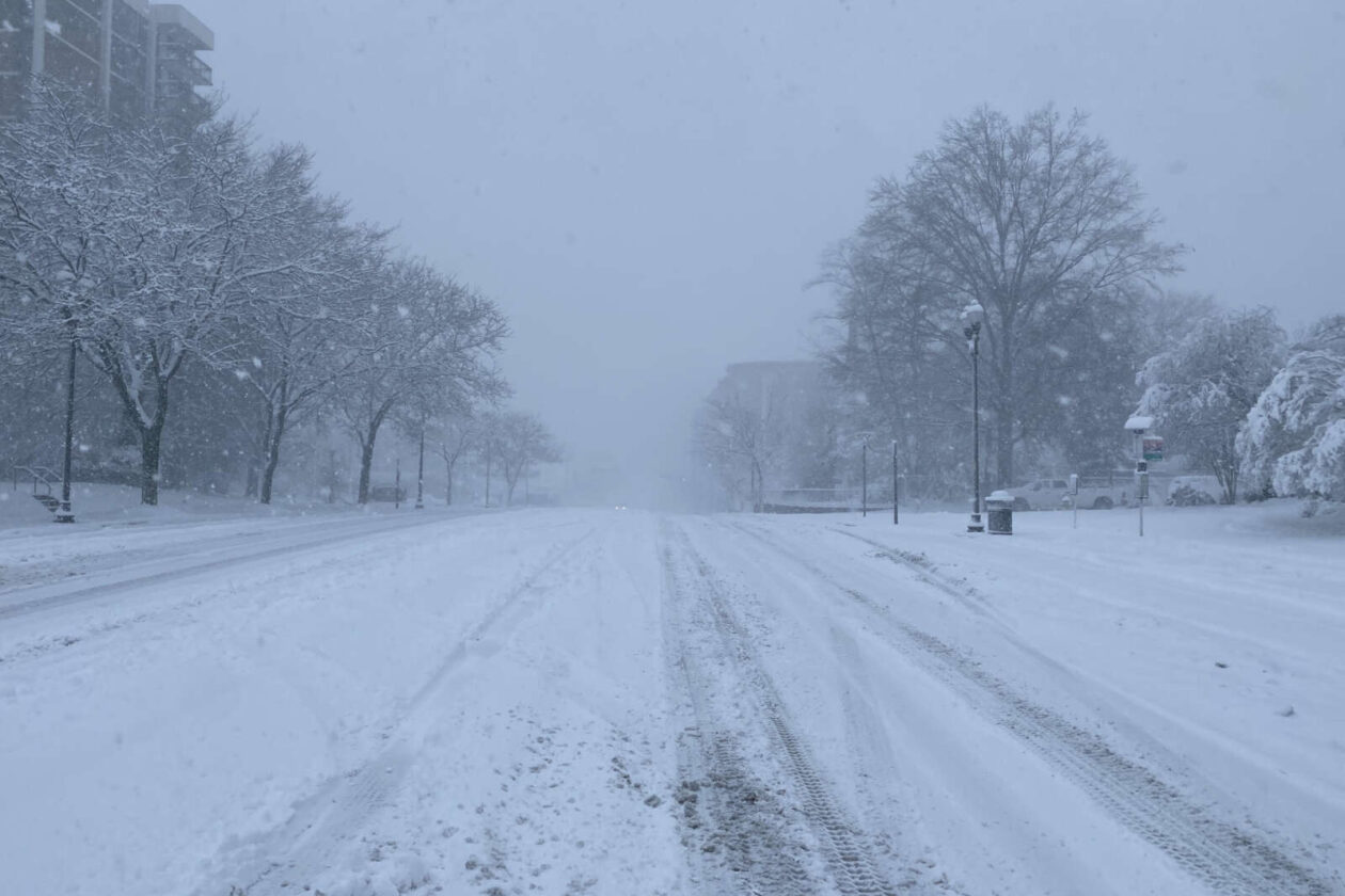
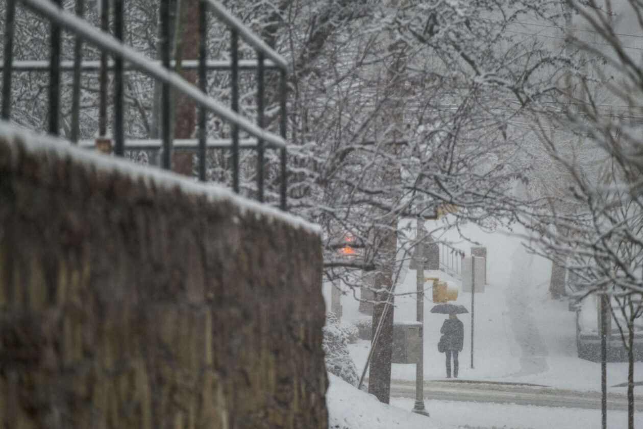
Prepare for more rain, and more flooding, the National Weather Service warns.
The NWS has issued a severe thunderstorm watch through 10 p.m. tonight, with a flash flood watch as well from 3 p.m. to 11 p.m. due to the excessive amounts of rain the region’s seen recently.
Showers and thunderstorms are expected this afternoon and evening as a cold front approaches the area. Both severe weather and flash flooding will be possible in association with these storms. For additional details visit https://t.co/o2JIHfMyKQ pic.twitter.com/JRDudNNHFT
— NWS DC/Baltimore (@NWS_BaltWash) July 27, 2018
Full details from the NWS:
…FLASH FLOOD WATCH REMAINS IN EFFECT FROM 3 PM EDT THIS
AFTERNOON THROUGH THIS EVENING…The Flash Flood Watch continues for
* Portions of Maryland, The District of Columbia, and Virginia,
including the following areas, in Maryland, Anne Arundel,
Carroll, Central and Southeast Howard, Central and Southeast
Montgomery, Charles, Northern Baltimore, Northwest Harford,
Northwest Howard, Northwest Montgomery, Prince Georges,
Southeast Harford, and Southern Baltimore. The District of
Columbia. In Virginia, Arlington/Falls Church/Alexandria,
Eastern Loudoun, Fairfax, King George, Prince
William/Manassas/Manassas Park, and Stafford.* From 3 PM EDT this afternoon through 11 PM EDT this evening.
* Showers and thunderstorms are expected to develop late this
afternoon and evening, with heavy rainfall rates likely. Given
saturated soil from this week`s excessive rainfall, any
additional heavy rain or repetitive thunderstorms may result in
rapid rises of water in streams and low lying areas.PRECAUTIONARY/PREPAREDNESS ACTIONS…
A Flash Flood Watch means that conditions may develop that lead
to flash flooding. Flash flooding is a very dangerous situation.You should monitor later forecasts and be prepared to take action
should Flash Flood Warnings be issued.
Photo via @NWS_BaltWash
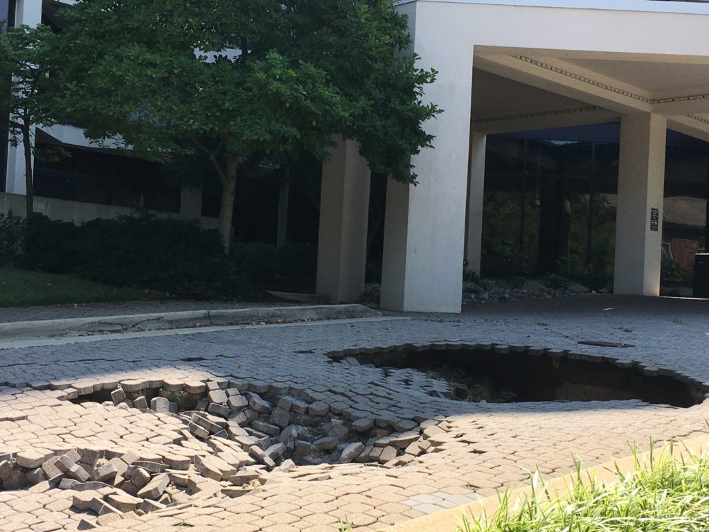
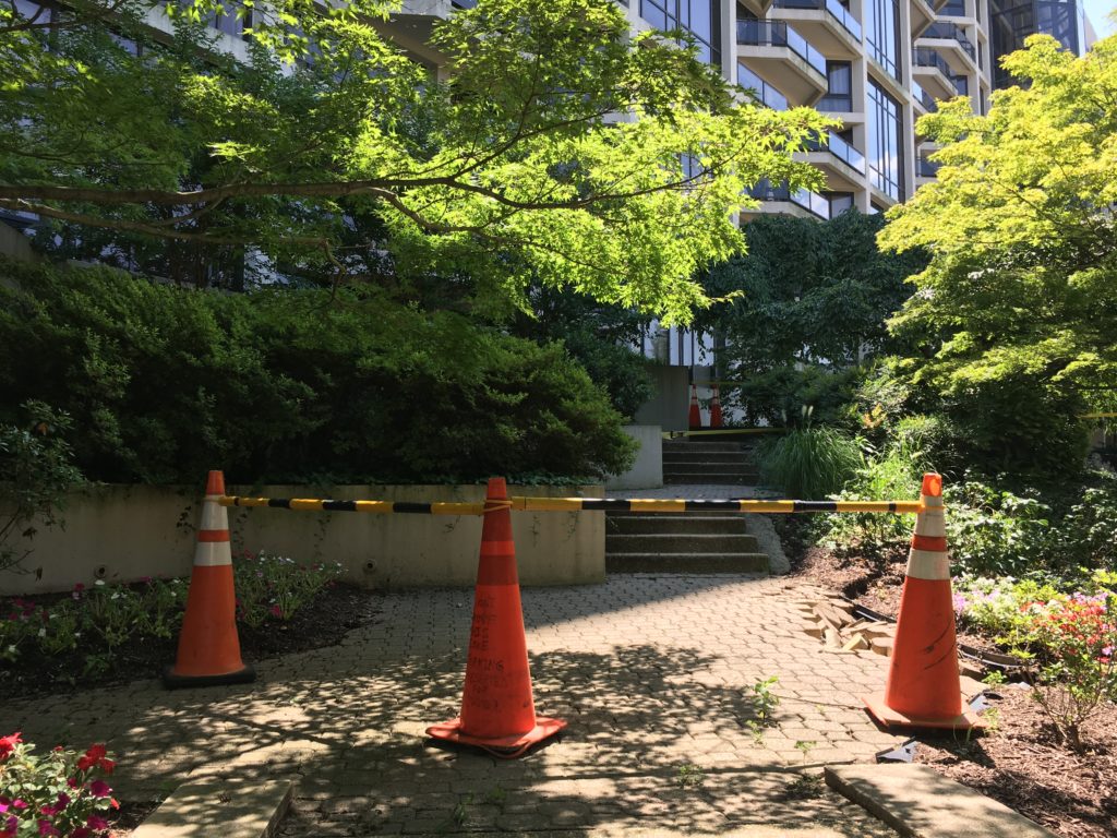
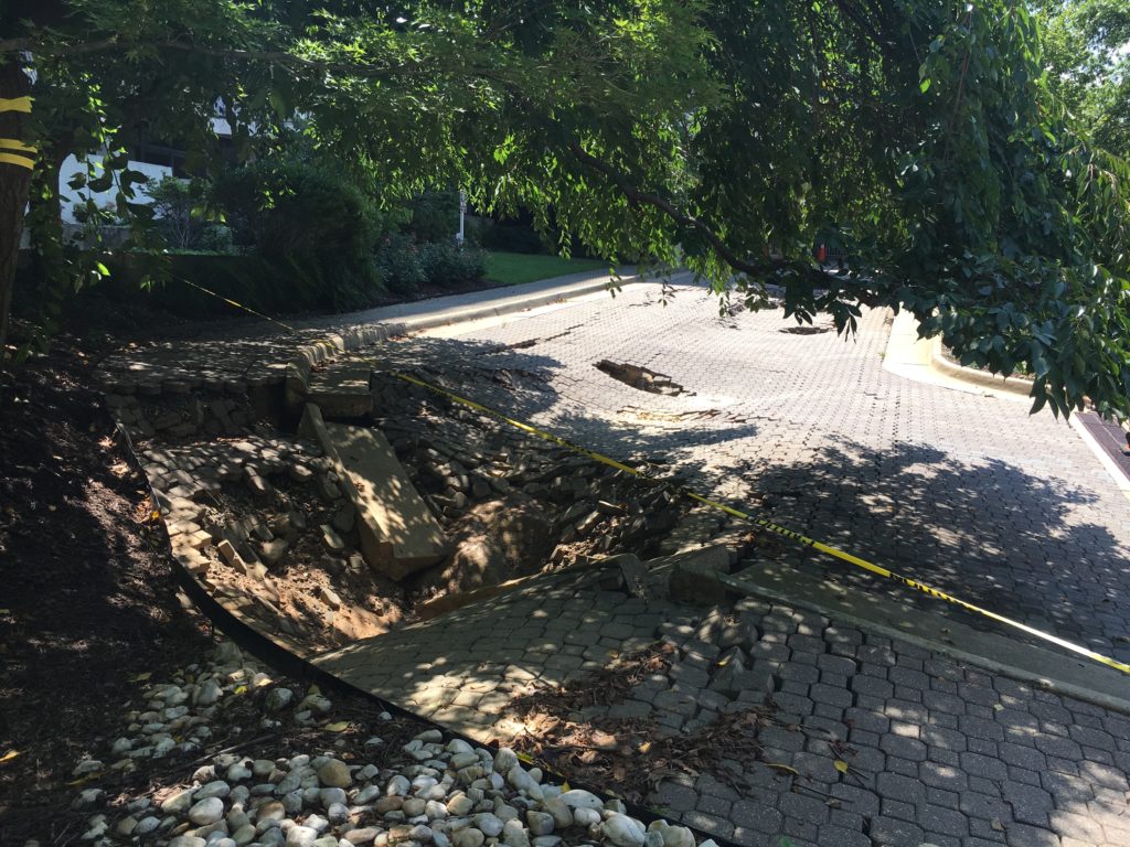
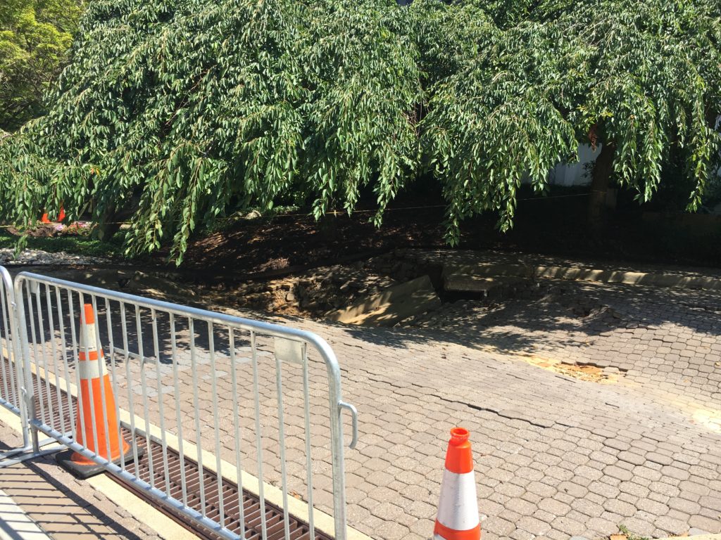
Following days of relentless rain, a series of sinkholes have opened up in front of a condo complex in Rosslyn.
The front driveway and lawn of the Atrium Condominiums, located at 1530 Key Blvd, are now marked by the large pits. Two holes several feet deep have opened up around some of the complex’s front lawn, and another has caused cobblestones to buckle leading up to its driveway in front of the main entrance.
Traffic cones currently block off the complex’s driveway, including parts of it unaffected by the pits.
A tipster told ARLnow that the sinkholes first appeared “many weeks ago” and have “gradually grown as more rain has come” over the last few days.
The complex’s management company did not immediately respond to a request for comment on the severity of the sinkholes, or when they might be fixed.
")
A perilously perched tree has prompted the temporary closure of a playground near East Falls Church.
The severe rain storms of the last few days has caused a “tree-mergency” in Madison Manor Park (6225 12th Street N.).
Susan Kalish, a spokeswoman for the county’s Department of Parks and Recreation, says the rain managed to so thoroughly soak the ground at the park that the tree eventually tipped over. She says workers will be removing it “first thing” tomorrow morning (Thursday).
“After they have finished, parks crew will clean up any mess and refasten a section of fence that has been removed,” Kalish wrote in an email. “None of the play equipment has been damaged. One section of the perimeter timber has been dislodged by the tree’s roots and will have to be repaired once the tree is removed.”
Kalish said the county hopes to reopen the playground by “close of business tomorrow,” or Friday morning at the latest.
Parks and recreation workers plan to announce exactly when it will re-open on the department’s Twitter account.
Photo via @arlparksrec
")
Flash Flood Watch Remains, Though Rain is Subsiding — Weather watchers warn that a risk of floods remains through this afternoon, but things are set to get steadily dryer as Thursday and Friday get closer. [NWS]
Are Tolls Worth It on Virginia’s HOT Lanes? — A new study shows it’s a bit of a mixed bag for commuters, though anyone hopping on I-66 instead of Route 29 or Route 50 is probably getting their money’s worth. Researchers don’t see those arterial roads as viable alternatives, given the time savings 66 still offers during rush hour. [WTOP]
Metro Remains Less-Than-Ideal for Blind Riders — Months after a blind woman fell off a platform due to problems with Metro’s new 7000-series trains, the transit service is still scrambling to improve conditions for the visually impaired. [Washington Post]
Nearby: A Tornado Touched Down Near Thomas Jefferson High School — Officials believe a twister made a roughly one-minute-long appearance near the school, around the border of Alexandria and Annandale. [Washington Post]
Flickr pool photo via wolfkann