
(Updated at 12:40 p.m.) The public comment period on a draft plan for the Lee Highway corridor is ending after Thursday.
The draft, first published online last month after a public “charrette” planning process in 2015, outlines a sweeping vision for the corridor, which currently is a primarily car-oriented mish-mash of strip malls, aging apartment buildings and other assorted low-density businesses and infrastructure.
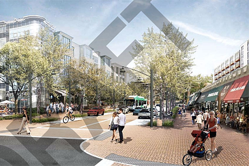
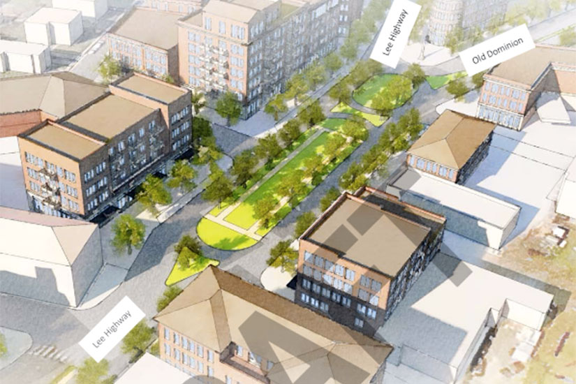
The plan envisions a tree-lined Lee Highway that’s more pedestrian- and bike-friendly, with mid-rise development concentrated in “mixed-use activity nodes.”
New apartment buildings, townhouses and retail hubs would be encouraged to spring up. New parks and bus service would be added. Building heights up to 12 stories are discussed, though 3-6 stories would be more common; the taller buildings would be along Lee Highway itself and “sensitive transitions to single family neighborhoods” would be emphasized.
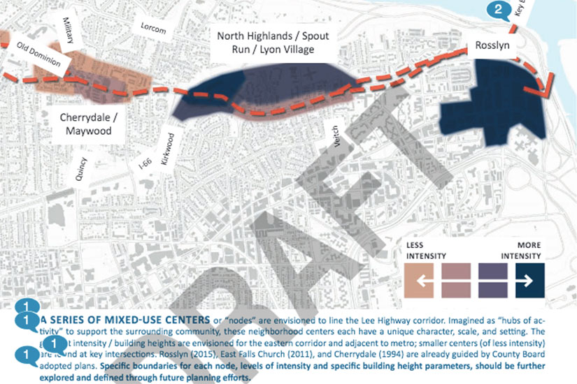
The activity nodes along Lee Highway, which would be the focus of pedestrian-oriented development and placemaking, include:
- Rosslyn
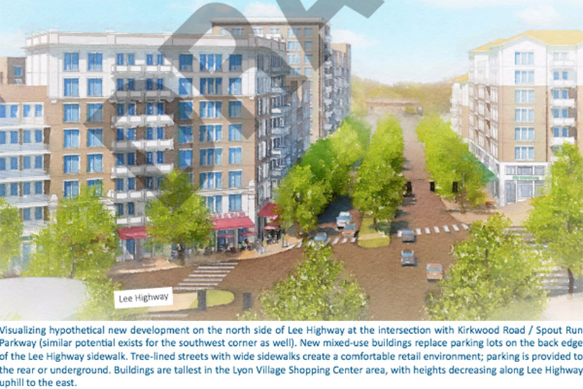
- North Highlands / Spout Run / Lyon Village
- Cherrydale / Maywood
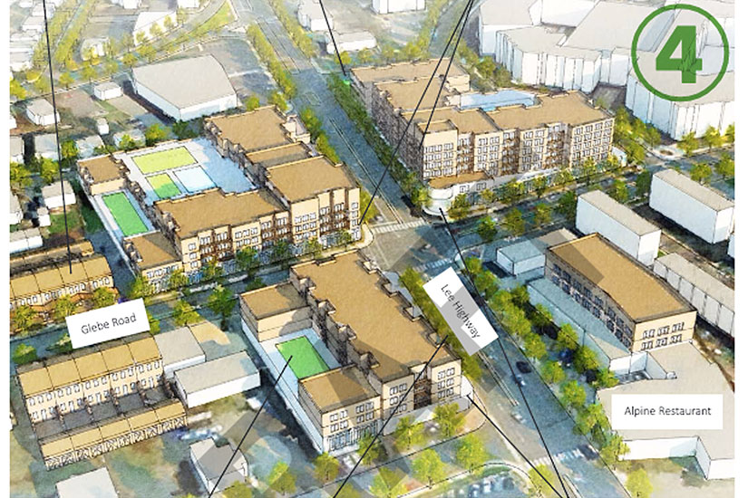
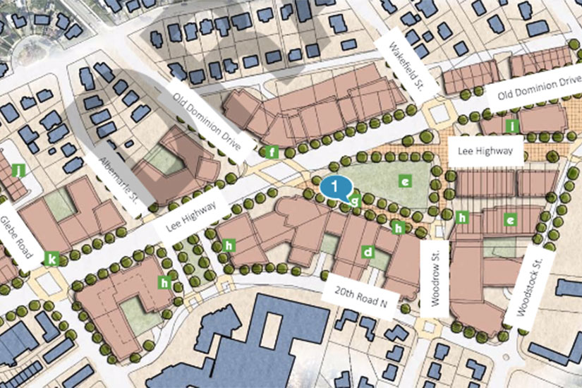
- Glebe Road / Lee Heights / Waverly Hills
- Harrison / George Mason
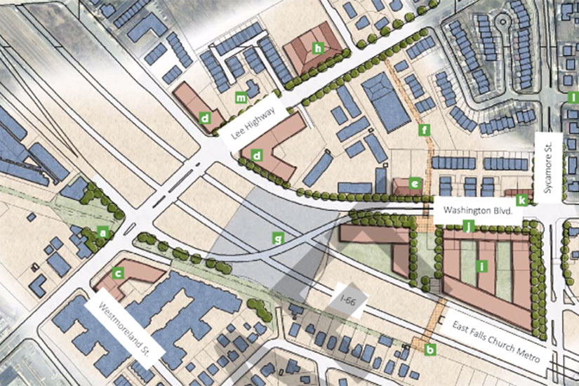
- East Falls Church
Changes are expected to be made to the plan based on feedback received online, before the County Board reviews it in May. Greater Greater Washington has more details about the Lee Highway plan and process.
Other notes and quotes from the draft plan, after the jump.
- “The highest priority for charrette participants, identified through written surveys and keypad polling, was the transformation of Lee Highway to a Complete Street. ‘Complete Streets’ balance the needs of all users of the roadway, creating an environment where transit riders, drivers, walkers, and cyclists of all ages and abilities feel comfortable. “
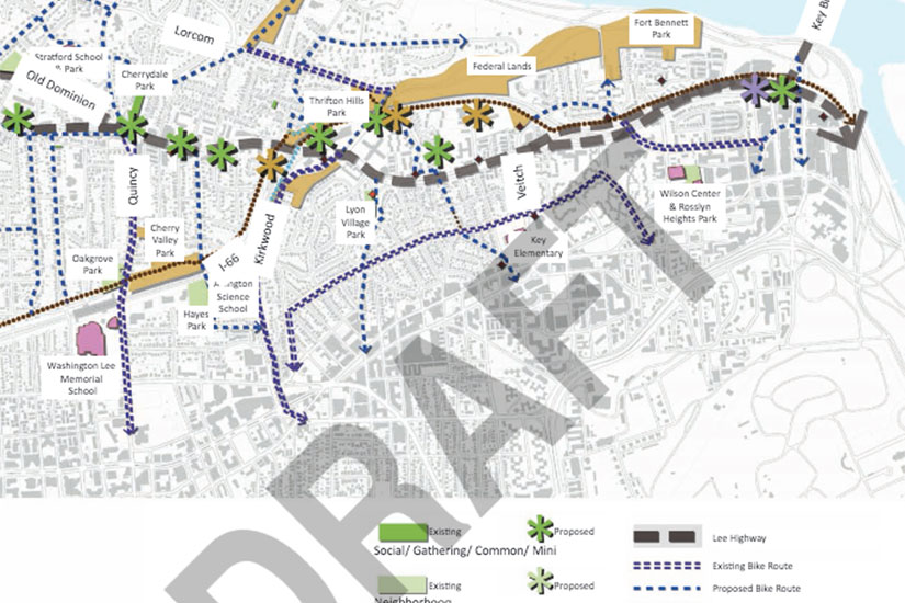
- Participants were split on whether bike infrastructure should be on Lee Highway itself or on parallel routes.
- “Another way to enhance Lee Highway connectivity to the Metro systems would be to add a circulator bus system that follows Lee Highway, Glebe Road, Fairfax Drive and Kirkwood Road. This service could run in both directions, thereby achieving short headways and smoothly connecting Lee Highway destinations in Lyon Village, Cherrydale, Lee Heights and Glebe Road to the Orange and Silver. This could open Lee Highway businesses to a broader trade area.”
- The reason why new parks are planned: “As new development occurs in mixed-use nodes and the corridor’s density increases, the desire to walk long distances will diminish, capacities of existing spaces will be reduced, and the type of needs for open space will change.”
- “In addition to affordable housing, there is a desire for an ‘affordable commerce strategy‘ to be part of the vision. It was reported that escalating rents for Lee Highway retail space are starting to price out long-time local, independent businesses. Future actions and policies are desired to counter this trend, to ensure that a changing and improved urban form does not come at the expense of the local businesses that make Lee Highway unique… The vision for the future of the Lee Highway corridor is to retain small, local businesses, while also adding new options to the mix, enhancing economic vitality and sustainability.”
- In the Lyon Village node, up to 3,000 new residential units possible via in-fill development alone (no residences torn down).
- “The intersection of Glebe Road is envisioned to be a pedestrian-oriented, mixed-use hub of activity; this transformation will not occur overnight. Likely, it would be a gradual process, as individual properties decide to redevelop over time, according to the vision.”
- Regarding the controversial title lending store at the intersection of Lee Highway and N. George Mason Drive: “This intersection also contains land owned by the Virginia Hospital Center. Today, these parcels contain small businesses such as a daycare and a TitleMax store; the latter, a recent reuse, was cited by participants as inappropriate and an example of what ‘not to do’ as it does not promote pedestrian activity. During pre-charrette interviews it was learned that these parcels have potential to become County-owned in the future. As such, the potential for future redevelopment is greater. Illustrations study the potential for new apartments or mixed-use buildings on these sites that fit the community vision for walkable, street-oriented buildings, that could also contain a portion of affordable units.”
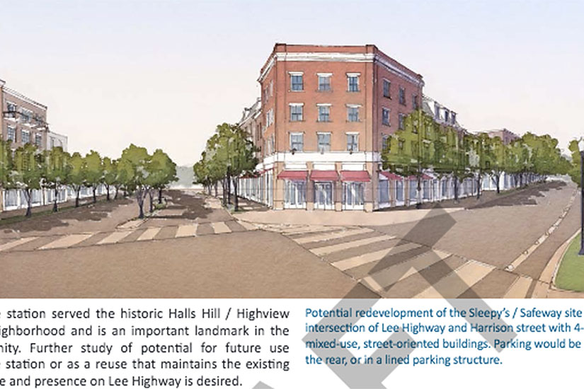
- A redevelopment or reconfiguration of the Safeway/Sleepy’s site is possible in the Lee Harrison area.
- Lee Highway would be a future center of small industry transitioning from co-working spaces: “Lee Highway may be able to attract small businesses with development of ‘maker’ spaces for businesses as they mature and no longer need to share equipment and facilities. “
- The plan includes the goal of preserving and creating more affordable housing.
- The plan also aims to preserve “sites of historic significance.” On such site was identified as the Lee Heights Shopping Center. The existing shopping center would be preserved, while a park or a mixed-use development could be built across the street in order to encourage more pedestrian activity.
- From Greater Greater Washington: “Currently Arlington has a lot of high-rise apartments and detached single-family homes, but not much in the middle. The Lee Highway vision will focus on adding more of those “missing middle” housing types. Rowhouses, stacked flats, and small-scale apartment buildings will dot the corridor and bring new life to areas that are now strictly commercial.”