
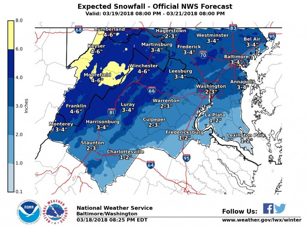
(Updated at 5:15 p.m.) A Winter Storm Watch has been issued for the D.C. area as Arlington County crews prepare for several inches of snow.
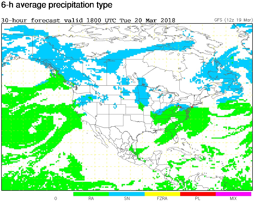
The storm is expected to start as rain tomorrow, the first day of spring, before transitioning to snow. The National Weather Service noted on its Twitter page that there is “lots of uncertainty” in terms of the type of precipitation.
More from NWS:
…WINTER STORM WATCH IN EFFECT FROM LATE TUESDAY NIGHT THROUGH WEDNESDAY EVENING…
* WHAT…Heavy wet snow possible, with a total wet snow accumulation of 5 inches or more.
* WHERE…Metropolitan Baltimore and Washington areas, as well as the northern and central Shenandoah Valley.
* WHEN…From late Tuesday night through Wednesday evening.
* ADDITIONAL DETAILS…Plan on difficult travel conditions. Significant reductions in visibility are possible.
PRECAUTIONARY/PREPAREDNESS ACTIONS…
A Winter Storm Watch means there is potential for significant snow, sleet or ice accumulations that may impact travel. Continue to monitor the latest forecasts.
Via Twitter, the Virginia Department of Transportation said crews will not be pretreating the roads because of the expected rain on Tuesday. An Arlington Department of Environmental Services representative confirmed that the county will not be pretreating for the same reasons, but added that trucks are “ready to treat arterials and any trouble spots should they appear overnight.”
More from VDOT:
The first day of Spring in northern Virginia is forecast to bring snow and sleet and Virginia Department of Transportation crews will be ready. The National Weather Service has already issued a Winter Weather Advisory and Winter Storm Watch for the area. Drivers should continue to monitor the weather and be prepared to stay off the roads if the timing and intensity of this storm impacts rush hours.
Overnight Monday, plow trucks will be staged and ready to treat roads with salt and sand at the beginning of the storm. After two inches have fallen, crews will be able to begin to push snow and/or continuously treat affected areas.
Drivers are asked to:
- Stay closely tuned to weather forecasts (see National Weather Service) throughout the day Tuesday and Wednesday.
- Consider adjusting trips around the forecast for safety.
- Assume any “wet” pavement to be slick. Bridges, ramps, overpasses and lower-volume roads may get slippery first, and even previously treated roads will become slick quickly with the low pavement temperatures.
- Ensure gas and wiper fluid tanks are full, and have a good emergency kit. Here’s how: www.ready.gov/car.
- Be aware that low temperatures will mean continued potential for refreeze and slick road conditions.
Via social media:
NEW: NWS has issued a winter storm watch for most of DC area late Tues night through Wed evening for the * potential * of 5"+ snow. It has also issued a winter weather advisory during the day Tues for our far north & northwest areas due to ice. More info: https://t.co/jwsjk8zUSI pic.twitter.com/8GKJN5QDSA
— Capital Weather Gang (@capitalweather) March 19, 2018
Crew shifts begin around midnight for any potential snow in the area but temperatures are still tricky. Rain will likely be part of the mix so pretreating at this point doesn't do much. At the least, expect a slower morning commute. https://t.co/HdhoMPlr9g #ARLWx pic.twitter.com/0o5KBDze2d
— Arlington DES (@ArlingtonDES) March 19, 2018
Friends– there is uncertainty with the forecast for Tues/Wed, but one thing that is *certain* is the readiness level of our crews. (FYI: very ready!) Pls keep monitoring the weather & check back here for updates. Be safe!
— VDOT Northern VA (@VaDOTNOVA) March 19, 2018