(Updated at 2:45 p.m.) Parks officials have signed off on some big changes at Theodore Roosevelt Island, including the rehabilitation of a troublesome section of the Mt. Vernon Trail and the addition of several new landing spots for small boats and kayaks.
The National Park Service announced yesterday (Monday) that it will move ahead with a variety of construction projects on the island, located off the George Washington Memorial Parkway near Rosslyn, after settling on some final designs and certifying they’ll have minimal environmental impacts on the island.
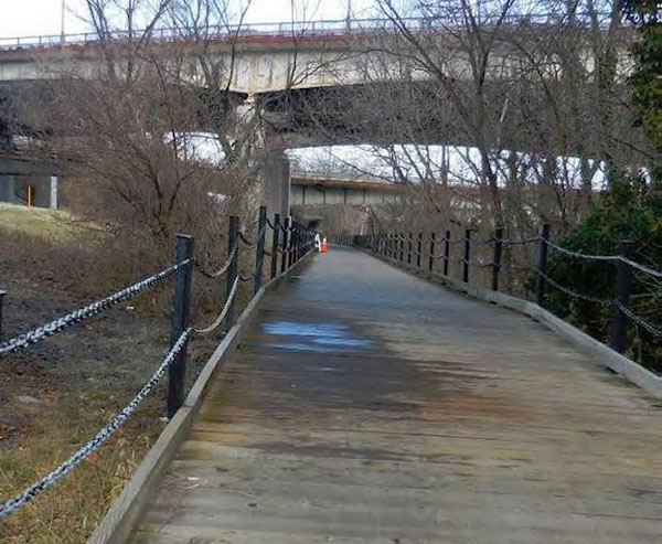
Some of the changes will be relatively small, like the addition of some new signs and markers detailing Theodore Roosevelt’s legacy — the island is home to the lone memorial to the nation’s 26th president in D.C. Others will be more substantial, such as the total overhaul and realignment of a boardwalk-style bridge on the Mt. Vernon Trail, which runs from underneath the Roosevelt Bridge to just south of the island’s parking lot.
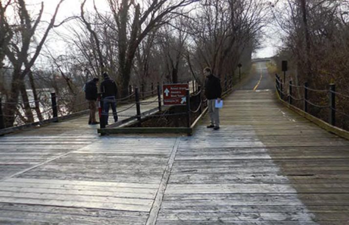
The park service’s plans call for a “replacement of the bridge deck and railing to provide a smoother riding surface.” That will likely come as good news to area cyclists, who have nicknamed it “the Trollheim Bridge” for its treacherous surface — TheWashCycle blog described it as a the “notoriously slippery part of the Mt. Vernon trail that has caused literally thousands of crashes” in a post last year.
The main, 1,400-foot-section of the bridge also meets an additional 90-foot section toward its north end, creating an awkward “T” intersection for cyclists. The realignment work will eliminate that intersection, creating a new left turn lane as well.
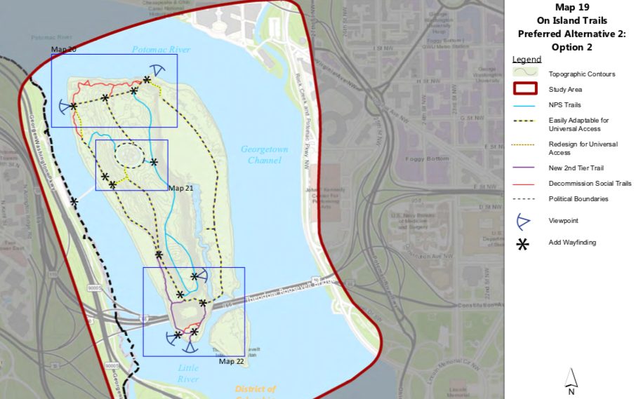
Other walking trails on the island will see some improvements under the plans as well. The NPS is hoping to improve connections between the pedestrian bridge and the island’s Memorial Plaza and create “universal access to the entire Swamp Trail, including access to the comfort station.” That small rest stop is also set to see a refresh under these plans.
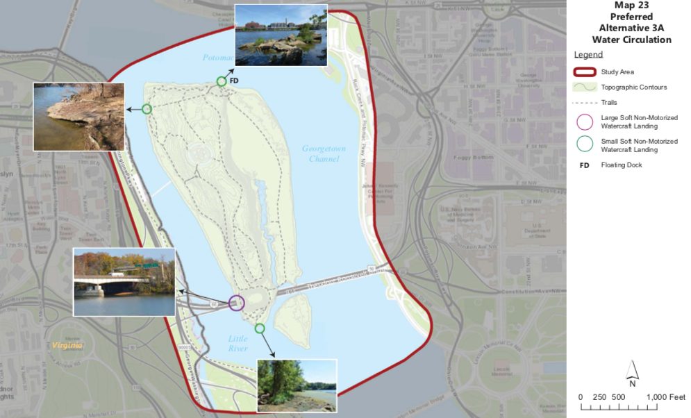
The NPS is also hoping to add a total of four landings for canoes, kayaks and row boats on the island. Each one will be about 12 feet wide, and provide “access for approximately 4-5 kayaks/canoes,” according to the park service’s documents. The plans also call for the construction of a roughly 100-foot-long “floating dock” for larger craft, to be located at the island’s northeast corner, once the home of a ferry landing.
The park service noted in an environmental analysis of these proposed changes that, currently, “boaters and kayakers anchor or beach their non-motorized watercraft on unmarked areas along the shoreline.” Officials fear that the “practice impacts natural and archeological resources and has the potential to expose boaters and kayakers to underwater hazards in shoreline areas,” reasoning that the new landings should alleviate that issue. The area could also be in line to see increased boating activity, should the NPS’ plans to build the long-anticipated Rosslyn boathouse continue to advance.
Additionally, the park service wants to add some more vegetation and trees to the largely wooded island. Some new shrubs will be designed to cover up existing “social” bike trails on the island’s north shore line; other tree plantings will replace the roughly 200 ash trees the NPS had to remove last summer due to an “emerald ash borer infestation.”
The NPS says it’s still searching for funding for the entire range of projects on the island, but some will move ahead in the near term. The Mt. Vernon Trail bridge improvements, for instance, are currently out for bid by federal officials and could be completed by sometime in 2020.


