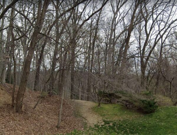
(Updated at 9:15 a.m. on 7/12/23) A secluded wooded area south of Pimmit Run in North Arlington with a little-known history is up for sale and Arlington County could become the buyer.
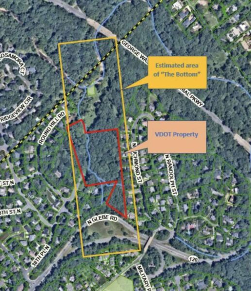
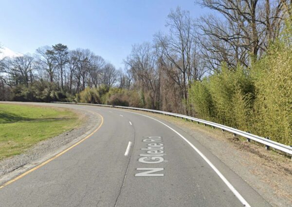
The county is considering whether to buy a 6.7-acre parcel near the Chain Bridge Forest neighborhood from the Virginia Dept. of Transportation for $2.88 million. The property, between a curving section of N. Glebe Road and Pimmit Run, includes both developable and protected land.
VDOT originally intended to use it for a connector road from N. Glebe Road to Route 123 (Chain Bridge Road) in Fairfax County, which it never built, the county says. It now is giving Arlington first dibs before turning to private buyers. Should the sale go through, the county would set the land aside for public open space.
The property in question sits within the historic boundaries of a near-forgotten settlement by freed Black people who worked the land from the 1850s to the 1950s, according to the county and Jessica Kaplan, a local expert on and author of a definitive 2018 article about the community.
Kaplan pieced her article together from census data, deeds, wills, maps and claims residents made against the government for property it confiscated during the Civil War.
The settlement grew after John Jackson, a free Black man, bought three acres from white landowner William Walker, who he had known since childhood, shortly before the Civil War broke out, Kaplan writes. She says it is unclear if he sold to Jackson because of their friendship or because white people were not interested because it was a low-lying, flood-prone area.
Despite those issues, Jackson went through with the purchase. Walker’s initial sale sparked a small exodus of Black families — who had either escaped slavery, bought their freedom or were born free — from Fairfax County to what is now Arlington.
In what may be a riff on the problems with the land, residents called it “The Bottom,” Kaplan writes. At its peak, 20 families lived there.
“Whether [leasees] or owners, they found relative safety in numbers and in the secluded, timber-lined hollow of The Bottom,” she said. “The Bottom remained their home through challenging times: war, Reconstruction, Jim Crow, segregation, and suburbanization.”

Residents eked out a living farming, tending livestock and quarrying stone, she said. During the Civil War, men helped build nearby Fort Marcy and Fort Ethan Allen while women sold baked goods and did laundry for soldiers. Some of the Union soldiers, however, raided their farms and burned the land for fuel.
With paltry government repayments for confiscated property, the families built back after the war, Kaplan wrote. They farmed, quarried stone and worked for nearby white families. Their children walked three miles to attend the closest school for Black children, then called Sumner School.
The enclave dwindled to non-existence in the 1950s as residents died, moved to other Black neighborhoods in Arlington such as Halls Hill, or left the area. Economic pressures were compounded by access: Arlington County abandoned a road running along The Bottom’s west side and circumvented it with the new N. Glebe Road to Chain Bridge.
Investors ended up owning all the land comprising The Bottom, eventually selling to the U.S. government. Kaplan says the community “became the anchor for an overpass of the George Washington Memorial Parkway.”
Arlington County says VDOT acquired the land for the never-built connector road between the 1960s and 1970s. Fifty years later, the state agency is shopping around for a buyer and the county seems primed to preserve the property from possible redevelopment.
“Acquisition of the Property would preserve a contiguous 6.7-acre tract of land in Arlington County, as open space, in its natural state,” a county report says. “The site is a ‘Generational’ or unique opportunity that if not acquired at the point of time of availability, would likely redevelop and the opportunity would be lost for a generation or more.”
When asked if part of the property could be the site of, for instance, a new fire station — given the higher response times in this part of Arlington — Dept. of Environmental Services spokeswoman Katie O’Brien told ARLnow the county has no plans to build there at this time.
Instead, the county may create a new park, a plan with which Kaplan agrees.
“If the county purchases the land it should retain it as a nature area with trails for public use and not release any of it for development purposes,” she told ARLnow. “The tree canopy is too important. Placing signage about the African American history of the Bottom would be essential no matter what the county intends for the tract. Also, I’d love to see some archaeological work done to uncover additional insights.”
If Arlington pursues using the land in some way, Historic Preservation Program staff will play a consulting role, but the county would have to work with a cultural resources firm or archaeologist, according to Cynthia Liccese-Torres, the coordinator for the preservation program.
Archaeological work could unearth clues as to the whereabouts of a possible cemetery presumed to be nearby — though the exact location has never been confirmed.
Kaplan will be presenting on a new project, “Memorializing the Enslaved,” Thursday from 7-8:30 p.m. at the Reinsch Library Auditorium at Marymount University (2807 N. Glebe Road). The event is free to attend and has a virtual option.


