Arlington County and much of the rest of the D.C. region is under a Tornado Watch through 5:00 p.m.
Forecasters say an incoming cold front could produce strong storms and possibly tornados. From the National Weather Service:

Arlington County and much of the rest of the D.C. region is under a Tornado Watch through 5:00 p.m.
Forecasters say an incoming cold front could produce strong storms and possibly tornados. From the National Weather Service:
Arlington County is under a Severe Thunderstorm Watch until 10:00 p.m. tonight, according to the National Weather Service.
Forecasters say severe storms may form as a cold front approaches the area. From Arlington County:
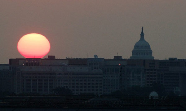
The low temperature at Reagan National Airport this morning was a chilly 60 degrees. Despite lots of sunshine, we’ll be lucky to reach 80 degrees this afternoon.
It’s a continuation of yesterday’s fall-like weather, which tied for the 4th-coolest Aug. 14 in recorded D.C. history, according to the Capital Weather Gang.
Arlington and the D.C. region is currently under an excessive heat warning. The National Weather Service says it will be dangerously hot today.
EXCESSIVE HEAT WARNING IN EFFECT FROM NOON TODAY TO 8 PM EDT THIS EVENING…

The restaurant reopened Wednesday morning with temporary A/C units, District Taco owner Osiris Hoil said in an email. The county’s health department told the restaurant to close Tuesday after it was determined that food was being stored in an environment that was too warm.
“The A/C was a contributing factor, but not the reason for closure,” said Department of Human Services spokesman Kurt Larrick. “With the A/C not working, the refrigerator was overburdened and wasn’t able to keep the food cool enough.”
Update at 11:00 a.m. — WMATA has announced that passengers on Metrorail and Metrobus will be permitted to carry water in sealable, reusable bottles or containers until Friday.
Arlington and the surrounding region is under a heat advisory this afternoon.
This article was written by Audrey Batcheller
A flash flood is a weather condition defined by the National Weather Service as “a rapid and extreme flow of high water into a normally dry area, or a rapid water level rise in a stream or creek above a predetermined flood level, beginning within six hours of the causative event.” In other words, a tremendous amount of water in a short amount of time caused by thunderstorms or heavy rainfall.
Arlington is under a Flash Flood Warning until 3:15 a.m.
Slow-moving storms moving into the area have the potential for heavy, persistent rainfall, which could flood streams and low-lying areas.
(Updated at 4:15 p.m.) The National Weather Service has upgraded the Severe Thunderstorm Watch for Arlington and surrounding areas to a Severe Thunderstorm Warning. It is in effect until 4:30 p.m.
From NWS:
In light of strong storms that are expected to blow through the area this afternoon and evening, the National Weather Service has issued a Tornado Watch for the D.C. metro area, including Arlington. It is in effect until 10:00 p.m.
From NWS:
Arlington is currently under a Severe Thunderstorm Watch as storms develop to the west of the immediate Metro area.
The watch is in effect through 10:00 p.m. From the National Weather Service:
The National Weather Service has issued a Severe Thunderstorm Warning for Arlington and the surrounding region.
A line of strong storms is approaching the area from the north. From the NWS: