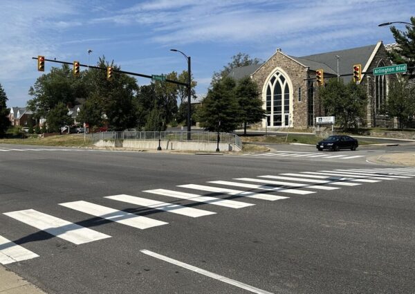
Arlington County has converted two intersections near Nottingham Elementary to four-way stops, in the wake of last year’s fatal crash on Little Falls Road.
In October, a driver struck and killed a woman at the intersection of Little Falls and John Marshall Drive. She was the third pedestrian killed along a two-block stretch of Little Falls Road near the school over the past eight years.
In the aftermath, the county began investigating the appropriateness of an all-way stop at the intersection.
Two such traffic patterns were installed along Little Falls Road in mid-March, Dept. of Environmental Services spokeswoman Katie O’Brien says: one at the intersection with John Marshall Drive and the other with N. Ohio Street.
“The two new all-way stop locations are located on both sides of the Nottingham Elementary School and help facilitate crossing opportunities for pedestrians and traffic control on this section of roadway,” O’Brien said. “Additional pavement markings and tactical improvements were made at the intersection of Little Falls Road and N. Nottingham Street.”
Last winter, as part of a traffic safety campaign, the county temporarily ramped up traffic enforcement on Little Falls Road, which saw two previous fatal crashes in 2014 and 2019.
Then, with the urging of the County Board to make safety improvements faster, it made some other short-term updates to the two intersections, says O’Brien.
The all-way stops were deemed necessary after multiple observations and on-site reviews to “assess the operations and effectiveness of the recent short-term improvements,” the spokeswoman said.

In another step to increase safety, last week the county reduced speeds near Nottingham. It made the area around the school a “School Slow Zone,” where there is a permanent 20 mile-per-hour speed limit on a neighborhood street within 600 feet of a key access point to a school.
Earlier this week, meanwhile, at the intersection of N. Quincy Street and 9th Street N. in Ballston, an all-way stop was added in response to an extensive study and data collection effort. Pavement markings will follow soon, says O’Brien.
Safety concerns at this intersection date back more than a decade. The county has added upgrades incrementally to the originally sign-free intersection, Google Maps shows.
By 2010, ARLnow previously reported, a crosswalk and “yield to pedestrians” flags were added. Then, the county added neon yellow pedestrian signs and a repainted crosswalk.
O’Brien says the county studied whether to add stop signs given the limited impact of previous upgrades and repeated safety concerns from residents who cited the high volume of traffic at the intersection.
“This most recent study’s conclusion at this location reflects further consideration of the travel volumes and crash history at this location,” O’Brien said. “It also is part of our Vision Zero approach to safety intervention that calls for a progressive method on implementing safety measures when past efforts do not result in the desired outcomes.”
Arlington County is looking to make a three-block stretch in Courthouse safer for pedestrians, cyclists and motorists.
Specifically, it is looking for ways to improve conditions along a three-block stretch of Wilson Blvd and Clarendon Blvd between N. Uhle Street and N. Adams Street.
The county says the overall project goal is to “create a safe and consistent travel experience for people walking, taking transit, biking, and driving through the Courthouse section of the Rosslyn-Ballston corridor,” which has a lot of pedestrian, transit and micro-mobility activity.
Through this Sunday, the county is asking people to share their current experiences as road users and what upgrades matter to them.
When it comes to government priorities, safety is a top concern. The county says Clarendon and Wilson Blvd have seen a higher concentration of critical crashes in recent years.
They are included in a “High Injury Network,” a designation the county uses to prioritize adding transportation safety features to its least-safe roads. This is part of Arlington’s Vision Zero initiative to eliminate fatal and severe-injury crashes by 2030.
Within the project’s boundaries, there was a pedestrian crash with severe injuries on Clarendon Blvd in 2015, per a dashboard of crashes with severe and fatal injuries. One block east of the intersection with N. Uhle Street, there was a fatal pedestrian crash in 2014.
Another aim is to fill a “missing link” in bicycling facilities. Clarendon and Wilson Blvd are identified as “primary bicycling corridors” in the county’s Master Transportation Plan, as is N. Veitch Street, which connects cyclists to Langston Blvd, the Custis Trail and the Arlington Blvd Trail.
The county says it aims to realize community visions for better walking, cycling and transit experiences in Courthouse with new curbs and ramps for people with disabilities and improved bus stops and facilities near the Courthouse Metro station.
To encourage (proper) use of shared e-bikes and scooters, the county will review and provide “adequate end of trip facilities.” That could look like the corrals it has installed elsewhere in the Rosslyn-Ballston corridor and in Crystal City and Pentagon City.
Whatever improvements are selected would link to upcoming road resurfacing work. The county previously incorporated small upgrades when it resurfaced Clarendon Blvd from Courthouse Road and N. Scott Street and from N. Garfield Street to N. Adams Street.
The improvements would also link to street upgrades developer Greystar is delivering via its under-construction Landmark development (2050 Wilson Blvd), set to wrap up this fall, and its redevelopment on the former Wendy’s site (2025 Clarendon Blvd).
Those projects will bring about:
- A “bike island” at the intersection of 15th Street N. and Clarendon Blvd, as well as more and wider protected and dedicated bike lanes
- Wider sidewalks
- Improving pedestrian crossings of Wilson Blvd and Clarendon Blvd
- Two new “floating” bus stops
- A pedestrian promenade along N. Uhle Street from Clarendon Blvd and 15th Street N.
- Relocated and newly installed traffic signals
More signs preventing right turns at red lights are going up around Arlington County to reduce crashes.
They were added to long stretches of major arterial streets, including Columbia Pike and Wilson Blvd. The county has concurrently reprogrammed walk signals to give pedestrians a head start crossing the street.
These changes are being made to eliminate crashes that are fatal or result in serious injuries, the aim of its two-year-old traffic safety initiative known as Vision Zero.
“This is a win for pedestrian safety benefit,” said Chris Slatt, a member of Sustainable Mobility for Arlington, which has advocated for more of no-turn-on-red signs in areas with many pedestrians. “You would want to be safe to walk and not have to worry about driving through crosswalk.”
Some drivers have anecdotally reported congestion and longer idling times to ARLnow.
“Seems like these signs cause a lot of cars to sit and idle at intersections longer than they used to,” notes one tipster. “They also generally gum up traffic.”
County documents note there have been safety benefits seen in areas with high pedestrian volumes. Additionally, a focus group of elderly adults appreciated the red light restrictions.
The county’s view is that any reasonable trade-off is worth it.
“Although traffic may slightly increase at times due these safety interventions, the trade-off is a safer environment for our most vulnerable users — pedestrians and bicyclists,” Dept. of Environmental Services spokeswoman Katie O’Brien said.
During Vision Zero’s second year, per a report, the county has been adding no turn on red signs on:
- Columbia Pike from the county line to Washington Blvd
- Fairfax Drive from N. Glebe Road to N. Kirkwood Dr
- Clarendon Blvd from N. Highland Street to Ft. Myer Drive and Wilson Blvd
- Wilson Blvd from N. Glebe Road to Fort Myer Drive
Year 2 of Arlington’s Vision Zero plan wraps up this spring.
The county says it has also grown the number of signalized intersections with a 3-7 second head start for pedestrians from 31 to 77 during Year 2. Studies show this change can reduce pedestrian-vehicle collisions by up to 60%.
As of March 2022, the county had no-turn-on-red signs at 147 approaches — each point of an intersection — after adding signs at 35 approaches in Year 1 of Vision Zero, per a May report.
Priority intersections for these changes include those with many pedestrians and bicyclists, restricted sight distance and a history of turn-related crashes, according to a “Vision Zero toolkit” of traffic safety treatments.
Arlington joins other states and municipalities, including D.C., phasing out the right-on-red at busy intersections. A number of studies have shown right on red decreases safety and restrictions improve safety for pedestrians and cyclists.
"Washington, D.C., will end most right-on-red turns by 2025. Already, the state of Hawaii has prohibited them on a tourist-dense stretch of road in Honolulu. The city of Berkeley in California is considering banning right on red at all intersections." https://t.co/zF0etmTtTr
— The War on Cars (@TheWarOnCars) March 10, 2023
Right on red was legalized 50 years ago to prevent idling and save gas during an oil embargo proclaimed by oil-exporting Arab countries, according to the county. The Energy Policy and Conservation Act of 1975 required states to allow right turns on red to receive certain federal funds.
“Unfortunately, the country has been experiencing the trade-offs of right on red turns ever since,” the county said in the Vision Zero toolkit.

Lower speeds near schools could soon become countywide policy in Arlington.
On Saturday, the Arlington County Board is set to consider an ordinance to lower speed limits to 20 miles per hour on streets within 600 feet of a school property or pedestrian crossing in the vicinity of the school. This would expand on slow zones around 13 schools instituted last year.
The county says in a report that the proposed slow zones respond to positive community feedback from the first round of school zones and are part of its efforts to eliminate traffic-related serious injuries and deaths by 2030, also known as “Vision Zero.”
The ordinance comes as Arlington County appears to have ended 2022 with fewer severe injury crashes than 2021 — when the County Board approved a Vision Zero plan — but the same number of fatal crashes.
In 2022, there were 44 severe and four fatal crashes, including two fatal pedestrian-involved crashes, per county data available through Nov. 23, 2022. The year before, there were 61 severe and four fatal crashes, none of which involved a pedestrian.
If approved, the Dept. of Environmental Services will lower the speed limit on 36 road segments starting next month, according to spokesman Peter Golkin.
“We expect signs to start posting the new speed limit in February-March,” he said. “We will follow up with additional pavement markings in the spring once weather permits.”
When complete, drivers will notice treatments such as high visibility crossings and school zone signage within the school zone, as well as appropriate speed limits on the school’s beaconed arterial roadways, per a December Vision Zero newsletter.
The new, lowered speed limit of 20 mph, applicable at all times of day, will be in effect and enforceable “as soon as the new speed limit signs are posted,” Golkin said.
To remind drivers of the change, the county will send public announcements during February and March through county email lists, civic associations, APS channels and social media, he said, noting that “news coverage like ARLnow’s will also be a great help.”
In addition, he said, the signs themselves will be a notification.
“Drivers should always be cognizant of the speed limit when driving,” the DES spokesman said. “They also have a bright neon yellow SCHOOL symbol on top of them, which should generate extra attention.”
The Arlington County Board last year took another step to reduce speeds, approving the installation of moveable speed cameras in school and work zones. In response to a rash of critical crashes, including a fatal pedestrian fatally struck near Nottingham Elementary School in October, Board members put more pressure on staff to respond more quickly.
Around where the pedestrian was struck on Little Falls Road, Arlington County police issued 10 traffic ticket in one hour during a one-day enforcement effort last month. Also in mid-December, some “quick-build” improvements were installed along the road, between John Marshall Drive & N. Kensington Street, per the December Vision Zero newsletter, below.
The improvements at John Marshall Drive include:
- Addition of a high visibility crosswalk on the south crosswalk
- Tactical curb extensions to sharpen/slow down turning vehicle turns and reduce crossing distances
- Additional signage
Improvements at N. Lexington Street include:
- Bus stop/sharrow markings
- High visibility crosswalks
- A tactical curb extension to sharpen/slow down turning vehicle turns and reduce crossing distances.
Improvements at N. Kensington Street (north side) include:
- High visibility crosswalks
- Tactical curb extensions to sharpen/slow down turning vehicle turns and reduce crossing distances
- Enhanced signage at the crossing over Little Falls Road
- Changing the yield to a stop sign (south side)
These improvements are currently in progress and will ultimately encourage slower vehicle speeds, and improved pedestrian and transit maneuvers.
Additionally, DES is conducting an all-way stop evaluation and is collecting footage of the Little Falls Rd and John Marshall Dr intersection to monitor operations between all road users. These evaluations will be considered as DES plans for permanent intersection improvements.


Arlington is proposing to lower speed limits near schools across the county to 20 mph as the county’s second year of Vision Zero enters the rear-view mirror.
This Saturday, the Arlington County Board is set to hear a proposal to expand these slow zones to all schools, after many people said they felt safer walking, biking and driving in 13 school zones where the speed limit has already dropped to 20 mph.
If the Board approves the changes, school zones will all get permanent signs with the new speed limits. The county says this is cheaper and more broadly applicable than flashing beacons, which will only be used on arterial streets within 600 feet of schools during arrival and dismissal times.
This change follows the approval earlier this year of moveable speed cameras to be installed in school and work zones, as well as calls from the Arlington County Board for a quicker staff response to critical crashes, after a driver fatally struck a pedestrian in an intersection near Nottingham Elementary School.
Schools have figured into other notable crashes, including a fatal crash involving a motorcyclist and a school bus in front of Drew Elementary in 2021 and a crash involving a drunk driver who killed a pedestrian near Thomas Jefferson Middle School this summer. In a less serious crash this fall, a driver struck an adolescent cyclist near Kenmore Middle School.
Lowering speeds is one action the county has taken over the last year and a half to work toward its goal of eliminating traffic-related fatalities and serious injuries by 2030, a plan known as Vision Zero.
“There are no corridors on county-owned roads that have a speed limit higher than 30 miles per hour, which is a big improvement. We’re very excited to say that,” Arlington Vision Zero coordinator Christine Sherman Baker said in a meeting last week.
In addition to lower speeds, the county has set up temporary school walking routes and roundabouts, completed 13 quick-build projects and made improvements to six critical crash sites and 14 crash “hot spots.” Staff are working on procuring speed cameras for school and work zones and red light cameras for six more intersections, which could be installed in 2023.
Amid the flurry of work, preliminary data from the first nine months of 2022 indicate crashes are down overall, according to a Vision Zero report released last month. As of Aug. 30, there were 1,313 crashes in Arlington, of which two were fatal and 34 were severe. (We’ve since reported on two additional fatal crashes.)

Pedestrian-involved crashes and crashes in intersections are both slightly lower, while bike crash figures are consistent with previous years. There has yet to be a crash in a work zone.
“Alcohol and speed prove to be some of our biggest challenges on our roadways,” Baker said in the meeting.
But some people say the county needs to be clearer in communicating if and how its work is reducing crashes as well as the dangers of driving.
A stretch of Lorcom Lane on the northern edge of the Cherrydale neighborhood is slated to get pedestrian safety upgrades, particularly aimed at improving a school walking route for kids.
Between N. Quebec Street and Nelly Custis Drive, the county will install sidewalks where there are none, widen existing sidewalks and reduce pedestrian crossing distances. Kids walk this stretch of Lorcom Lane to get to Dorothy Hamm Middle School and Taylor Elementary School.
These changes, and others, “originated through community-reported transportation safety concerns, crash data, and the results of the Vision Zero Pilot Safety Project on the north side of this corridor,” per a project webpage.
This summer, a driver struck a woman pushing a stroller at the intersection of Military Road and Lorcom Lane, just west of the corridor slated for improvements. This area had previously been re-striped with the goal of reducing conflicts between drivers and cyclists.
The pilot project responded to safety concerns for the 40% of students who walk or bike to Dorothy Hamm and the 10% who bike to Taylor. Last spring, Arlington Public Schools encouraged kids to walk or bike to school, if they could, to reduce the number of students on the bus, and thus their risk for a Covid exposure.
For kids walking on the northern side of Lorcom Lane between N. Oakland and N. Quebec streets, that meant navigating vehicle and bicycle traffic without a sidewalk. So the county installed temporary parking restrictions to create a dedicated walking path for pedestrians.
Feedback was positive, according to a summary of survey results.
“About 70% of people walking or biking felt safer while traveling here than before the pilot project was implemented,” per the report. “Most respondents for each mode of transportation felt as safe or safer while traveling here than before.”
During a 20-hour period, staff observed about 60 people — nearly one-third of all pedestrians on Lorcom Lane — using the buffered walking path. Nine times out of 10, at least one vehicle drove by when a pedestrian was walking in the buffer area.
Based on that data and positive feedback, staff decided to make the pilot permanent.
Other planned changes include resolving “alignment issues” with the intersection of N. Quebec Street and Lorcom Lane and addressing safety issues at the intersection of Lorcom Lane and Nelly Custis Drive. This intersection is adjacent to a preschool run by Cherrydale United Methodist Church.
There are three other projects within a half-mile radius, including the controversial roundabout pilot project at Military Road and Nelly Custis Drive that could become permanent.
Arlington County also plans to fill in a missing sidewalk at 4100 Nelly Custis Drive and execute a “quick-build” project at N. Quincy Street and Nelly Custis Drive.
This southeast corner of the intersection will get a marked curb extension, while the pedestrian crossing over Nelly Custis Drive will be shortened and the entire intersection will get new, accessible curb ramps. These changes were identified via a safety audit conducted on the Fairfax Drive corridor in 2019.
The project, initially set to be completed this calendar year, won’t be ready until next spring or summer, as county staff are working on an easement there, says Department of Environmental Services spokeswoman Claudia Pors.


Arlington County Board members have indicated their impatience for traffic changes at an intersection where a woman was fatally struck by a driver two weeks ago.
During a meeting yesterday (Tuesday), Board members received a briefing from team members from Vision Zero — the county’s initiative to eliminate traffic fatalities and serious injuries — about all the work they do after a critical crash.
But Board members were less interested in the process and dwelled more on getting answers to questions like “How long will this take?” and “What can we do now?” Part of that motivation, according to Board Chair Katie Cristol, was that the death of 85-year-old Gwendolyn Hayes felt preventable.
“Any fatal crash is unacceptable to our community, as I know you feel deeply, as do we. And what feels so difficult about Ms. Hayes’ death is the sense that this is one that should have been prevented, especially because of those who had been killed at the same location before her,” she said.

This was the second pedestrian death and the third notable crash in recent months, and the rash has prompted residents to demand more action. Viviana Oxlaj Pérez died in early August after being struck by an alleged drunk driver on 2nd Street S. and Old Glebe Road. A man charged with involuntary manslaughter related to her death has hearings set for February 2023, according to court records.
Shortly after, a child on a bicycle who allegedly pedaled into oncoming traffic was struck at the intersection of 3rd Street S. and S. Carlin Springs Road. Then, Hayes died at the intersection of Little Falls Road and John Marshall Drive.
All three crashes were near schools: Thomas Jefferson Middle School, Kenmore Middle School and Nottingham Elementary School, respectively. And while school zones are slated to get speed cameras, possibly later next year, it won’t help safety at the intersection where Hayes died, which is just outside the school zone boundaries.

In light of these crashes, Board members pressed staff to give timeframes for the police investigation into Hayes’ and Oxlaj Pérez’s deaths. They asked when police will choose a vendor for speed cameras, and asked if more red light cameras could be installed. They urged staff not to let new research into this intersection slow them down.
“We’ve got a lot of data, we’ve got a lot of information that doesn’t require a lot of time to initiate original research and study,” Board Vice-Chair Christian Dorsey said. “I would encourage us to use the data that we have and the analytical framework and tools we have to work as expeditiously as we can.”
County Board member Matt de Ferranti said he visited with a neighbor near Little Falls Road who always has first aid supplies ready to take care of people who get into crashes. There have been a total of three fatal pedestrian crashes along a two-block stretch of Little Falls Road near Nottingham Elementary School over the past eight years.
De Ferranti said he has seen videos showing how hazardous the conditions are. These are examples of “qualitative data” staff should use to prioritize changes to this intersection, he said.
“I really hope we can be thinking in weeks and not months in terms of additional action,” he said.
Staff at Arlington’s Dept. of Environmental Services, which builds and maintains local roads, say they’re working on preliminary designs for safety improvements, but are waiting for the facts of the police investigation to finalize these designs.
“We are prioritizing this [intersection],” Transportation and Operations Bureau Chief Hui Wang said. “We are trying to see if there are other data we can utilize without the fresh collection.”

(Updated, 4:55 p.m.) A recent crash has renewed concerns about an intersection near the year-old Lubber Run Community Center.
For years, the intersection of N. Park Drive and N. George Mason Drive in the Arlington Forest neighborhood has been a source of worry for neighbors. The mix of speeding, four lanes, and a lack of a traffic signal have resulted in too many vehicle crashes, residents told ARLnow.
There have been 19 crashes at the intersection dating back to 2017, per data provided to ARLnow by the county’s Department of Environmental Services (DES). That includes one pedestrian-involved crash in 2018. None of the crashes resulted “in severe injury,” DES said.

But since the new Lubber Run Community Center opened in July 2021, the problem has only gotten worse. Nearly half of those crashes have happened in just the past 19 months, statistics from the Arlington County Police Department show.
That includes another crash earlier this week.
@ARLnowDOTcom yet another crash at N. Park Dr. and N. George Mason. @ArlingtonVA how many accidents at this intersection before we get a light? Or are you waiting for a child to get hit first? This is right by the community center and school. pic.twitter.com/ZgcJB4zMyJ
— David (@Dhartogs) October 11, 2022
The county did add Rectangular Rapid Flashing Beacons (RRFBs) at the intersection in late 2020 as part of a transportation study related to the community center project.
“The intersection so far has not been identified as part of the Vision Zero High-Injury Network corridor or Hot Spot program,” DES said.
But this has not alleviated neighbors’ concerns. There’s a considerable worry that with increased pedestrian traffic, plus with Barrett Elementary School also nearby, it’s just a matter of time before a driver hits another pedestrian.
In other parts of the county, preventing pedestrian and bicyclists-involved crashes has been a significant ongoing concern amid a continued series of tragedies.
David Hartogs, who has lived in the townhomes across the street since 2005, told ARLnow he’s witnessed a “handful of crashes” and has heard at least another dozen at the intersection just over the last few years.
He recounted several of the crashes that stick in his mind most to ARLnow, including a car jumping a curb last spring, two accidents that resulted in vehicles ending up in the woods, and even a school bus “brushing” a motorcycle last November.

Earlier this week, Hartogs saw another crash and tweeted about his concern. As he noted on social media, he believes that there needs to be a traffic signal at that intersection and not just an RRFB.
He walks his kids to school and often thinks about their safety crossing that intersection.
(Updated at 4:30 p.m.) A handful of main roads in Arlington may be getting speed limit reductions.
At its meeting this Saturday, the Arlington County Board is slated to vote to advertise a potential reduction in the speed limit on four arterial streets, per a staff report.
The reductions would target road segments with high volumes of pedestrians walking to and from transit stations, schools, apartment buildings and commercial areas, the county says. Among them:
- Washington Blvd from Arlington Blvd (Route 50) to N. Pershing Drive (35 to 30 mph)
- S. Joyce Street from Columbia Pike to Army Navy Drive (35 to 30 mph)
- Columbia Pike from S. Dinwiddie Street to the Fairfax County line (35 to 30 mph)
- Lorcom Lane from Cherry Hill Road to Military Road (30 to 25 mph)
The segments also have more serious and fatal crashes than other roads, the report said.
The selected segment of Washington Blvd, south of Clarendon, sees lots of foot traffic due to the public transit stops on both sides of the road connected by controlled and uncontrolled marked crosswalks, according to the county.
The corridor had 39 crashes in a 5-year period, and is one of the roads in Arlington’s Vision Zero High Injury Network, which accounts for 78% of all serious or fatal crashes. North of Arlington Blvd, the speed limit on Washington Blvd is already 30 mph.
S. Joyce Street, in the Pentagon City area, also has “steady” pedestrian activity due to a transit stop. The county says more people will walk, cycle and scoot along the road — which passes near the Air Force Memorial — once Columbia Pike is realigned to expand Arlington National Cemetery.
Lower speeds here “are essential” for lowering the risk of severe collisions, since the lane widths are limited and have no shoulders, per the report. To improve walkability on this stretch of S. Joyce, the county widened sidewalks and installed new lighting in 2013.
The Dept. of Environmental Services also recommends lowering speeds on the segment of Columbia Pike from S. Dinwiddie Street to the Fairfax County line to account for increased walking and transit use associated with new transit stations. Columbia Pike, with 85 crashes in a five-year period, of which six involved pedestrians, is also part of what has been designated the “High Injury Network.”
Continuing east on Columbia Pike, the speed limit is currently 30 mph.
Meanwhile, a high volume of people walk and cycle across Lorcom Lane to go to and from Dorothy Hamm Middle School, per the report. The school also has foot traffic outside school hours and on weekends, for events such as the Cherrydale Farmers Market, which started last year, despite complaints from some neighbors.
This road saw 18 crashes in six years, and of those, speeding contributed to three crashes.
The county considered, but decided not to lower speeds on segments of S. Walter Reed Drive, S. Four Mile Run Drive and Wilson Blvd from N. Glebe Road to the Fairfax County line — where the limit is currently 30 mph.
At its upcoming meeting, the Board is also expected to enact some speed reductions in Courthouse and Glencarlyn, which were advertised last month. The planned speed limit changes are:
- Fairfax Drive from Arlington Boulevard to N. Barton Street (30 mph to 25 mph)
- 5th Road S. from S. Carlin Springs Road to the Fairfax County line (35 mph to 25 mph)
(Updated at 1:45 p.m.) The Arlington County Board has put a project to construct a segment of 12th Street S. on hold indefinitely in its Capital Improvement Plan guidance.
The segment between S. Monroe Street and S. Glebe Road, located near the post office in the Douglas Park neighborhood, is currently a paved sidepath. The path runs in the middle of two sections of 12th Street S., which is designated as one of the Columbia Pike Bike Boulevards, according to the project’s website.
The project to change the path into a two-lane street with curb and gutter was put on hold by the County Board after evaluating the “multiple additional improvements” needed to fulfil Vision Zero, a national initiative to eliminate all serious traffic accidents, and the Columbia Pike Neighborhood Plan, according to the County Board Guidance for CIP.
“This is a particularly challenging project initially identified as an opportunity to improve grid connectivity,” County Board Chair Katie Cristol said in a Board meeting. “I think we have found that it has been very difficult to serve the needs and meet the needs of all users as envisioned in that project.”
Instead, the County Board decided to move the $2.7 million allocated to other “priority projects” within the Columbia Pike Bike Boulevard program, which is intended to provide cyclists with a continuous route parallel to Columbia Pike.
Since the shelving of the project, the county’s Department of Environmental Services is planning to “conduct a corridor analysis” to complete the bicycle route, DES spokesperson Erin Potter said.
The project on 12th Street S. prompted a significant amount of concern from residents, especially on the introduction of cars to what is currently a bike-and-pedestrian-only path. Many commenters wanted “the existing trail and sidewalk configuration to remain as is” with no cars allowed, according to a summary of public feedback done in the beginning of this year.
Moreover, residents who gave feedback were concerned about possible increase in cut-through traffic if a two-lane street were to be constructed, as well as the risk to children since the road segment was near a school bus stop, according to the summary.
Arlington has thankfully shelved its bizarre “12th St S Complete Streets” project that would have converted a bike path into a 2-lane road for cars. https://t.co/ggqTfBLNtV
— &rew (@orang55) July 26, 2022
This project originally aimed at connecting S. Lincoln Street, now a dead-end street in the middle of the block between Glebe and Monroe, to 12th Street S., as well as to fill the gap in the bike boulevard. Construction was originally supposed to begin in spring next year, according to documents for a public meeting.

More on the decision, from the project web page:
Based on County Board Guidance on the FY 23-32 Capital Improvement Plan (CIP), this project is being indefinitely deferred. Funding allocated to this project will be “redirected to support future priority projects within the Columbia Pike Bike Boulevard Program. Staff will conduct additional feasibility and scoping work that would focus on completing the Bike Boulevards throughout the Columbia Pike corridor and specifically addressing areas where gaps exist.”
The project may be revisited in the future, “triggered by changing conditions including development opportunities, multimodal corridor needs, and other County priorities.”
Map via Google Maps

Four people died in crashes in Arlington during 2021, the first year of the county’s initiative to eliminate traffic fatalities and injuries.
That’s in addition to 61 severe crashes, according to the first annual report evaluating the transportation safety initiative Vision Zero.
Arlington County is measuring the effectiveness of its five-year action plan by tracking the severity of crashes and factors involved, such as speed, alcohol and whether a pedestrian or bicyclist were injured.
This month marks the kickoff of the initiative’s second year, which will feature awareness campaigns around behaviors that lead to serious crashes. The campaign will run through December and concentrate on different behaviors each month, starting with bike awareness.
The overall number of crashes in 2021 — 1,785 — decreased by about 30% compared to previous years, but that was attributable to lower traffic levels compared to pre-pandemic years, according to the report.
All four fatal crashes occurred at intersections, and did not involve a pedestrian or bicyclist. In 2020, there were four fatal crashes and 50 that caused severe injury, according to the county’s crash analysis dashboard.
The report noted the 174 alcohol-related and 487 speed-related crashes in 2021 marked a slight uptick. Speed was a factor in one of the fatal crashes.
Lessons learned
Many of the more than 90 action items the county lists in the framework have been checked off. Arlington has completed or started 36 small-scale safety projects, finished an analysis of 69 crash hot spots, and facilitated 55 transportation safety classes and events, among other tasks.

Some of the lessons learned in year one include a need to amp up community engagement, and decrease the frequency of crash hot spot analyses from once a year to every two years.
Two walkability routes that were piloted saw opposite outcomes. A pilot on Lorcom Lane in residential North Arlington was extended and county staff are looking to fund a permanent sidewalk there in the upcoming Capital Improvement Plan.
The report noted the Lorcom Lane path “showed high usage, positive community feedback, and observed benefits from separating cars, bikes, and pedestrians.”
But the county halted a similar effort — temporary bollards and wheel stops on S. Carlin Springs Road — months after placement. Arlington Public Schools, Arlington police and community members raised concerns with the pilot after observing “erratic driving around the barriers.”
That area of S. Carlin Springs Road has narrow sidewalks, little or no pedestrian buffer and a history of crashes. The goal of the pilot was to create a safer walking path for students at Campbell Elementary School, Carlin Springs Elementary School and Kenmore Middle School.
County staff will continue to assess options for “enhancing sidewalks and access along the corridor, including connectivity options when the County redevelops the Virginia Hospital Center site,” according to the report.
Several other efforts to increase safety, particularly around schools, advanced in the first year of Vision Zero. The installation of 20 mph school slow zones around 13 schools in early 2022 is under evaluation and could be extended to all schools in the county.
In January, the County Board approved speed cameras in school and work zones, heralding them as a step toward the Vision Zero goal.
In the upcoming year, the report says, there are two full-time employees confirmed to work on Vision Zero and some studies will be completed, such as the evaluation of roadways that have speed limits above 30 mph.