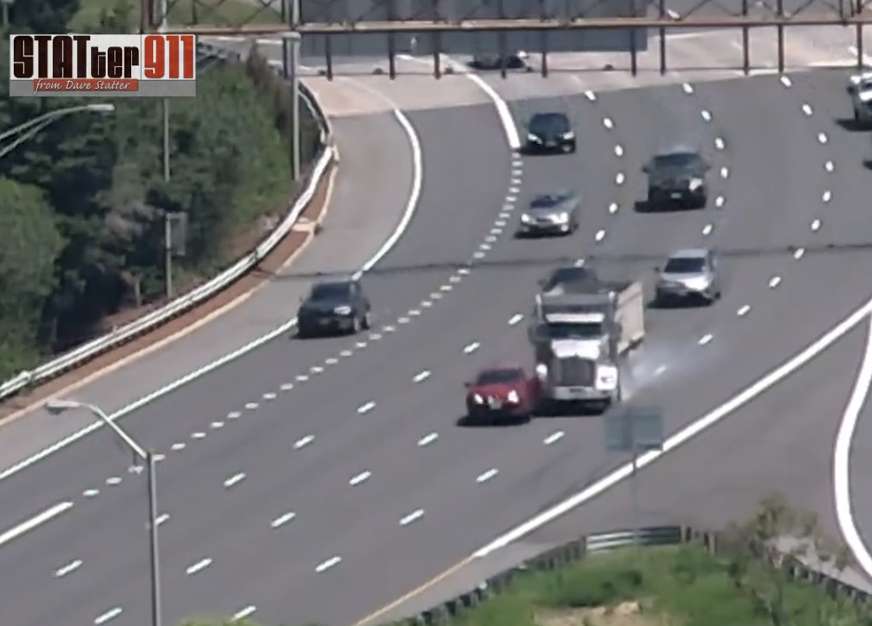
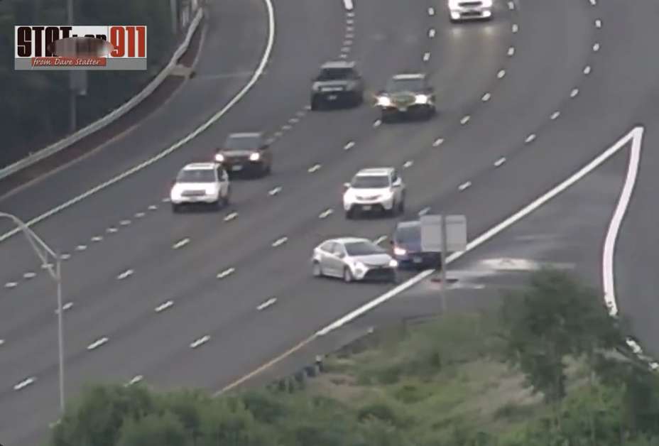
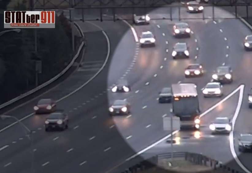
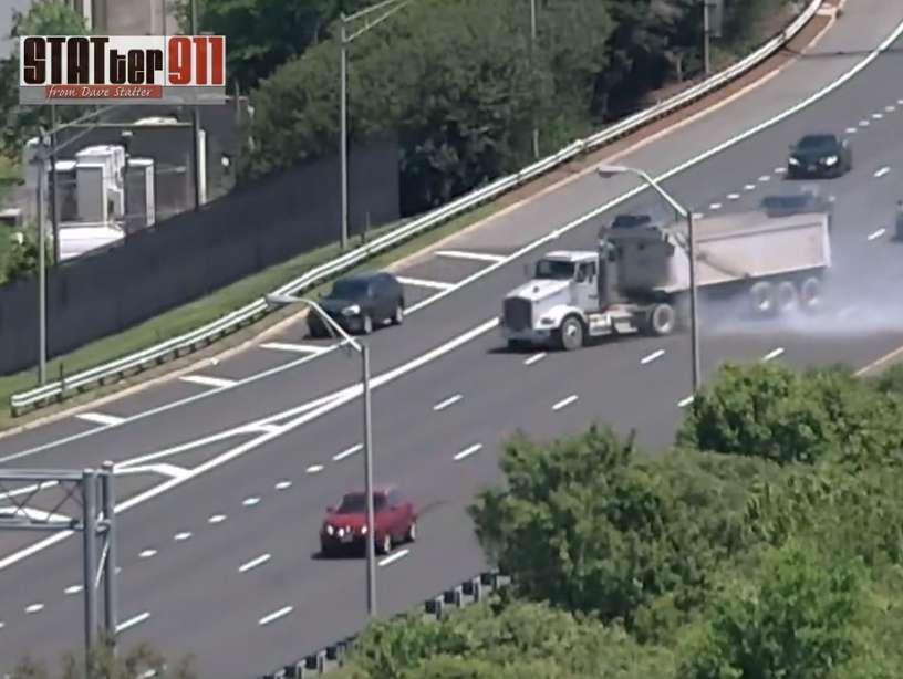
Wonky GPS directions and old road design are some of the factors that have led some drivers to haphazardly cross several lanes of highway traffic at an I-395 exit, leading to multiple crashes.
Videos, captured from a Crystal City high-rise apartment by former local news reporter Dave Statter, show drivers consistently and dangerously moving across four lanes of southbound I-395 traffic specifically to make the lefthand Route 1 exit (8C).
Watch: Look at the chaos created behind this car as the driver stops in the middle of I-395. They were likely dutifully following GPS dangerously routing them from Boundary Channel to Rt 1. @WTOPtraffic @ARLnowDOTcom @VaDOTNOVA @luzcita @JWPascale @AdamTuss @tomroussey7news pic.twitter.com/uG7fAjqBLu
— Dave Statter (@STATter911) April 27, 2022
The situation is at its most perilous when a driver is coming from Boundary Channel Drive, takes the I-395 southbound on-ramp, and realizes the exit to Pentagon City, Crystal City and Alexandria is only a few hundred feet on the left. Meaning, in order to take it, the driver has to move their car over four lanes of high speed highway traffic in a very short distance.
Some of the numerous videos Statter posts look something like a real-life game of Frogger.
“Watching these people doing this crazy dance to get to the left hand exit,” Statter says. “It’s just a constant, constant thing.”
Caught this one a few minutes ago. How do you do this on an interstate highway? @ARLnowDOTcom @VaDOTNOVA #traffic #vatraffic #395cam #statcam pic.twitter.com/Q6R7PY29bO
— Dave Statter (@STATter911) June 1, 2022
Even when we are talking, Statter spots two more drivers attempting to make the same maneuver, despite the fact that VDOT had recently put up a line of orange barrels in an attempt to prevent it.
He also seen plenty of drivers entering I-395 southbound from further down, like the onramp from the GW Parkway, but still realizing too late that they need to take exit 8C on the left.
Since Statter started training his cameras on this section of I-395 back in November, he says he has caught upwards of 18 accidents. All of which involve drivers trying to quickly take the left hand exit.
#caughtoncamera: A crash on I-395S at Exit 8A tonight. You'll never guess how it happened. @ARLnowDOTcom @charlienbc @tomroussey7news @JohnKelly @RealTimeNews10 @CordellTraffic @VaDOTNOVA @JWPascale @AdamTuss @FitzFox5DC @HCBright10 @luzcita #395cam #drivers #traffic #vatraffic pic.twitter.com/CYxIfmqpSH
— Dave Statter (@STATter911) June 3, 2022
Statter says that part of the issue here is the design of the roads and the Pentagon, which was built nearly 70 years ago.
“There’s a lot of on-ramps in such a short period of time,” he says. “[It’s my impression] that’s not the standard for interstate highways of today.”
But a culprit also appears to be modern technology. At least until recently, app-based GPS directions like Google Maps and Apple Maps were telling drivers to engage in this dangerous lane-shifting.
Statter calls it an “enormous problem” with drivers getting “hyper focused” on GPS directions instead of using their own eyes and critical thinking skills to realize that perhaps the directions being offered are not safe.
“You get the impression [the drivers] are panicked,” he says. “They stop in the middle of 395, trying to do what GPS is telling them to do or where they think they need to go.”
#caughtoncamera: Just happened. 3rd crash in as many days on I-395S at Exit 8C/Rt 1. It appears the red car didn't stop & no other cars struck. @VSPPIO has all lanes open. @WTOPtraffic @DildineWTOP @ARLnowDOTcom @tomroussey7news @AdamTuss @JWPascale @luzcita #drivers pic.twitter.com/k103reTdzF
— Dave Statter (@STATter911) May 9, 2022
These videos have actually led to action, though. Ellen Kamilakis, spokesperson for the Virginia Department Transportation, tells ARLnow the social media posts have directly led to VDOT looking at ways to fix the issue.
Earlier this week, crews put up the temporary barrels to discourage swift moves to the left hand exit — even if some drivers still don’t get the message.
.@VaDOTNOVA's barrels have reduced the numbers crossing 4 lanes to get to Exit 8C but there are still plenty of dangerous drivers making the trip. Check the hang time on this one a short time ago. What are they thinking? @ARLnowDOTcom @tomroussey7news @CordellTraffic @charlienbc pic.twitter.com/soKbmRZNXH
— Dave Statter (@STATter911) June 7, 2022
“We regularly interact with Dave Statter on Twitter. We saw the videos and agreed that something needed to be done,” Kamilakis writes to ARLnow. “The barrels are the first physical step in short-term improvements that we are doing at that exit.”
The barrels will eventually be replaced by flex-post bollards, much like what’s seen on northbound I-395 at the Route 110 ramp and express lane split. In that case, VDOT took action after seeing videos Statter posted of drivers — including a Metrobus driver — cutting across the highway to get to the express lanes.
Southbound I-395, Kamilakis said, will also be getting new orange signage that will be mounted on existing overhead signs.
“We want to be as clear as possible that Route 1 is a left exit,” she writes.
The Boundary Channel Interchange project is also expected to help alleviate some of the confusion and the issue, with construction starting on that in the coming weeks. It’s expected to be completed in the fall of 2023.
Additionally, in terms of app-based GPS directions, it appears that Google Maps has changed where it directs drivers.
Earlier this week, ARLnow plugged in “2300 Richmond Highway” in Crystal City into Google Maps, proceeded to drive to Boundary Channel Drive and take the I-395 southbound on-ramp. Rather than telling us to take the Route 1 South/8C exit, it told us to go further down to exit 8A.
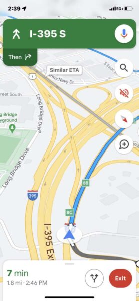
VDOT’s understanding is that Google Maps recently made that tweak, Kamilakis said.
As for the other app-based GPS systems, Waze stopped recommending that move perhaps as early as 2014, according to the Washington Post. Apple Maps, on the other hand, does appear to be still telling drivers to make the short, risk-filled trip across the highway.
ARLnow has reached out to Apple but has yet to hear back as of publication.
It may not be a surprise to learn that Statter is a former local news reporter, working for TV station WUSA for more than two decades. He even covered traffic for WTOP radio in the early 1980s. Now, he’s a consultant for media issues and public safety who also runs a website focused on firefighter and first responder issues, including trying to improve D.C.’s 911 response.
He re-picked up his traffic-watching hobby during the pandemic because it gave him “something to do.” But he also says he enjoys helping to fix problems.
“It’s about the greater good and what it means to be a good citizen,” Statter says. “And that means not putting other people in danger.”
Sometimes that means just driving by an exit and catching the next off-ramp.
“If you’re about to miss your exit, simply go to the next one and loop back around,” Kamilakis said. “It may take a couple more minutes, but it can likely prevent a crash.”


