

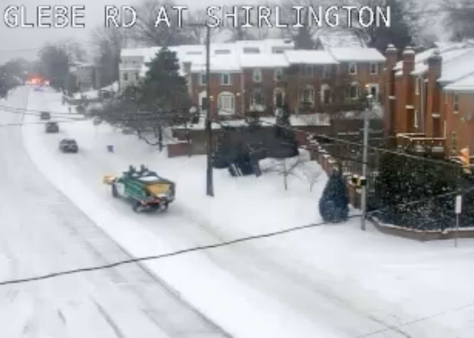
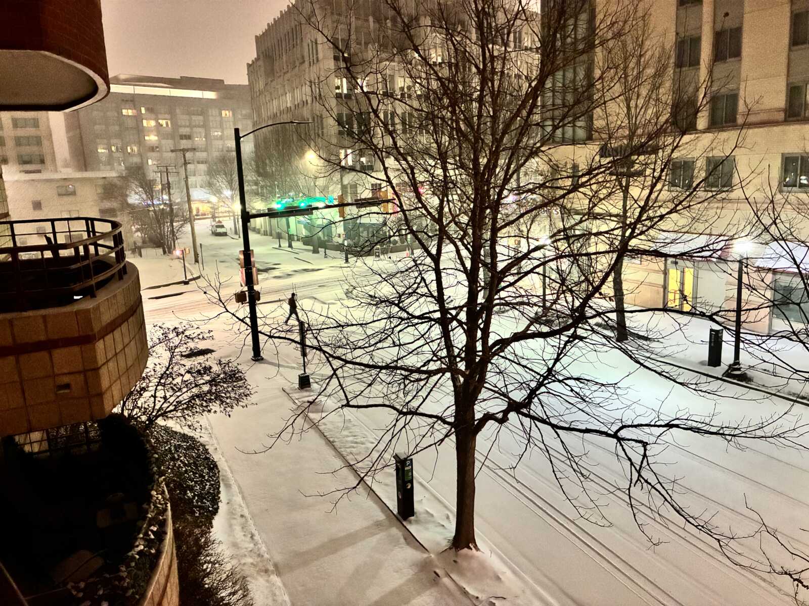
Roads in Arlington are snow- and sleet-covered as of 9 a.m., leading to driving difficulties even for the professionals.
As of 8 a.m., 5 inches of snow accumulation were measured in North Arlington by ARLnow, as an increasing amount of sleet started mixing with the flakes.
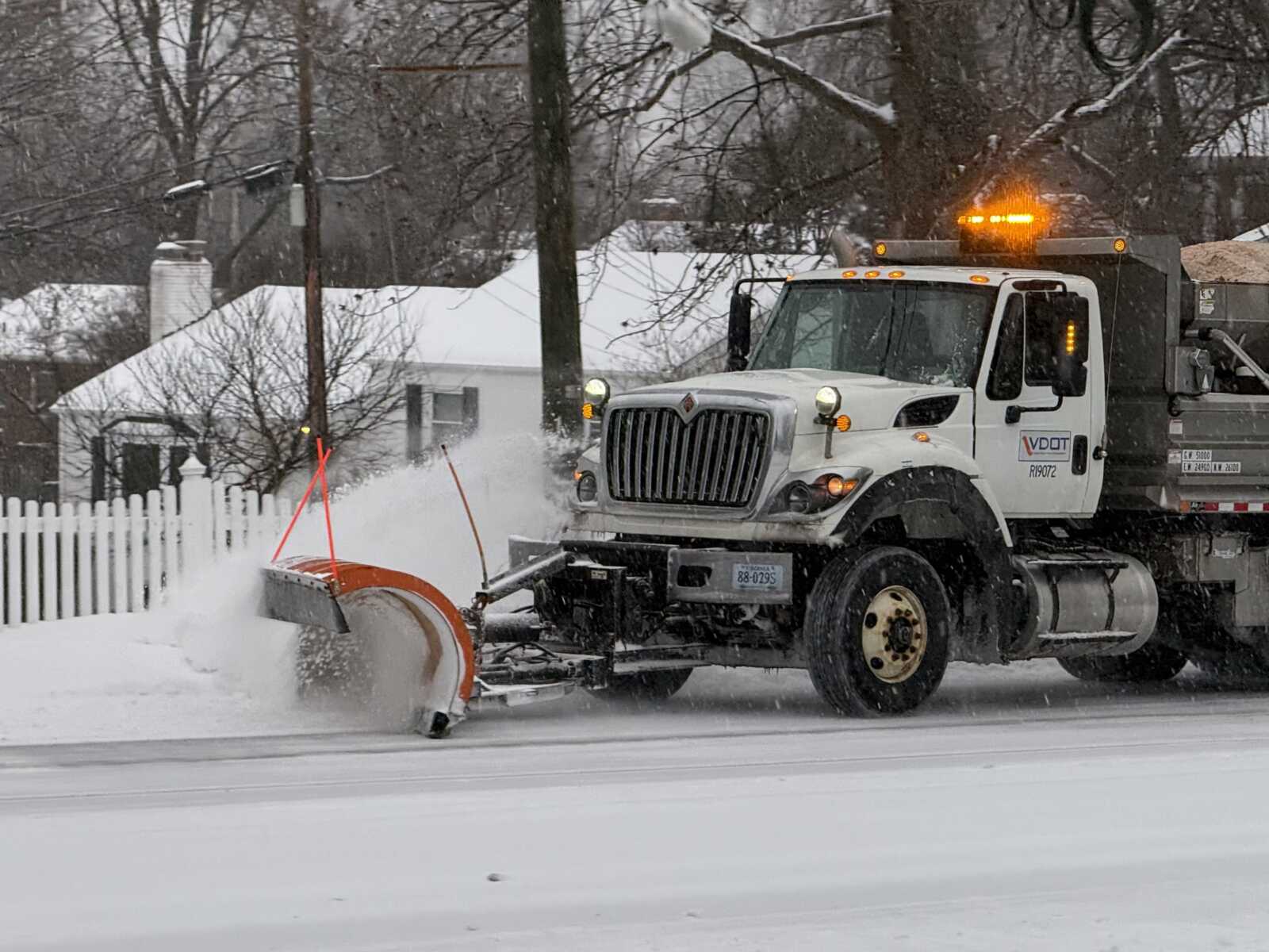
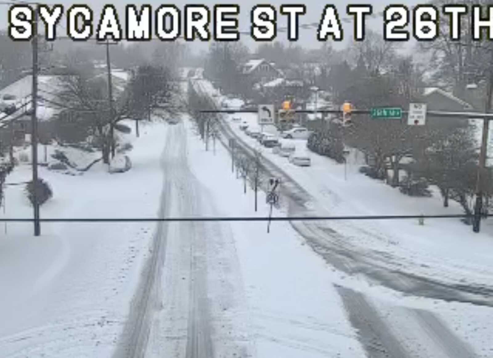
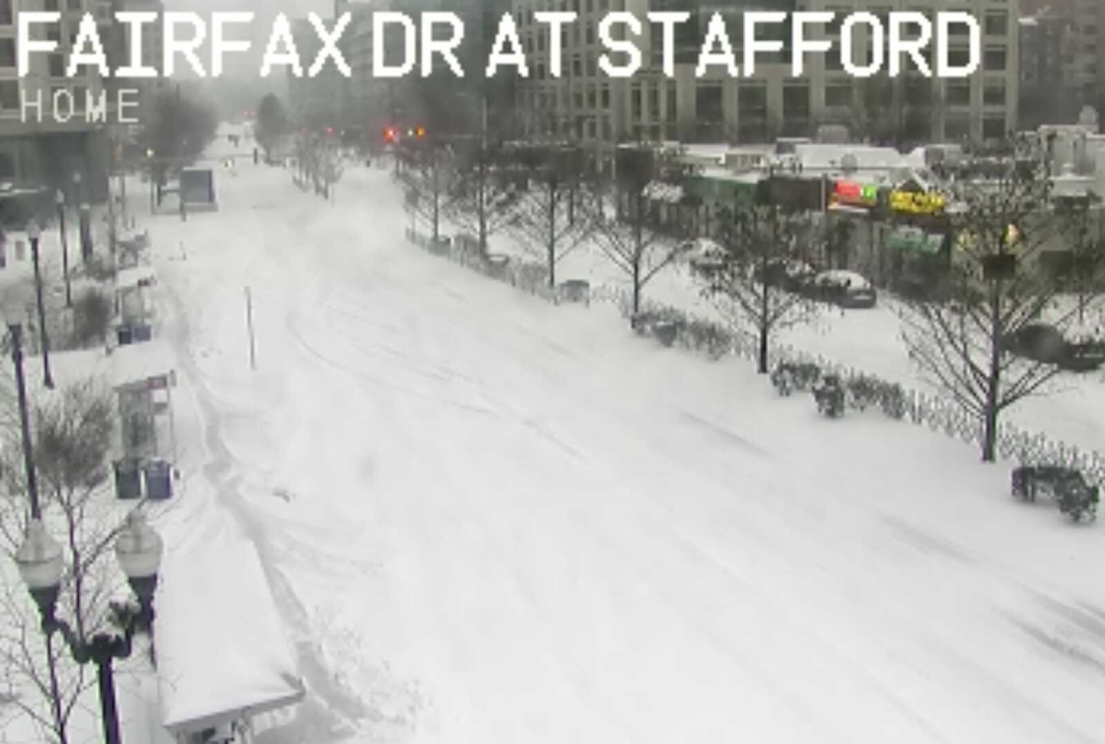
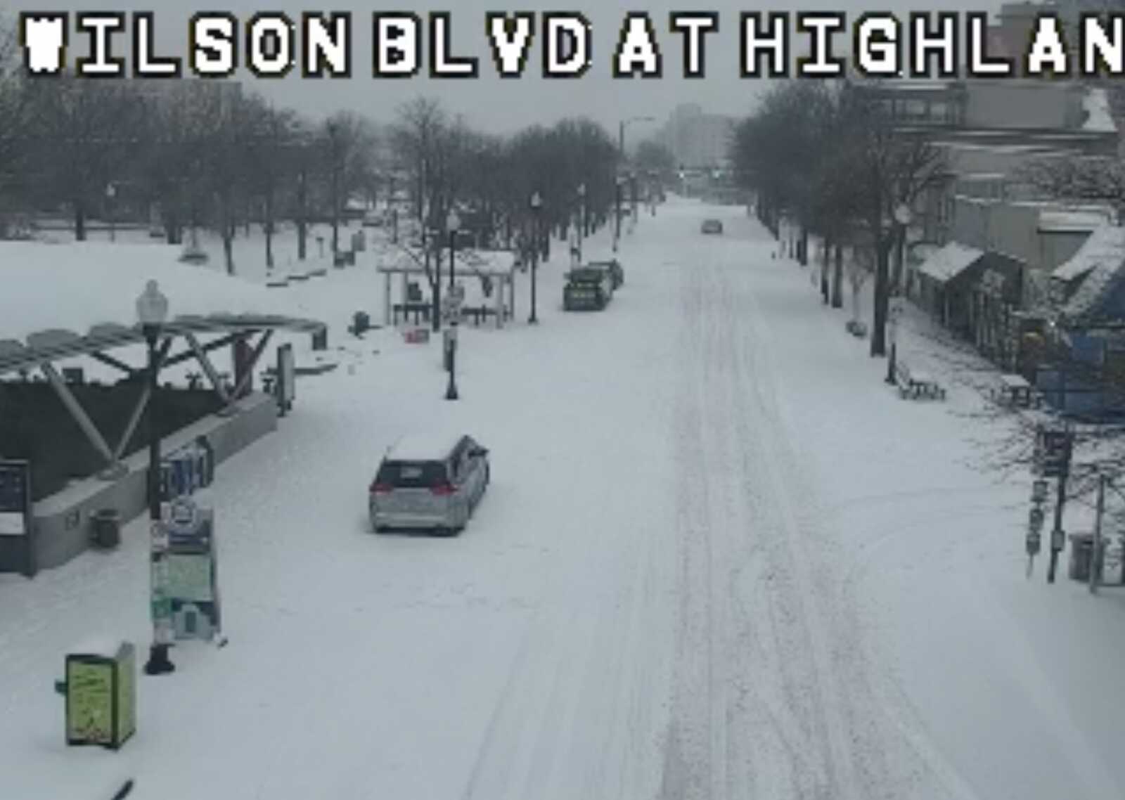
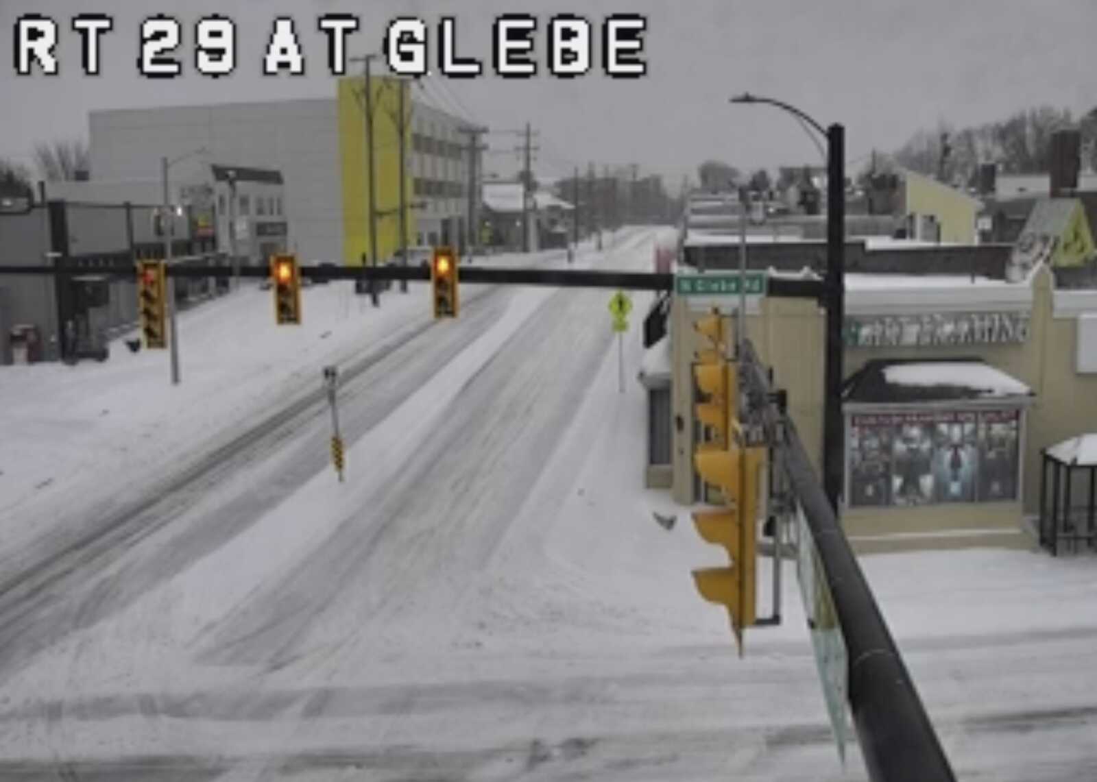
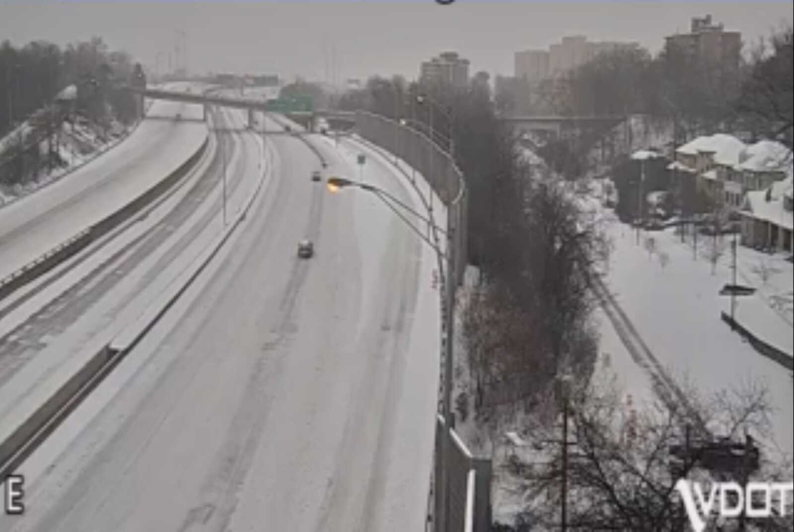
Traffic volumes on main roads are light, according to a survey of traffic cameras. While main roads are being plowed and treated — and are passable by drivers with the right tires and vehicles — local roads are largely untreated and treacherous, especially on hills. Even highways like I-395 have a layer of snow and very light traffic, traffic cameras show.
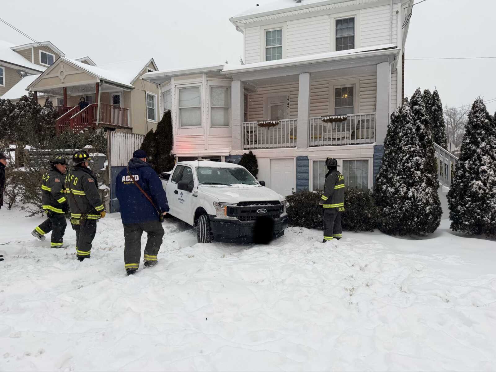
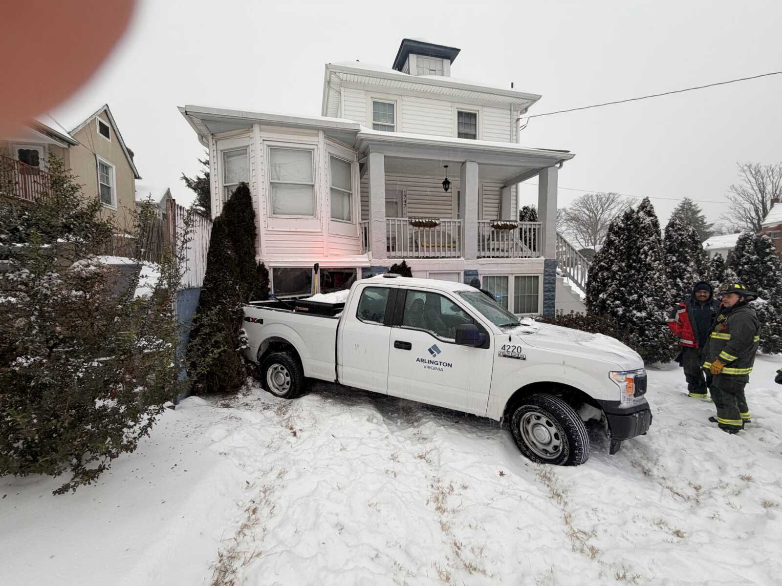
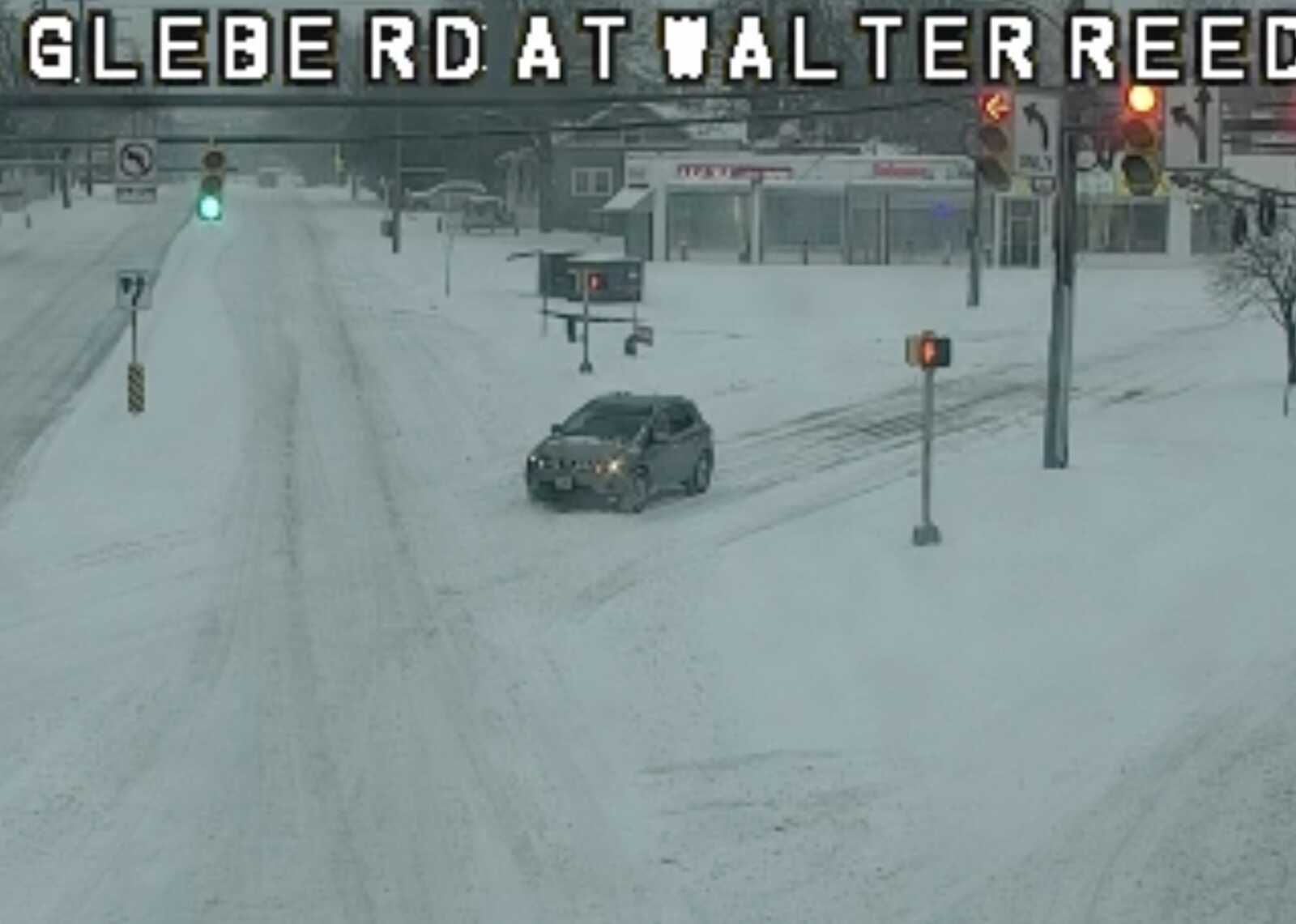
Around 8:20 a.m., slick conditions led the driver of an Arlington County public works pickup truck to slide off a somewhat hilly portion of the 1700 block of S. Glebe Road and into a house. The driver was evaluated for injuries but no one was inside the house at the time, according to scanner traffic.
“A vehicle slid off the roadway and struck a home at the intersection of S. Glebe Rd. and Walter Reed Dr.,” the Arlington County Fire Department said on social media. “There were no injuries reported. S. Glebe Rd. northbound will remain closed while the vehicle is removed. Please stay off the roads if possible!”
A short time ago an Arlington County Government vehicle came off of S. Glebe Road and into the front yard of a home at S. 17th Road. No indication of serious injuries. @ArlingtonVaPD and @ArlingtonVaFD hadled. #snow #arlington #weather #traffic @ARLnowDOTcom @matthewyoung31… pic.twitter.com/ES4f2gBabU
— Dave Statter (@STATter911) January 25, 2026
Hills elsewhere in Arlington are also producing problems. A social media user captured an SUV driver trying — and failing — to drive up a hill near the Marine Corps War Memorial.
Slick roads at 110 & Marshall Drive in Arlington @capitalweather @wjlaweather @ARLnowDOTcom pic.twitter.com/hu0ohPQcYu
— Stefanie Mullin Johnson (@StefJohnson21) January 25, 2026
As a result of the weather, many Metrobus routes have been suspended and ART service has been suspended in its entirety until further notice, according to the respective transit agencies.
Arlington County declared a local state of emergency Saturday night, ahead of the winter storm, warning of “hazardous conditions that could result in power outages, make travel nearly impossible, and cause peril to life and property.”
Arlington County Manager Mark Schwartz signed a Declaration of Local Emergency for Arlington County in response to the winter storm forecasted to impact the region this weekend.
The impacts of the storm and prolonged sub-freezing temperatures are likely to create hazardous conditions that could result in power outages, make travel nearly impossible, and cause peril to life and property. The declaration goes into effect on Saturday, Jan. 24, 2026.
A declaration of a local emergency allows the County to formally and quickly request additional resources from the state and federal governments, as available, to assist in response and recovery efforts.
Arlington remains under a Winter Storm Warning from 11 p.m. Saturday to 4 a.m. Monday, with heavy mixed precipitation expected, per the National Weather Service (NWS). Snow and sleet accumulations could total between 6 and 10 inches, with up to 14 inches possible.
Arlington’s declaration follows Virginia Governor Abigail Spanberger declared a State of Emergency in advance of the winter weather.
Stay informed throughout the storm by signing up for Arlington Alert at ArlingtonAlert.com and visiting the County website.
The current mix of snow and sleet is expected to turn into freezing rain later today, making conditions even more dangerous for drivers and pedestrians alike. Arlington and the D.C. area remains under a Winter Storm Warning until 4 a.m. Monday.
More, below, from the National Weather Service.
…WINTER STORM WARNING REMAINS IN EFFECT UNTIL 4 AM EST MONDAY…
* WHAT…Heavy mixed precipitation expected. Total snow and sleet accumulations between 6 and 10 inches, with up to 12 inches possible, especially in the far northern and western suburbs of Washington and Baltimore. Ice accumulations between one and two tenths of an inch.
* WHERE…DC, central, northeast, and northern Maryland, and northern Virginia.
* WHEN…Until 4 AM EST Monday.
* IMPACTS…Power outages and tree damage are likely due to the ice. Travel could be nearly impossible. The hazardous conditions could impact the Monday morning commute.
* ADDITIONAL DETAILS…Snow will continue today, heavy at times with rates of around one inch per hour possible at times. A mix with
sleet or freezing rain is later this morning and into the afternoon. Significant icing is possible especially south of Highway 50. Visibility of one-quarter mile or less is possible at times. A prolonged period of wind chills in the single digits and teens continues this evening and lasting through the middle of next week, with sub-zero wind chills possible at times.PRECAUTIONARY/PREPAREDNESS ACTIONS…
If you must travel, keep an extra flashlight, food, and water in your vehicle in case of an emergency. The latest road conditions for
the state you are calling from can be obtained by calling 5 1 1.Persons should consider delaying all travel. Motorists should use extreme caution if travel is absolutely necessary.
