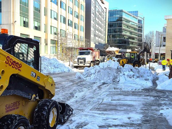
Lingering 'snowcrete' at 1400 N. Quincy Street (staff photo)
Piles of “snowcrete” and debris are still hanging on at a Virginia Square site almost two months after the winter storm that hit Arlington in late January.
Two main mounds of ice are still present in the parking lot at 1400 N. Quincy Street as of today (Monday) — the larger of which appears to be around 5 to 6 feet high at some points.
While the past 24 hours might be particularly extreme — National Airport recorded a record high of 86 yesterday, and now it’s 33 degrees in North Arlington and snowing — the temperature roller coaster isn’t done.
Monday’s expected high temperature of 70 will be followed by a predicted low of 28 on Tuesday, according to forecasts.
That brings us to our poll question: What do you think about the snow today? Given the following two poll options, which one are you choosing?
A pothole on 10th Street N. near Courthouse in 2025 (staff photo by Dan Egitto)
A cold and snowy winter has produced large numbers of potholes in Arlington, though perhaps not as many as some might expect.
About 190 pothole fill requests have been filed in Arlington since Feb. 1, Peter Golkin, a spokesperson for the Department of Environmental Services, told ARLnow. About 50 were pending as of Wednesday.
County crews clear snow in January 2026 (via Arlington County/X)
Local residents will be roasting under the midsummer sun when county staff bring forward plans to improve snow response in the 2026-27 winter season.
County Manager Mark Schwartz told County Board members on Feb. 24 that he would be back in July with new plans. And he wasn’t kidding about the timing.
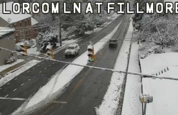
Lorcom Lane plowed on a snowy Monday morning (via traffic cam)
What a difference a storm makes.
After January’s winter storm left nearly-impossible-to-plow snowcrete covering neighborhood roads in Arlington for days, local residents are waking up today to something very different: neatly plowed streets across much of the county.
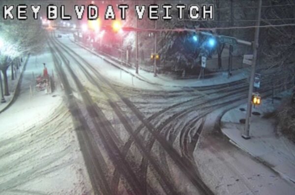
Snow covering Key Blvd near Courthouse (via traffic cam)
With heavy snow continuing to fall, Arlington Public Schools has decided to close Monday.
The snow day for Arlington students follows earlier decisions by nearby Fairfax County and Montgomery County to also close. D.C. schools, meanwhile, will open on a two-hour delay.
Snow in Westover on Jan. 3, 2022 (staff photo by Jay Westcott)
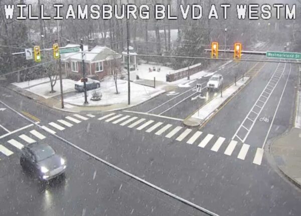
A Winter Weather Advisory has officially been issued for Arlington and much of the D.C. area, ahead of Sunday’s expected storm.
The National Weather Service is currently predicting 2-4 inches of snow accumulation. The flakes will mostly fall Sunday night and early Monday, with temperatures dipping below freezing after a cold rain for most of the day.
Another winter storm could arrive in Arlington in a few days, but forecasts are still shaky going into the weekend.
As of this afternoon, the National Weather Service is predicting increasing odds of a winter storm warning going into effect on Sunday, and places Arlington at “elevated” risk for heavy snow and sleet.
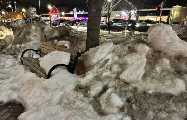
Large chunks of dirty snow around a sidewalk bench in Rosslyn (courtesy George Brazier)
The county government has issued 15 citations for failure to clear snow and ice after last month’s storm and responded to hundreds of complaints.
Nearly 630 complaints about violations were recorded by county officials in the days and weeks after the winter storm, county spokesman Ryan Hudson told ARLnow.
A recent meeting zeroed in on a lack of attention given to a key entrance to the Bozman Government Center, as well as lingering snow on many curb cuts and sidewalks.