HEAT ADVISORY issued for Sunday. Significant heat may continue through at least Monday. Take appropriate precautions to avoid any heat related illnesses. pic.twitter.com/pwWnKv0RoK
— NWS Baltimore-Washington (@NWS_BaltWash) June 30, 2018


HEAT ADVISORY issued for Sunday. Significant heat may continue through at least Monday. Take appropriate precautions to avoid any heat related illnesses. pic.twitter.com/pwWnKv0RoK
— NWS Baltimore-Washington (@NWS_BaltWash) June 30, 2018

Arlington County and much of the D.C. area is under a Heat Advisory today.
Forecasters warn that the sweltering temperatures outside are dangerous and outdoor activities should be avoided.

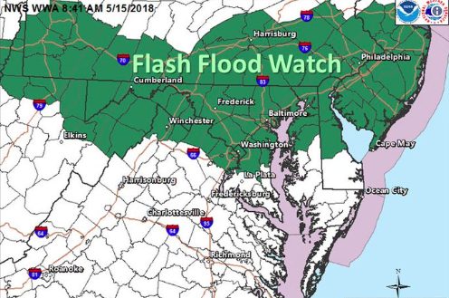
Arlington County is among the areas under a Flash Flood Watch Thursday afternoon through early Friday morning.
Forecasters say slow-moving storms may develop and drop several inches of rain in a short period of time.

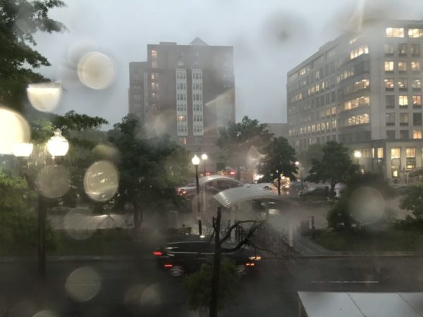
Update at 5:15 p.m. — As heavy rain continues to fall, high water has been reported on a number of roads, including: along Route 50; on Route 110 below Memorial Drive; at the intersections of Lorcom Lane and Lee Highway; Old Dominion Drive and N. Thomas Street; and at the intersection of N. Quantico Street and 26th Street N.
https://twitter.com/LuckyLyzzie/status/999035569920409601

Arlington County is under a Severe Thunderstorm Warning as strong storms approach.
The National Weather Service issued the warning just before 8:35 p.m. It is in effect, at least initially, through 9:15 p.m.
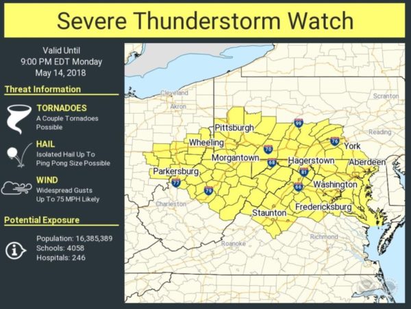
Update at 5:55 p.m. — Arlington and much of the D.C. and Baltimore region is now under a Severe Thunderstorm Watch.
A severe thunderstorm watch has been issued for parts of DC, MD, VA until 11 PM EDT pic.twitter.com/wRkTqvrADp
Update at 7:45 p.m. — There have been reports of downed trees, branches and power lines in Arlington, but no major power outages have been reported by Dominion. Flights are Reagan National Airport are resuming.
No major flooding issues have been reported, though ARLnow.com’s office sprung a leak during the storm.
Update at 2:25 p.m. — Forecasters warn that a derecho is possible tonight. The last such wind event to hit the region caused significant damage on June 29, 2012.
Potential for a derecho…a line of severe thunderstorms producing widespread damaging winds to develop this afternoon & move through parts of the central Appalachians and northern mid Atlantic region including Washington DC metro. Stay alert for warnings and seek safe shelter. pic.twitter.com/rlkbNzJPgV

Arlington and much of the D.C. region will be under a Wind Advisory starting at 10 a.m. Wednesday.
Forecasters say that a line of showers and thunderstorms in the morning will give way to gusty winds through Wednesday evening. The wind gusts may damage trees and cause power outages.

Meltwater from the wet spring snow that fell today may refreeze overnight, leading to treacherous conditions Thursday morning.
That’s the message from VDOT, which issued the following press release this evening.
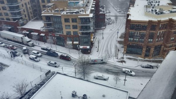
Four inches of snow has fallen in Arlington, according to the 2 p.m. snowfall total at Reagan National Airport.
The snow has led to slippery roadways and numerous closures. Though above-average temperatures and dogged work by Arlington and VDOT crews has resulted in many main roads being more wet than snow-covered as of mid-afternoon, a number of accidents and spinouts have been reported.

Most roads in Arlington have become snow-covered throughout the course of the morning as the D.C. area’s first — and likely last — big snowstorm of the season continues.