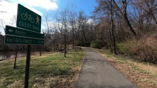
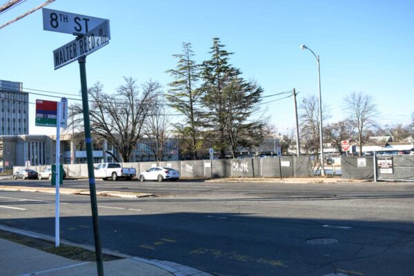
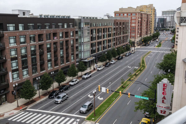
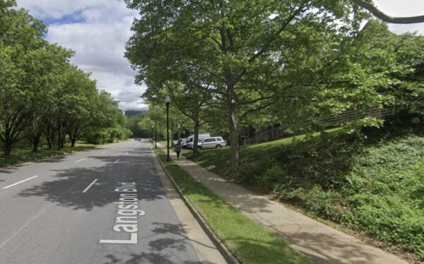
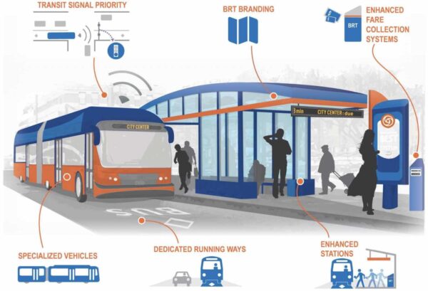
One day, a new bus rapid transit line could connect East Falls Church to Alexandria and Tysons Corner.
But the planning effort for the bus line, Envision Route 7, needs more studies and outreach, according to Northern Virginia Transportation Commission, or NVTC, which is leading the planning effort.
Although it received federal and state funding, NVTC appealed to the jurisdictions served by the bus line — including Arlington — for additional local funding to advance that work. This weekend, the Arlington County Board approved chipping in $70,000 over two years.
The bus rapid transit line would run between the Mark Center in Alexandria and the Spring Hill Metro station in Tysons, mostly making stops along Leesburg Pike in Bailey’s Crossroads and the City of Falls Church. Along the way, it will briefly pass through Arlington via the East Falls Church Metro station.

Envision Route 7 is now in its 10th year of planning and its fourth planning phase.
During this phase, NVTC will study traffic and environmental impacts and conduct extensive public outreach.
To do that work, it received $2 million in federal funds, requiring $500,000 in non-federal match. It then received $500,000 this fiscal year from the state Department of Rail and Public Transportation, requiring local match of $500,000.
Arlington previously contributed into earlier planning stages, which helped to decide on using bus rapid transit along the corridor.

This weekend, the Arlington County Board is set to consider a proposal to funnel nearly $400,000 into the second phase of the Bluemont Junction Trail safety project.
Phase 2 includes moving and updating three trail connectors to be accessible to people with disabilities and improving cyclist and pedestrian intersections between the W&OD Trail and the Four Mile Run Trail on both sides of Wilson Blvd, per a county report.
The plan also calls for resurfacing a 480-foot segment of Four Mile Run Trail and repairing a nearby pedestrian bridge.
The project is part of a multi-year county effort to address poor visibility between trail users and drivers along the Bluemont Junction Trail, which crosses the Bluemont neighborhood and connects Ballston to the W&OD Trail at Bluemont Park. Plans were developed by the county with input from the public and the Bluemont Civic Association, the Bicycle Advisory Committee and the Pedestrian Advisory Committee
In the project’s first phase, which spanned the fall of 2021 to last summer, the county and the Virginia Dept. of Transportation made upgrades to roughly 4,500 linear feet and 13 connector trails, the report said. This included reconfiguring the trail’s intersections with N. Emerson Street and N. Kensington Street.
The second phase, however, demands more “in-depth engineering” than the milling and repaving carried out in the first phase, the report said.
Rep. Don Beyer has earmarked $325,000 in federal funds for the second phase of the project, which has an estimated total cost of $711,662.
The community will have an opportunity to provide input on the designs and proposed improvements if the funds are allocated, a county staff report notes.

The Arlington County Board is set to update the rules of the road to align with a new state law aimed at improving pedestrian safety.
This weekend, the Board is set to enact changes to local ordinances requiring drivers to stop for pedestrians in crosswalks. These changes were advertised this summer.
Currently, county code only requires drivers to yield to those crossing the street on foot, according to a county report. This conflicts with state code, which was amended this March to require drivers to “stop for” pedestrians.
In addition to being consistent with state law, the proposed changes support Arlington’s Vision Zero effort to eliminate traffic deaths and serious injuries by 2030, the report says.
“Pedestrians are one of our most vulnerable road users because their bodies are not surrounded with a metal frame and airbags,” the report says. “This law encourages drivers to look for, be aware of, and stop for pedestrians to help get to Arlington’s goal of Vision Zero transportation deaths or serious injuries by 2030.”
The report notes that, from 2018-2022, a third of all severe or fatal crashes in Arlington County involved a pedestrian.
A county data dashboard shows there were 82 pedestrian crashes in those years, spread fairly evenly over those years and located all throughout the county. The number of fatal pedestrian crashes reached a high of four in 2019.

Any driver who does not stop is guilty of a traffic infraction and can face a $100-$500 fine, according to the new law.
The county intends to notify residents of the change via a press release, emails and social media posts, per the report.
There will also be new signage, the Dept. of Environmental Services previously told ARLnow.
Three years after studying a crash-prone stretch of Arlington Blvd, the Virginia Dept. of Transportation is moving forward with plans to make some improvements.
There will be a virtual meeting this Thursday on changes coming for a nearly mile-long stretch of Route 50 between Glebe Road and Fillmore Street. Construction is scheduled to begin in early 2030, VDOT spokesman Mike Murphy tells ARLnow.
The changes, based on study recommendations made in 2020, include building a raised median along Arlington Blvd and adding eastbound and westbound dedicated left-turn lanes at Irving Street.
Difficulty making left turns and a lack of dedicated left-turn lanes were a top concern for surveyed members of the public, says VDOT. Other top concerns included “aggressive driving.”
Currently, this segment of Route 50 averages 58,000 vehicles a day and has a median that ends just east of the Glebe Road underpass. It also has a few tricky intersections where drivers can turn left, such as at Irving Street. During rush hour, drivers going straight can be seen jumping around those turning left to avoid waiting for them to turn.
Beyond adding left-turn lanes at Irving Street, VDOT also plans to:
- extend the eastbound and westbound left-turn lanes at Fillmore Street
- extend the eastbound service road to connect existing driveways between S. Old Glebe Road and Jackson Street
- extend the westbound service road to connect existing driveways between Irving Street and Jackson Street
- Reconstruct portions of the shared-use paths on both sides of Arlington Blvd
The state transportation department is also mulling new lighting between Irving and Fillmore streets, on-street parking between Garfield and Fenwick streets and bus stop improvements.
These recommendations came from VDOT’s 2020 Strategically Targeted Affordable Roadway Solutions study. This assessed safety and operational upgrades for this segment of Route 50, which VDOT says experiences congestion during rush hour and a high number of crashes.

Within four months of the release of recommendations, the Arlington County Board endorsed an application for $25 million in grant money to realize these upgrades.
In 2021, the Commonwealth Transportation Board approved $29 million in Smart Scale funding for this project, Murphy says.
But the plan did not sit well with members of the county’s Transportation Commission. Downvoting the application, they argued VDOT did not evaluate how high speeds contribute to crashes or consider how to lower speeds, such as by narrowing lanes. County staff, meanwhile, sought the commission’s approval retroactively.
In a column subsequently written for ARLnow, Transportation Commission Chair Chris Slatt said the following:
VDOT’s decision to select a costly, construction-intensive capital project to solve the safety issues in this stretch means our community will be stuck with six to eight years of additional crashes, injuries and even fatalities when VDOT’s own study makes it clear that a the majority of the safety benefit of their preferred alternative could be implemented in the short-term, with temporary materials and a much lower cost.
Residents and road users can provide feedback through Thursday, Sept. 14.
Plans to build the future pedestrian bridge from Crystal City to National Airport are firming up.
A new report outlines the impact the bridge could have on the environment. It also details how the project will relate to separate plans to redo roadways and add more parking, new car rental facility and office space.
The environmental assessment says the impact on scenic views for drivers on the GW Parkway, as well as vegetation removal, is expected to be relatively minimal. Up to 146 trees could be removed for construction and the area would later be replanted.
Now through Oct. 3, community members can comment online on the report, Arlington Dept. of Environmental Services spokeswoman Erin Potter tells ARLnow. They can also attend a public hearing on Sept. 19 at the Aurora Hills Recreation Center (735 18th Street S.).
Even with the pedestrian bridge, the Metropolitan Washington Airports Authority (MWAA), which governs DCA and Dulles International Airport, says it does not project reduced vehicle traffic to and from the airport. As such, it is designing significant upgrades for drivers.
“The overall number of passengers and employees shifting to the multi-modal access would not have a notable effect on the forecast traffic demand on the Airport roadway network or the demand for on-Airport passenger and employee parking,” a report for the MWAA project says.
While MWAA is not leading the bridge project, it did have input on where the pedestrian bridge could go, the report says. It notes that where the bridge goes and what angle it is at will not alter the project’s environmental impacts.
MWAA asked Arlington County and the Virginia Dept. of Transportation to move the bridge to reduce impacts on existing parking and accommodate a proposed elevated ramp west of the West Entrance Road, the report says.
“Arlington County and the CC2DCA project team have been working closely with MWAA staff to coordinate delivery of the safety and access improvements provided by both projects,” says Potter.
Construction on the CC2DCA bridge is expected to begin construction in late 2027 and last for two years, Potter said. Since MWAA is still finalizing a timeline for its road improvements, VDOT and Arlington are blocking off an area where the bridge could go and deciding on a final alignment later.
The new report describes how the preferred option marries two other alternatives: one that crossed the GW Parkway and Mount Vernon Trail at a significant angle and another that provided a straight shot. The new renderings also show that, of the two Mount Vernon Trail link options, a more curved path was chosen.

As planning efforts continue for projects at DCA, the surrounding area is set to see changes, too.
An airport access road is set to be removed to make way for a redevelopment project proposed by JBG Smith. Near the Crystal City-side of the bridge, a second entrance to the Crystal City Metro station and a new Virginia Railway Express station and Amtrak platform are being built.
Meanwhile, the Mount Vernon Trail is set to be widened to 11 feet, a planned Crystal City bicycle network could be completed next year and the bus rapid transit network will be extended to Pentagon City.

(Updated at 8:30 p.m.) The Virginia Dept. of Transportation is exploring potential upgrades for sections of Route 50 and Washington Blvd in Arlington in response to concerns about safety and congestion.
The department is urging residents and road users to share their feedback – via an online survey through Aug. 15. Possible improvements identified by VDOT include better bike and pedestrian access, improved safety at intersections, and traffic congestion management.
The study, conducted by VDOT as part of its Project Pipeline program, will assess three-quarters of a mile of Arlington Boulevard, from Fillmore Street to N. Pershing Drive, and about a mile of Washington Boulevard, between Columbia Pike and N. Pershing Drive. The study is expected to be complete by the summer of 2024.
Any potential project solutions that come from the study may be funded through various programs, including Smart Scale (a federally funded statewide program that allocates money to states every six years for transportation projects), Revenue Sharing, and interstate funding, among others.
“The Commonwealth is partnering with Arlington County to develop targeted improvements for the Route 50 and Route 27 study that minimize community impacts and address priority needs in a cost-effective way,” VDOT said in a press release Tuesday.
The study area includes some crash-prone ramps to and from Washington Blvd and Route 50.
In addition to the online survey, comments can be emailed to [email protected] or mailed to Khalil Minhas, P.E., Virginia Department of Transportation, 4975 Alliance Drive, Fairfax, VA 22030.


Some neighbors and nearby businesses are fed up with drivers illegally parking near the Penrose Square Starbucks.
They say improperly parked cars are leading to traffic jams and a loss of business, while blocking a public space and causing safety hazards.
Recent posts on social media have highlighted traffic jams near the intersection of S. Barton Street and 9th Road S., along Columbia Pike. The posts show several parked cars with hazard lights on, partially blocking traffic on the pedestrian-oriented roadway that connects the Pike and a parking garage for the retail center.
🤷♂️ all day everyday.. cars have over run this park.. the splash pad for children should just be a car wash @ArlingtonDES @arlparksrec https://t.co/VdMIFCiibI pic.twitter.com/EG46rn98CH
— Arlington Anti Pickleball League (@ARLINGTONAF) July 25, 2023
It’s also happening near Penrose Square, a park that features outdoor seating and dining as well as a splash pad for children, as Twitter user @ArlingtonAF points out.
There are currently only a couple legal parking spots along S. Barton Street due to a number being replaced by a Capital Bikeshare docking station a few years back. But a public parking garage is just around the corner.
Cars running stop signs and pulling unsafe driving maneuvers are also common along that short stretch of road, according to the pseudonymous Twitter account.
🙄
#VisionZero #ColumbiaPike pic.twitter.com/EQKuP47wvQ— Arlington Anti Pickleball League (@ARLINGTONAF) July 27, 2023
In case anyone was curious to as how all the bollards are busted at #PenroseSqaure pic.twitter.com/7zgYc8A7tB
— Arlington Anti Pickleball League (@ARLINGTONAF) May 7, 2023
Neighbor and president of the advocacy group Sustainable Mobility for Arlington County Chris Slatt agrees that this has become a problem at Penrose Square.
Slatt told ARLnow that illegally parked cars have become an “extremely common” thing ever since Starbucks opened at that location in 2015. Drivers who park illegally can restrict traffic flow, block pedestrian access, and get in the way of bike lanes.
“We didn’t see these issues much with the previous tenant,” he wrote in an email.
Starbucks’ next-door neighbor also some complaints. Zak Mancini, the owner of Mancini de Paris Salon, told ARLnow that he sometimes sees three or four cars lined up in the middle of the street with no one in them. All the drivers, he said, are in Starbucks, picking up orders.
Mancini said cars are sometimes blocked from turning onto S. Barton Street from the Pike by those illegally parked in the middle of the street. When that happens, the honking starts.
“It’s a big mess, especially on weekends,” he said. “[Customers] come to me pissed off, saying they are going to find a new salon because of the noise and honking.”

Mancini said he’s seen disputes nearly turn into fistfights and has had to call the police a few times. Slatt believes that the county needs to do something about this.
“Arlington should also strongly consider increasing the fine for illegal parking,” said Slatt, who also chairs the Arlington County Transportation Commission.
What also really concerns him is the persistent running of a stop sign and unsafe driving seen at the intersection of S. Barton Street and 9th Road S., particularly due to the proximity to a splash pad.
“This is dangerous, especially in large vehicles like pickup trucks and SUVs which tend to pitch struck pedestrians under the vehicle rather than onto the hood, which tends to happen with sedans,” Slatt said.
“This is especially egregious given the direct adjacency to a park filled with happy but unpredictable children,” he continued. “We desperately need Arlington County PD to prioritize enforcing laws that are supposed to prevent unsafe behavior like this.”
The Arlington County Police Department confirmed to ARLnow that the section of S. Barton Street in question is indeed a public roadway and, therefore, enforcement is the responsibility of ACPD. Spokesperson Ashley Savage said that police patrol the area and ask the community to report any transportation safety issues.
“ACPD has previously conducted parking enforcement in the area and educated the businesses and patrons along S. Barton about the parking restrictions,” Savage wrote. “As time and resources permit, ACPD will continue to conduct random rotating enforcement and education in the area with the goal of compliance even when police are not present. Community members can report ongoing transportation safety concerns to police using our online form.”
ARLnow has reached out to Starbucks media relations staff for comment but has yet to hear back as of publication.

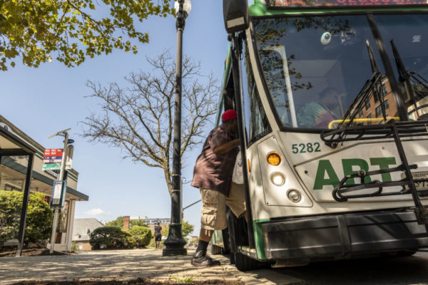
Arlington is looking to operate buses more frequently and expand service with more off-peak and weekend service.
These are just some of the recommendations that could be implemented as part of an overhaul of the municipal bus service, called Arlington Transit, over the next decade. The changes are part of an update to Arlington’s Transit Strategic Plan, which it is required to have by state law and update every six years.
As part of the update, Arlington County will be redesigning service in North Arlington and enhancing service along Columbia Pike, in Pentagon City and Crystal City, and around the under-construction Shirlington Transit Center. The proposed changes also include closing down some underutilized routes, adding service to community destinations such as Long Bridge Park, and ensuring schedules use easy-to-remember time intervals.
This update comes as ridership continues to recover from being slashed in half by the pandemic.
From July 2022 to this March, the most recent ART Bus ridership report available, monthly ridership increased from 130,299 to 164,516. Today, the highest concentration of riders is taking the bus north-south between Columbia Pike or Shirlington and the Rosslyn-Ballston corridor or east-west along Langston Blvd.
Still, there are gaps in service and barriers to bus use that this update is intended to address. In preparation for the strategic plan update, the county says it heard from users that their biggest asks are reliability, frequency and efficiency, as well as a better user experience.
“People want more direct routes with fewer transfers, taking less time to make their trips… [as well as] a better user experience (clean buses, safe and accessible waiting areas, and high levels of customer service and transparency) overall,” the county said.
Right now, reliability can depend on which route users take. ART bus data from March, for instance, shows that on-time performance is higher from Rosslyn to East Falls Church and from Crystal City to Courthouse but lower from Columbia Pike to Rosslyn and Courthouse. The Columbia Pike routes, however, see four to six times the number of riders.
Well, I was wanting to go to the #VisionZero open house at Arlington Mill rec center, but as usual, the 45 @ART_Alert is a no-show *twice in a row* from N Barton St near Courthouse. Been standing here waiting for 40+ minutes. Ironic, yes? pic.twitter.com/o7Xb6ZX3OE
— Theo in Arlington 🏘️🚴💛 (@TheoForARL) April 26, 2023
The county tracked where bus service and demand are mismatched, plus researched popular places people congregate and want to go to — but currently cannot get to easily by bus. County staff specifically looked at places with higher concentrations of people without cars, seniors and people with disabilities or limited English proficiency, among other socioeconomic factors.
It found the following communities, circled in the graphic, could benefit from expanded service.

New routes serving these identified neighborhoods include a new ART 43 providing a “one-seat ride” between Clarendon, Courthouse, Rosslyn and Crystal City — a potential time and cost-saver compared to Metrorail — and a new ART 85, linking Shirlington, Long Branch Creek, Aurora Highlands, Crystal City and Potomac Yard.
These have the support of transit advocacy group Sustainable Mobility for Arlington County (SusMo), which evaluated each of the proposed route changes on its website.
“We’ve looked at the proposed route changes in detail and have a bunch of recommendations, both for routes that need improved frequencies, as well as for routes that are overly meandering, duplicative and should not be a priority in this constrained fiscal environment where both buses and bus drivers are at a premium,” SusMo said.

The pedestrian experience is set to improve in nearly a dozen spots across the county.
The Arlington County Board this weekend is expected to approve two projects for accessibility improvements, along the Rosslyn-Ballston corridor and in three residential neighborhoods.
The Metro corridor contract, for up to nearly $1.4 million, is the second phase of an existing effort to bring the streetscape up to Americans with Disabilities Act standards. The planned improvements include “new sidewalks, curb and gutter, curb extensions, handicap accessible ramps, storm sewer pipes and inlets, paving, pavement markings and signage.”
From a county staff report:
The Rosslyn – Ballston Corridor ADA Improvements Project – Phase 2 sites are located along the Rosslyn – Ballston Corridor. This project reconstructs multiple intersections within the Rosslyn-Ballston Corridor where existing sidewalks, curb ramps or street intersections do not comply with standards of the ADA.
The project undertakes redesign and construction in batches with the highest priority problem areas reconstructed to achieve ADA compliance. The project incorporates a “second set” of improvements previously designated under P14D. It spans multiple neighborhoods, including Buckingham, Ballston-Virginia Square, Clarendon, Courthouse, Rosslyn.
The other project is part of another ongoing effort, the county’s Neighborhood Complete Streets (NCS) program.
It would bring improvements to three residential neighborhoods, including curb extensions to resolve several blocks of sidewalk obstructed by decorative streetlights.
From a staff report, the project would:
Construct one block of missing sidewalk on 14th Street North from North McKinley Road to North Ohio Street, in the Highland Park Overlee Knolls neighborhood;
Construct two improved intersections, with updated curb ramps and reduction of pedestrian crossing distances, on 8th Road South in the Arlington Mill neighborhood;
Construct eight curb extensions to relocate existing Carlyle Streetlights currently obstructing the sidewalk and provide an accessible path along three blocks of existing sidewalk on South Irving Street, in the Arlington Heights neighborhood
“The Neighborhood Complete Streets program was approved by the Arlington County Board at its January 2016 meeting,” says the report. “The program was intended as a replacement to and evolution of the prior Neighborhood Traffic Calming (NTC) program, which built approximately 175 projects designed to slow vehicle speed. The NCS program was designed to holistically address inadequacies in the complete streets paradigm, outlined in the Master Transportation Plan.”
“A complete street is one that provides facilities for pedestrians, cyclists, transit riders and motorists to each move comfortably and safely through the community,” the report notes. “Project requests were to be solicited from community members, prioritized based on objective data, and selected with consultation and oversight from the [Neighborhood Complete Streets Commission], following a public engagement period.”
Photo via Google Maps
A long-planned-for second entrance to the Crystal City Metro station is set to hit a milestone during the Arlington County Board meeting tomorrow.
The Board on Saturday is set to approve a $117.2 million contract with JBG Smith and Clark Construction, which intend to design and build an east entrance to the station on the northwest corner of 18th Street S. and Crystal Drive.
JBG Smith approached the county with an unsolicited proposal to undertake the project and, in 2020, the county struck a deal with the developer. It was one of the five transportation projects associated with Amazon’s second headquarters, including a pedestrian bridge to Reagan National Airport and an at-grade Route 1.
This May, JBG Smith and Clark submitted 30% complete designs and the $117.2 million price tag. Since then, county staff and the developers have been negotiating the terms of the contract, which would hold the developers responsible for budget overages.
Project costs have increased by a few million dollars since 2022, when JBG Smith and the county agreed to tweak the project to save $13 million from the then-estimated total of $126 million.
In a report, the county says this entrance project is targeting one of Arlington’s most heavily used Metro stations in an area expected to grow even more in the near future.
“The Metrorail station serves high-density residential buildings, office buildings, and retail development,” the report said. “The station is also a major transfer point for Metrorail, commuter bus and rail, and premium bus service.”
The new entrance will provide a direct route accessible to people with disabilities and forge a better connection to the Virginia Railway Express station to the east.
When the Board reconvenes in September, members are expected to consider a separate agreement with WMATA, the county report said. It will outline the county’s role overseeing design and construction and how it will coordinate with WMATA.

But this is not the only second Metro entrance project taking a step forward on Saturday.
Next up, in Ballston, the Board is slated to accept $4.5 million in Northern Virginia Transportation Commission I-66 Commuter Choice Program Funds for a long-envisioned western entrance at the intersection of N. Fairfax Drive and N. Vermont Street.
The county has pooled together a hodge-podge of funding sources, including an $80 million from the Northern Virginia Transportation Authority, approved last summer. NVTA helped cover the cost to develop design costs in 2016 but denied a 2019 request for $33.5 million.
Despite these funding wins, costs continue rising: a county report now estimates a price tag of $150 million, up from $140 million in 2021 and $130 million in 2019.
The county expects to have a final estimate after WMATA finishes reviewing the 35% complete plans. Then, Arlington County will seek out a company to finish the designs and build the project.
“A second station entrance will improve access from the Glebe Road area and growing development in the western part of Ballston. The project will also improve egress in the event of an emergency incident requiring evacuation from the station and train platforms.”
There will be two street-level elevators and either escalators or stairs to an underground passageway and a new mezzanine with stairs and elevators to the train platform. The new entrance will have fare gates, fare vending machines and a station manager kiosk.
The project will come with improved street-level transit connections.


Changes might eventually be coming to the busy stretch of Glebe Road between Columbia Pike and I-66 in Ballston.
The Virginia Dept. of Transportation today kicked off the public engagement process for a study of the state-maintained stretch of arterial roadway.
The study, which will take about a year and a half, is part of a VDOT program to “develop comprehensive, innovative transportation solutions to relieve congestion bottlenecks and solve critical traffic and safety challenges throughout the commonwealth.”
A new public survey for the study is open through Thursday, July 27. It notes that Glebe Road is a “major north-south travel corridor for Arlington County, and the segments in the study area are in the County’s High Injury Network.”

Earlier this year ARLnow reported that an intersection in the study area, S. Glebe Road and 9th Street S., was on tap to get some safety upgrades — potentially to include a traffic signal — in response to community concerns, particularly among cyclists.
VDOT said on its survey page that the study will only result in proposals and will not automatically lead to construction.
“This STARS (Strategically Targeted Affordable Roadway Solutions) study… will consider and develop potential safety and operational improvements for all users in the study area and develop cost estimates for the preferred alternatives,” the department said.
“The study will not set construction dates for any of the alternatives,” continued VDOT. “The purpose of this study is to develop proposed improvements that localities can pursue for funding, and to consider including in their comprehensive plans.”
The portion of Glebe Road being studied has been the scene of numerous crashes in recent memory, including a crash in the Ballston area that injured multiple people in April 2022.
More, below, from a VDOT press release.
The Virginia Department of Transportation is seeking feedback on a STARS (Strategically Targeted Affordable Roadway Solutions) study assessing potential safety, multimodal and operational improvements for over two miles of Glebe Road (Route 120) between Columbia Pike (Route 244) and I-66. Glebe Road averages about 29,000 vehicles a day within the study limits.
VDOT invites residents and travelers to take an online survey regarding corridor priorities. This feedback will be used to help develop improvement alternatives that will be evaluated and presented during another opportunity for public comment scheduled this fall.
The survey, which has a translation tool for Spanish and many other languages, is available at virginiadot.org/GlebeSTARS through July 27. Comments can also be sent to [email protected] or to Mr. Bobby Mangalath, P.E., Virginia Department of Transportation, 4975 Alliance Drive, Fairfax, VA 22030.
The study is expected to be completed this winter. It does not set construction dates for any improvements but develops proposed improvements that localities can pursue for funding.
VDOT ensures nondiscrimination and equal employment in all programs and activities in accordance with Title VI and Title VII of the Civil Rights Act of 1964. If you need more information or special assistance for persons with disabilities or limited English proficiency, contact VDOT Civil Rights at 703-259-1775.
Ballston looking west down Wilson Boulevard at Glebe Road, October 1971. Pre-Metrorail, pre-Car-Free Diet. #ThrowbackThursday. https://t.co/UihRdovEZU pic.twitter.com/1IymGwpBXa
— Arlington Department of Environmental Services (@ArlingtonDES) July 13, 2023