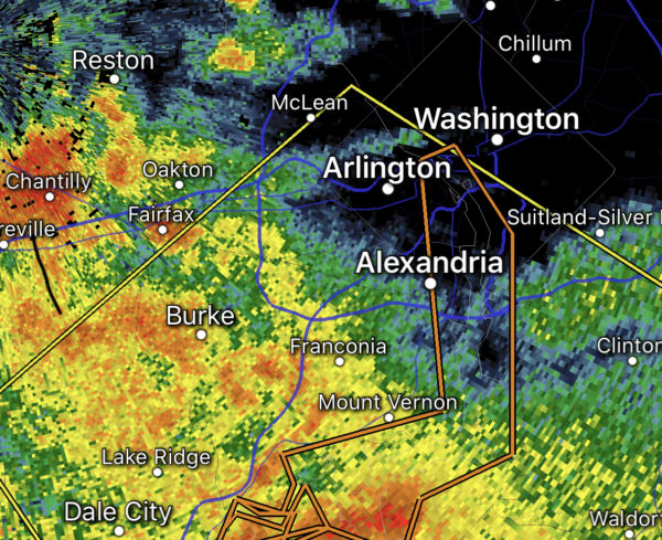
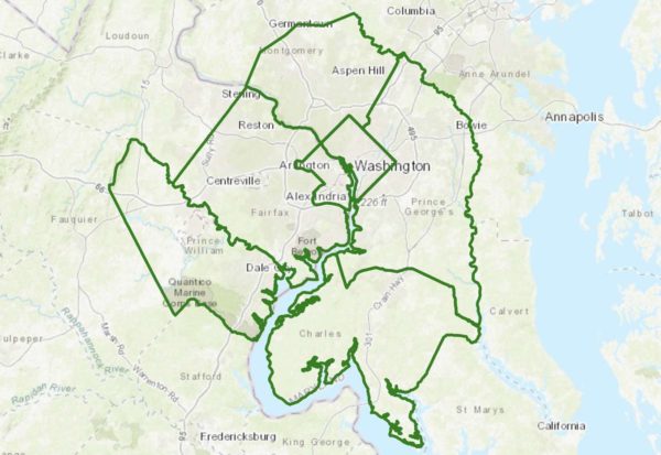
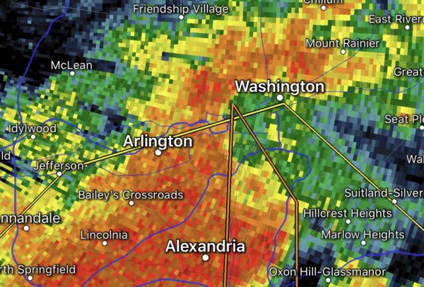
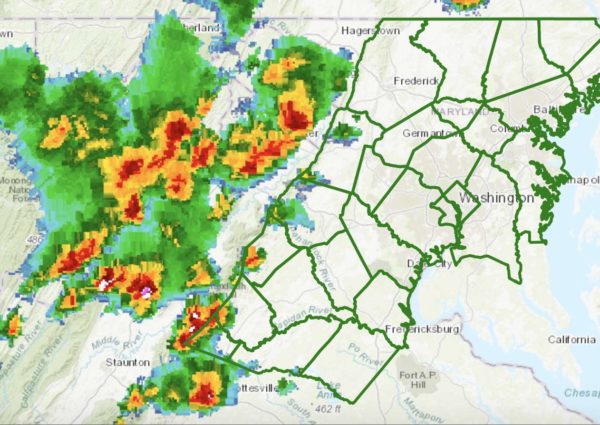
This winter in Arlington has been an anomaly.
It’s the only winter since 1932 in which the temperature has failed to drop below 22 degrees. And it’s generally been cloudy, rainy and — well — pretty gloomy.
This winter in Arlington has been an anomaly.
It’s the only winter since 1932 in which the temperature has failed to drop below 22 degrees. And it’s generally been cloudy, rainy and — well — pretty gloomy.
The Flood Watch has been cancelled, but now the wind is the next possible hazard Arlington and the D.C. region will face.
The National Weather Service has issued a Wind Advisory from 9 a.m. to 3 p.m. Friday. Gusts of up to 50 mph are expected.
Expect gusty winds to start whipping up soon.
Arlington and much of the region is under a Wind Advisory from 11 a.m. to 5 p.m. today. Forecasters say gusts of up to 50 mph are possible, which could down trees and power lines.
(Updated at 6:45 p.m.) Some local roads around Arlington are becoming snow-covered as moderate-to-heavy snow continues fall into the early evening hours.
Early dismissals for the federal government and local schools resulted in an early rush hour, with I-66, I-395 and Columbia Pike jammed as of 2:45 p.m. Conditions have since improved somewhat, but slow traffic remains on large portions of 395 in Arlington.
Update at 4:15 p.m. — See the latest snow updates and photos here.
Update at 12:55 p.m. — Arlington County government offices and facilities are remaining open for the time being, but parks department programs in school and park facilities are cancelled after 2 p.m., the county says.
(Updated at 3:10 p.m.) The worst of today’s fog is starting to lift after an earlier Dense Fog Advisory that was in effect for Arlington and surrounding areas
The fog has prompted delays at Reagan National Airport.
If you’re outside, on the road, or looking out of a window tonight, you won’t be able to see very far in front of you.
The National Weather Service has issued a Dense Fog Advisory for Arlington and the region, warning about hazardous driving conditions due to low visibility.
(Updated at 3:55 p.m.) Though it’s likely to be more wet than wild in Arlington, Wednesday morning’s commute may still be made more difficult by snow.
Up to an inch of snow is expected to fall overnight, though temperatures are expected to stay above freezing. Roads are expected to remain mostly clear locally, but the first snowfall of the season may nonetheless cause some concerns for motorists during the morning rush.
Much of the D.C. region, including Arlington, will be under a Wind Advisory starting tonight.
Strong winds with gusts up to 50 mph are expected to start whipping up Wednesday night and will continue through Thursday afternoon, making for a blustery Thanksgiving holiday.
Arlington County and surrounding areas are under a Freeze Warning starting at 2 a.m. Saturday morning.
Freezing temperatures, which could kill crops and some vegetation, are possible overnight in Arlington, D.C. and other parts of Northern Virginia and Maryland.
Update at 10:45 p.m. — Power has been restored to most of the outage area, but additional outages are possible overnight. On the heels of a Severe Thunderstorm Warning that just expired, a Wind Advisory is now in effect until 4 a.m.:
…WIND ADVISORY IN EFFECT UNTIL 4 AM EDT FRIDAY… * WHAT…WEST WINDS 15 TO 30 MPH WITH GUSTS UP TO 50 MPH EXPECTED. * WHERE…PORTIONS OF THE DISTRICT OF COLUMBIA, CENTRAL, NORTH CENTRAL, NORTHERN AND SOUTHERN MARYLAND, NORTHERN AND NORTHWEST VIRGINIA AND PANHANDLE WEST VIRGINIA. * WHEN…FROM 6 PM THIS EVENING TO 4 AM EDT FRIDAY. * IMPACTS…GUSTY WINDS COULD BLOW AROUND UNSECURED OBJECTS. TREE LIMBS COULD BE BLOWN DOWN AND A FEW POWER OUTAGES MAY RESULT. PRECAUTIONARY/PREPAREDNESS ACTIONS… USE EXTRA CAUTION WHEN DRIVING, ESPECIALLY IF OPERATING A HIGH PROFILE VEHICLE. SECURE OUTDOOR OBJECTS. &&
A Tornado Watch has been issued for Arlington and the D.C. region as severe storms threaten dangerous conditions amid tonight’s Halloween festivities.
The Tornado Watch is in effect until midnight.