Better signage and wider lanes may be on their way for the Custis Trail.
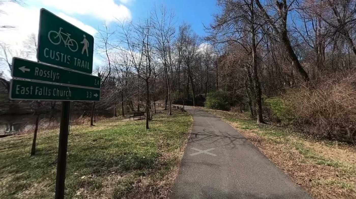
The four-mile paved trail between the Key Bridge and the W&OD Trail is “a very useful short cut for area cyclists” getting to downtown D.C., but has some missing signage and limited sight lines, says local bicycling guide BikeWashington.org.
This winter, Arlington’s Environmental Services and Parks and Recreation departments began reviewing the trail to determine what kinds of improvements should be made.
The county says it intends to widen the trail to 12 feet in width where possible, enhance trail markings and wayfinding and improve existing lighting.
“This review will document the existing conditions of the trail and its access points, identify maintenance and improvement opportunities, and look for opportunities for future investment in the trail that delivers on county goals for park access, recreation, and multimodal transportation,” a project overview says.
Through Sunday, Feb. 18, people can submit feedback on how they use the trail, what their current experiences are and what changes they would like to see.
So far, resident feedback has raised concerns about poor and inconsistent lighting and paving, hazards from culverts and tree roots, poor visibility and a troublesome intersection near the Key Bridge that commenters say could benefit from a redesign.
The county is due to release preliminary infrastructure recommendations and a draft report in the spring, followed by a final report in the summer.
Photo via Google Maps
Two years ago, a motorcyclist died in a crash involving a school bus near Drew Elementary School in Green Valley.
A week later later, a car seriously injured a toddler who was playing in the sidewalk intersecting with an alley in Westover.
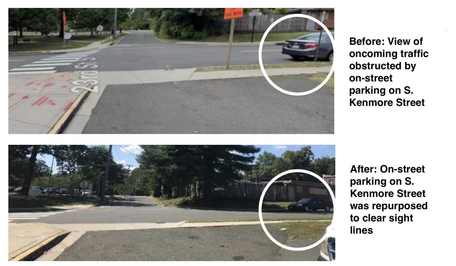
Following those two crashes, Arlington County embarked on a county-wide look at alleys to identify possible problems, from insufficient signage or markings to degraded road conditions. This year, it made upgrades to around a dozen of the 100 alleys it reviewed.
The 23rd Street S. alley in Green Valley, where witnesses say the motorcyclist exited at a high speed and died trying to avoid hitting a school bus, had parking spaces removed to improve sight distances, Arlington Dept. of Environmental Services spokeswoman Katie O’Brien said.
Meanwhile, the Westover alley at N. Longfellow Street and 15th Road N., near where the toddler was seriously injured, had a “watch for pedestrians” sign added, according to a county map.
Neighbors previously said this alley was frequented by cyclists and pedestrians, including students from nearby schools, but had dangerous blind spots. This included untrimmed hedges, which were cut around the time the toddler returned home from the hospital.
After evaluating sight line obstructions such as foliage, barriers and parked vehicles, and checking for unclear or worn signage and pavement markings, the county made changes to several other alleys.
Alleys in East Falls Church, Ballston and Alcova Heights had pedestrian warning signs added, while faded signage was replaced at a second alley in Alcova Heights.
Parking was repurposed to improve sight lines at an alley in Bluemont while a “no parking” sign was added to a second Green Valley alley where neighbors said parked cars blocked visibility.
Changes were made through general funding since they were small in scale, O’Brien said.
Sometime next year, three residential streets in Arlington without sidewalks could get upgrades to allow for safer pedestrian and cyclist use.
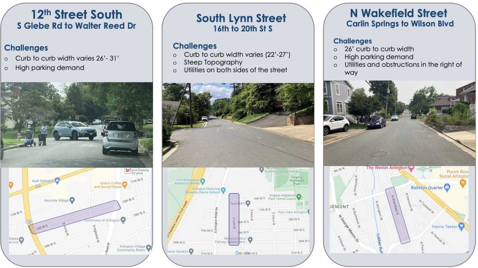
To help address demonstrated safety and access issues on S. Lynn Street, N. Wakefield Street and 12th Street S., Arlington County’s Neighborhood Complete Streets Program is considering piloting “shared streets.”
On these streets, the county would slow down traffic and give cyclists and pedestrians more space through signs, barriers and other features, rather than building a sidewalk.
County staff picked these streets because they have incomplete sidewalks and characteristics “that make adding a sidewalk prohibitively difficult,” says Neighborhood Complete Streets Program Manager Michelle Stafford.
These characteristics include limited public right-of-way, difficult terrain and high parking demand. The streets also ranked above other streets nominated for the pilot program because of their crash histories as well as their proximity to schools, commercial corridors and transit.
“People currently drive, bike and walk in the street in these locations, but we can add features to the street to make that shared street conditions safer and more comfortable for all,” Stafford said in a recent presentation.
The identified streets in the Arlington Ridge, Douglas Park and Bluemont neighborhoods, and the challenges they pose for adding sidewalks, are as follows:
Shared streets can surmount these challenges, according to pilot project manager Brian Shelton.
“Shared streets can meet the desires of adjacent residents and function foremost as a public space for recreation, socializing and leisure,” Shelton said. “Many streets in Arlington already function as a shared street, however, we are missing some of the treatments which would enhance pedestrian comfort on these roadways.”
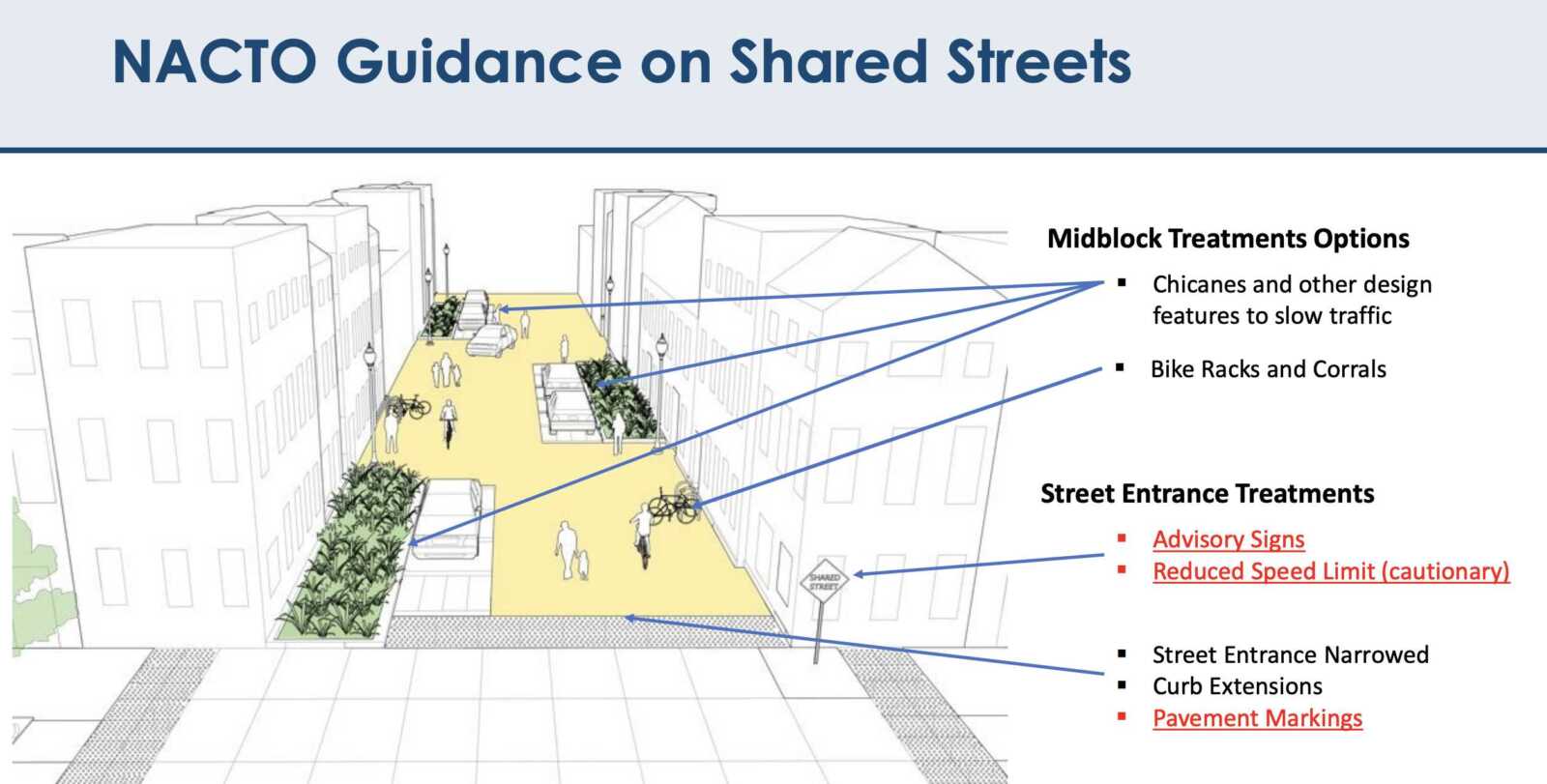
Shelton said staff have looked at recommended shared street tools from the National Association of City Transportation Officials, or NATCO, and opted to pursue a handful of strategies that make use of temporary materials and do not require significant construction.
These include midblock treatment options, such as chicanes — which narrow the road such that drivers are forced to slow down — and street entrance changes, including curb extensions.
Entrances to shared streets also typically have advisory signs and pavement markings to “eliminate the confusion of how the street is intended to be used,” Shelton said.
This fall, the county solicited feedback from residents on how the projects might change how they feel travelling these roads. This input will be used to refine designs, which are set to be finalized for funding hearings in early spring of next year.
Later this coming spring, the county expects to start implementing these shared streets. County staff will monitor these streets to ensure each corridor is functioning as intended, per the county website.
A nearly $20 million project to make Boundary Channel Drive and the I-395 interchange near Crystal City and the Pentagon safer has resulted in significant traffic pattern changes.
Last week, the Virginia Dept. of Transportation permanently closed two ramps: the southbound I-395 ramp to eastbound Boundary Channel Drive and the eastbound Boundary Channel Drive ramp to southbound I-395.
The closures will allow VDOT to reconfigure the ramps between I-395, Boundary Channel Drive and Long Bridge Drive.
The traffic pattern changes are the next step in a multi-year project to upgrade this area for drivers and make pedestrian and cycling improvements nearby. After two years of design work, construction began in September 2022 and will continue through early 2024.
“The project aims to improve safety and operations on that stretch of southbound 395,” Mike Murphy, a spokesman for VDOT, told ARLnow. “One such way is closing those two ramps in order to eliminate and mitigate some of the weaving areas, or spots where you have vehicles trying to get on southbound 395 mixing with vehicles trying to get off.”
The ramp closures will require drivers to do the following:
- Southbound I-395 drivers must now use Exit 10A to access both westbound and eastbound Boundary Channel Drive via the western roundabout.
- Eastbound Boundary Channel Drive drivers must now use the western roundabout to access southbound I-395 via the same loop ramp used by westbound Boundary Channel Drive drivers to access southbound I-395.
ICYMI yesterday… #Arlington: Fri 12/1 @ 5 am, ramps between SB I-395 & EB Boundary Channel Dr to close FOR GOOD. SB I-395 drivers use Exit 10A to access EB Boundary Channel, EB Boundary Channel drivers use the roundabout to access SB I-395.
More: https://t.co/pYrgPOgeOk pic.twitter.com/kruPQIov8Q
— VDOT Northern VA (@VaDOTNOVA) November 30, 2023
Ahead of the closure, public safety watchdog Dave Statter posted to social media a highlight video of the notorious section of highway.
Here, reckless drivers could be seen backing up, crossing multiple lanes of highway traffic and pulling other stunts to circumvent bollards and access the left-hand ramp to Route 1.
A tribute: Less than 12 hours left and I'm getting nostalgic and a bit teary-eyed. As @VaDOTNOVA alerted us yesterday, the ramp from Boundary Channel southbound to I-395S closes permanently at 5 a.m. Countless drivers have convinced themselves it's perfectly fine to dash almost… pic.twitter.com/Y1czlRDPbJ
— Dave Statter (@STATter911) November 30, 2023
The video included several memorable moments over the last two years, including when an Oscar Mayer Wienermobile and a Metro bus both tried the maneuver.
Statter and his videos got a shout out from VDOT as part of the closure announcement.
We have some news to report. As of Fri 12/1 at 5 am, the Boundary Channel Dr onramp to I-395 SB will be permanently closed. @STATter911 is our guy, but we'll be happy to see less of his crash videos from this location. #VaTraffic pic.twitter.com/yFjodYaE4y
— VDOT Northern VA (@VaDOTNOVA) November 29, 2023
Statter also observed that the Boundary Channel Drive onramp, set to close at 5 a.m. on Friday, made it through one more rush hour.
“Did the governor give a short reprieve on the death sentence for the Boundary Channel ramp to I-395S?” he said on X, the platform formerly known as Twitter. “Besides @VaDOTNOVA crews, this bus and contractor’s van appear to be the last vehicles on the ramp just before 8:45 a.m.”
Murphy confirmed that the ramp from southbound I-395 to eastbound Boundary Channel Drive — the one with the green overhead sign saying “Exit 9 to Clark St” — closed around 4:30 a.m. on Friday. The ramp from eastbound Boundary Channel Drive to southbound I-395 closed around 8:45 a.m. Friday.
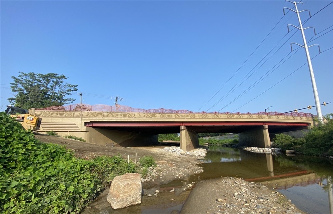
Tomorrow, Arlington County officials will officially mark the reopening of the West Glebe Road Bridge after a year-long rehabilitation project.
Tuesday’s event comes after the bridge opened to pedestrians and cyclists last month, though it reopened to vehicular traffic this March.
In May of 2022, the county embarked on a $10 million project to shore up the 67-year-old bridge linking Arlington and Alexandria near the I-395 ramps to and from S. Glebe Road.
Deemed “structurally deficient” in 2018, the bridge had severely deteriorated since its construction in 1952, requiring partial closures over the years. In April of 2021, the Arlington County Board approved plans to make structural upgrades, improve the lighting and add dedicated lanes for cyclists and pedestrians.
To beautify the bridge, the county once again commissioned stylistic improvements by artist Vicki Scuri, who has adorned other county bridges — notably the bridges over Route 50 in the Courthouse area — with artwork.
Arlington and Alexandria split the project’s costs but Arlington County has taken on sole responsibility for inspecting and maintaining the bridge.
“This project was a partnership between Arlington County and the City of Alexandria to maintain safe passage between the two communities for all residents regardless of mode of transportation,” a county press release said.
More details on the ribbon-cutting, which is open to the public, are below.
When: Tuesday, Sep. 12, 2 p.m.
Where: Pizza Hut, 1049 W Glebe Rd, Alexandria, VA 22305 (this event will be held outdoors. In the case of inclement weather, the event will move into the Pizza Hut)
How to Get There:
- By bus: ART 87 (Arlington side only); DASH 36AB, 103; Metrobus 23AB
- Limited parking available onsite
Who:
- Christian Dorsey, Chair, Arlington County Board
- Justin Wilson, Mayor, City of Alexandria
- Greg Emanuel, Director, Arlington County Department of Environmental Services
- Vicki Scuri, Artist
Plans to replace the nearly 70-year-old Mount Vernon Avenue Bridge are set to move forward with more than $17 million in state funding.
On Saturday, the Arlington County Board is slated to accept the state funding and adopt a resolution committing the county to pitch in local funding. The $28 million project is in an early design phase, according to the county’s project webpage.
“The Mount Vernon Avenue bridge project will replace the deteriorated roadway substructure and reuse the existing piers, which are stable,” per a county report. “The new bridge will include wider sidewalks and bike lanes in both directions.”
The project will extend the new sidewalks and bike lanes to the intersection of Arlington Ridge Road and S. Glebe Road and improve connections from the bridge to the Four Mile Run Trail, according to the county. The northern sidewalks are currently closed to prevent more wear and tear.
The Mount Vernon Avenue bridge is one of five bridges that allow vehicle traffic across Four Mile Run, between Arlington County and the City of Alexandria. It and the W. Glebe Road bridge, both built in the 1950s, were found to be structurally deficient in 2018 and identified for replacement.
“Both bridges are of a similar design and construction and have experienced significant deterioration as they approach the end of their useful life,” according to a county report.
This spring, after a number of weight and access restrictions, the W. Glebe Road Bridge was closed to allow for the replacement of the road deck and beams. Work on the Mount Vernon Avenue Bridge will begin after this bridge reopens.
“The replacement of the West Glebe Road bridge is expected to be substantially completed in fall of 2023 and will be fully open to motorized and non-motorized traffic prior to construction commencing on the Mount Vernon Avenue bridge,” per the report.
Arlington’s Dept. of Environmental Services posted a photo last week of concrete being poured for the bridge replacement project.
This just in from the West Glebe Road bridge. Here we see concrete being piped in from above while crews make it smooth on the bridge deck. Who wants to build their own at home with their Legos? ✋https://t.co/iBZpWFf691 pic.twitter.com/ESyHwH1YqH
— Arlington Department of Environmental Services (@ArlingtonDES) December 8, 2022
The Mount Vernon Avenue Bridge will remain open to motorists, pedestrians and cyclists during construction, although there will be vehicle travel lane reductions, per the county website.
Arlington County and the City of Alexandria will hire a firm to complete the designs, which are currently 30% complete. Then, the project will go out for bid and a contractor will be selected.
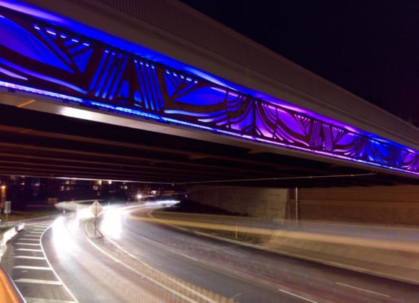
“The new bridge will include integrated art elements by artist Vicki Scuri that will enhance the bridge aesthetically,” according to the county report. “The new bridge and the integrated art elements will be completed simultaneously.”
The county says her forthcoming art installation for the Mount Vernon Avenue Bridge will provide more lighting on the Four Mile Run trail and “connect the design of the bridge to the communities of Arlington and Alexandria,” per the project webpage.
Commuters may be familiar with a current example of Scuri’s work adorning a bridge over Route 50. Her work will also be incorporated into the W. Glebe Road Bridge replacement.
The two bridge replacement projects are funded with a combination of local and state dollars as well as federal funding from the Infrastructure Investment and Jobs Act, which President Joe Biden signed last year.
Of the $17.2 million in state funding that the County Board is set to appropriate, about $4.2 million comes with a local funding requirement. This will be shared equally between Arlington and Alexandria under the terms of an intergovernmental agreement that governs their joint responsibility to maintain and inspect the bridges and share short- and long-term rehabilitation and replacement costs.
Construction is wrapping up at the intersection of Langston Blvd (Route 29) and Glebe Road.
Last week, the traffic signals hanging from wires were swapped out for new mast-arm signals. This week, the contractor is expected to complete the remaining sections of sidewalk, curb ramps, and curb and gutter, according to the county’s project webpage.
These changes were part of a years-long project to add dedicated left turn lanes, make bus stop upgrades, take utilities underground and replace an old water main. The changes were intended to improve safety, access and travel times for motorists, pedestrians and transit riders at the intersection.
And now, the county says the project is almost done.
“Construction on the intersection improvements is nearing the finish line,” the project’s webpage said.
Work was anticipated to be completed by this coming spring, but progress is moving faster than expected.
“Spring ’22 was the expected completion date when we started construction, but work has been ahead of schedule and we now expect substantial completion in September,” Arlington Department of Environmental Services spokesman Eric Balliet said.
It’s a beautiful day to check out the new signal lights at VA-120/Glebe Rd @ US-29/Langston Bl. @WTOPtraffic @ARLnowDOTcom pic.twitter.com/kE6gpKcWQz
— Joe Conway, WTOP (@JoeConwayWTOP) August 27, 2021
The county said it will be releasing a schedule of the project’s final paving and the installation of the final pavement markings, both of which will likely occur at night this month (September).
The first phase of the project, including utility undergrounding, kicked off in 2017. The county has spent years obtaining easements from property owners along Glebe to allow the roadway expansion.
The County Board approved a $3.88 million contract for the remainder of the work in December 2019. Work started on this phase in May 2020, according to the project webpage.
This phase included the new exclusive left-turn lanes along N. Glebe Road “to ensure safer turning movements and reduce delays,” the county said. North-south traffic on Glebe had previously flowed only in one direction at a time, allowing turns without a dedicated turn signal but causing backups during rush hour.
The phase also included the mast-arm traffic signals with new phasing and timing, the upgraded water mains and stormwater infrastructure, enhanced crosswalks and bus stops, widened sidewalks and accessible curb ramps and commercial driveway aprons.
The need for upgrades to Langston Blvd and Glebe Road dates back to studies conducted in 2004.
“[The study] identified considerable traffic backups at the Lee Highway and Glebe Road intersection,” the county webpage said. “The backups resulted in traffic cutting through the neighborhood.”
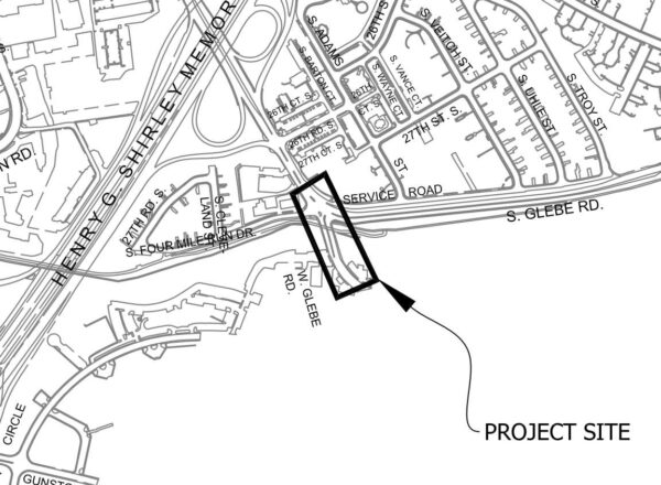
Work could begin soon on the 65-year-old W. Glebe Road Bridge, which Arlington County says is “structurally deficient.”
This Saturday, the Arlington County Board is set to approve a $9.9 million contract that would kickstart the project. Improvements include replacing the top of the bridge, repairing its supports and making it more pedestrian- and cyclist-friendly.
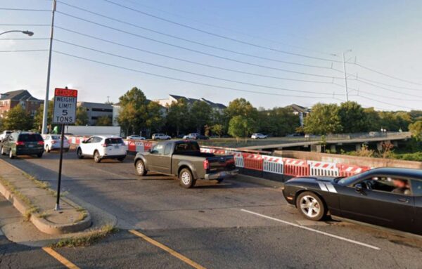
According to the county, the bridge is in poor condition and requires attention soon. The bridge has been restricted to vehicles weighing fewer than five tons since a routine inspection in November 2018 uncovered structural problems.
The bridge “needs immediate superstructure replacement as further deterioration of the beams may result in bridge closure for [an] extended period,” a staff report said.
W. Glebe Road Bridge will remain open to vehicles and pedestrians during construction, which is expected to last 18 months, the county said, adding that extra time is needed to move underground utilities.
“The project includes removing the existing prestressed concrete superstructure and constructing a new superstructure with steel girders and a concrete deck,” the report said. “The project also includes repairing the existing substructures, and installing new,
wider sidewalks, bike lanes, architectural features and enhanced lighting.”
This bridge is the first to be rebuilt as part of an agreement between Arlington and Alexandria to share the costs of rehabilitating and maintaining five bridges across Four Mile Run which connect the two jurisdictions. Once the repairs are complete, Arlington will be fully responsible for inspecting and maintaining the W. Glebe Road Bridge.
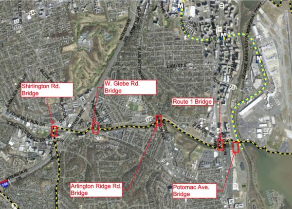
The next bridge slated for attention is Arlington Ridge Road, which needs to be repaired in two to five years, according to the county. Other bridges in the agreement are at Shirlington Road, Route 1 and Potomac Avenue.
The county said it has received community feedback in favor of replacing the bridge, adding separate areas for pedestrian and bicycle traffic and incorporating art.
Such art elements would “connect the design of the bridge to Four Mile Run and the communities that live in the area,” the report said.
According to the county, some people voiced concerns about the length of the project. A shorter build time would require closing the bridge, staff said.
“The public prefers the bridge remain open during the construction period,” the county said.
Photo (1) via Google Maps, (2-3) via Arlington County
The county could soon get started on some eagerly awaited improvements to Wilson Blvd in Virginia Square this spring.
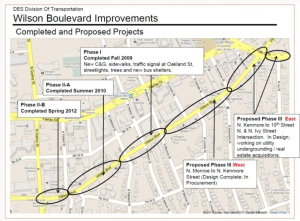
Between 2009 and 2012, Arlington County completed two previous phases of road construction from N. Quincy Street to N. Lincoln Street, adding new sidewalks, streetlights, trees, bus shelters and a traffic signal at Oakland Street.
The second phase was divided into two different areas, with the first one finished in 2010 and the second one in 2012.
Now, last part of the project has been split into “east” and “west” phases along N. Kenmore Street.
The County Board is now set to award Sagres Construction Corp. a contract and $1,084,766 for the work needed for the “west” portion between N. Monroe Street and N. Kenmore Street. Construction could then begin next spring and then wrap the following summer.
For the final section, which spans from N. Kenmore Street to 10th Street N., construction is expected to start in spring of 2020 and then finish in spring of 2021.
Project elements for both “east” and “west” include new curbs and gutters, ADA-compliant sidewalks, traffic signal improvements, Carlyle-style streetlights and trees along the street. Upgrades to the storm sewers and new asphalt paving, signing and markings will also happen, according to the county.
“During the conceptual design process, residents especially noted concern for providing a safe pedestrian crossing at the N. Kenmore Street intersection,” according to county documents.
The Board is set to approve the contract at its meeting Saturday (Dec. 15) as part of its consent agenda, which is generally reserved for noncontroversial items.
Map via Arlington County
Starting this week, construction to improve the intersection of Lee Highway and N. Lynn Street in Rosslyn will significantly narrow a portion of the Custis Trail.
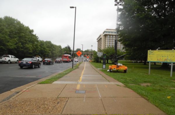
 The Custis Trail will be restricted to six feet wide for the section between N. Fort Meyer Drive and Lynn Street, as crews work to transform one lane of Lee Highway into additional trail width and buffer space.
The trail narrowing will last for nine to 10 months while construction takes place on the south side of the trail.
Construction on the two-year, $9.3 million project officially kicked off in May and will happen in phases to reduce impacts on pedestrians, bicyclists and drivers, according to the county.
Workers will add wider sidewalks, on-street bike lanes and improved curb ramps as the northbound and southbound sections of Lee Highway meet Lynn Street.
The project will also include improvements to the Custis Trail as it runs alongside Lee Highway, including bicycle and pedestrian facility upgrades, lane reconfiguration and widening of the trail.
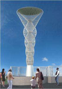
For street beautification efforts, the “Corridor of Light” public art installation will get added to each of the four corners of the Interstate 66 bridge.
The county is helping to fund the construction. The project, expected to wrap up in spring 2020, will require some lane and sidewalk closures.
Photo via VDOT and rendering via Arlington County
McCoy Park, a humble triangle of grass and trees between Lee Highway and I-66 near the new MOM’s Organic Market, is set for some upgrades.
Arlington County is in the midst of a design process for the park. A public open house is planned for Wednesday, Dec. 14 at 7 p.m., in a first floor conference room at Courthouse Plaza (2100 Clarendon Blvd). Residents can also share their thoughts via an online survey on the project page.
The draft plan for the park calls for more landscaping and amenities, including:
- A re-aligned sidewalk
- A seating deck with tables and chairs
- A shade canopy
- An interactive chalk art plaza with Four Square and Tick-Tac-Toe games
- Flowering trees, shrubs and perennials
- Trash and recycling receptacles
- “Discovery path” stepping stones
- New signage
The improvements are expected to be paid for with $125,000 in funding from the developer that built the adjacent shopping center, MOM’s market and apartments.
Additionally, the county is considering offering a dog bag dispenser and a Little Free Library — if it can find sponsors for either amenity.
The design process for the park is expected to wrap up within the first three months of 2017.


