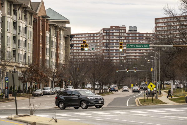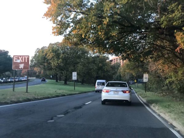
After five years, Arlington County is putting finishing touches on its Complete Street plan to improve walking, biking and driving conditions along a stretch of Army Navy Drive in the Pentagon City area.
The updated plans — which are 90% complete — were presented in a virtual public hearing on Wednesday. County staff are taking public comments via email on this version until Dec. 4, and the final plans will be submitted next summer. Construction on the section of road from S. Joyce Street to S. Eads Street is slated to begin in 2022.
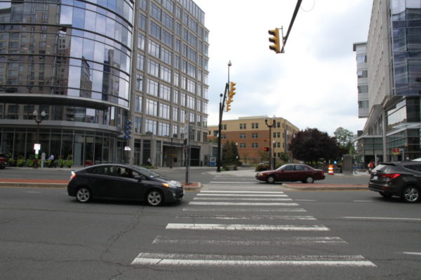
The $16.87-million project aims to reduce conflicts among cars, buses, bikes and pedestrians with narrower lanes, stretches of bus-only lanes, protected left turns and signalized right turns, clearer sidewalks and shorter crosswalks. The south side of Army Navy Drive will have two-way bike lane protected by a line of trees.
“A lot of the signalizations will improve safety, prevent fatalities, reduce collisions, things like that,” Jon Lawler, the project manager, said during the meeting.
Crashes happen frequently in its intersections: Staff said the S. Hayes St/I-395 off-ramp intersection had the second-most collisions of any Arlington intersection in 2016.
The measures mean the new Army Navy Drive will be reduced to two through lanes in each direction, narrowing to one lane east of S. Eads Street.
“This segment has much lower traffic volumes than the other four blocks of the project corridor,” Lawler said in an email.
Reducing a lane of traffic to accommodate a bus lane between S. Joyce Street and S. Hayes Street will actually improve flow because buses will not block traffic while loading passengers, he said.
Traffic lanes will be narrowed to slow down cars, but staff are not planning to propose a lower speed limit, which is 35 miles per hour, Lawler said during the meeting.
Construction is still a ways off. Staff expect construction to begin in the spring of 2022. With work scheduled block by block to minimize disruptions, it could last until the fall of 2024. Original plans had construction starting in 2020 and ending in 2022.
Lawler attributed the delays to the additional tasks needed for a project receiving federal aid.
“For this project, it took much longer to receive our National Environmental Policy Act document approval than we had envisioned,” he said in an email.
Staff skipped the 60% design phase to make up for lost time, he said.
After the medians are removed, work will start on the south side of Army Navy Drive, beginning with the area where Amazon HQ2 will be, along S. Eads Street, and moving west. Once the medians are replaced, the road will be repainted and striped, concluding the project.
Lawler said in the meeting that “we won’t have any conflict” with Amazon construction.
Community feedback led to two major changes, he said. First, another block of protected bike lane was added to connect the bike lane west of S. Lynn Street with the planned protected bike lane starting at S. Joyce Street.
“This way we don’t have a missing link in the system,” Lawler said in the meeting.
Staff could not insert this change into this project, as it is receiving federal funding, so they created a separate capital improvement project to address it, he said.
From S. Lynn Street — near Prospect Hill Park — to S. Eads Street, Army Navy Drive is “pretty uncomfortable to use scooters and bikes on,” Lawler told ARLnow after the meeting. “The changes will provide them a safer route for them to use.”
With the changes, bicyclists on Army Navy Drive will be able to use the major east-west link more easily to connect with the Mount Vernon Trail and get to Washington, D.C., he said.
Another change was to align the bumpy pedestrian ramps with the crosswalk. Initially, the ramps were perpendicular to the crosswalk, which advocates said directs vision-impaired pedestrians into harm’s way.
Arlington is planning to host an open house to mark the start of the development of the county’s Vision Zero Action Plan.
Last July, the County Board directed County Manager Mark Schwartz to develop goals and an action plan for a comprehensive analysis of traffic safety in Arlington as part of the County’s Vision Zero goals — the name for a series of initiatives aimed at eliminating traffic fatalities.
Details on the plan were vague at the time, though similar plans have been enacted in Alexandria, where some changes like traffic calming measures and lane reductions have been famously controversial.
The open house is scheduled for Tuesday, Jan. 28, from 5-8 p.m. at Washington-Liberty High School (1301 N. Stafford Street). An event listing said visitors will be able to learn more about current Vision Zero plans and share their priorities for improving transportation safety in Arlington.
Staff photo by Vernon Miles
The county has kicked off its four-block traffic calming project along N. Stafford Street, north of Washington-Liberty High School.
The project, between Lee Highway and 15th Street N. in Cherrydale, is part of the county’s “Neighborhood Complete Streets” program.
A key feature of the project is the implementation of a “chicane,” or curved design, on the street. The Institute of Transportation Engineers suggests curving a street slows traffic by forcing drivers to “steer back and forth instead of traveling a straight path.”
The traffic calming is necessary because the current road design allows drivers to speed down it.
“The existing roadway is long and straight, has a lot of topography which creates a lot of slope, and these are characteristics of the road that allow vehicles to pick up speed,” said an Arlington Dept. of Environmental Services (DES) official at a recent meeting about the project.
The official noted that observed speeds on the road were not enough to justify “vertical” traffic calming measures like speed bumps, but did call for something “less obtrusive,” like the chicane.
The county is planning to remove remove three to five parking spaces to make room for the chicane changes.
The project includes other upgrades and changes.
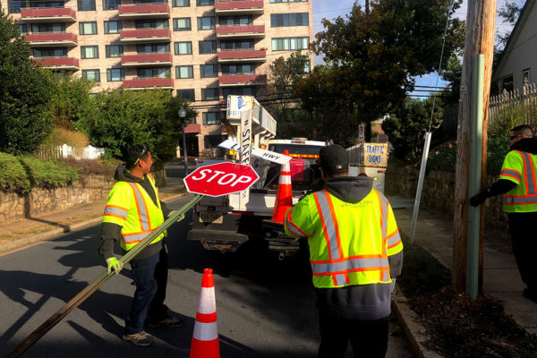
Crews could be seen yesterday (Thursday) replacing the stop signs at the intersection of N. Stafford Street and Lee Highway. One worker noted the sign was “rusty and outdated,” and the replacement sign would have “better reflectivity so drivers know to stop.”
Workers will also soon be installing a new curb ramp at the intersection of 19th Street N. and N. Stafford Street, plus a new all-way stop at the intersection of 17th Street N. and N. Stafford Street, according to DES spokesman Eric Balliet.
The traffic-calming project is intended to:
- Slow vehicle speeds
- Reduce/eliminate crashes
- Meet engineering best practices
- Provide a better pedestrian experience
Arlington officials picked N. Stafford Street for the project after asking for public nomination of dangerous streets across the county. According to the project page, it was the “top ranked street from the first round of [Complete Streets] applications.”
In a public survey by DES, 41% of responders said they would feel “safer” with the proposed changes on N. Stafford Street, while 11% said they would feel “much safer.”
A spokeswoman for the Arlington County Police Department said police have not recorded any crash at the intersection of N. Stafford Street between Lee Highway in the last four years.
The N. Stafford Street improvements are being considered a pilot project. County staff will observe and measure conditions on the street for at least one year, per the project website.
The project will cost an estimated $20,000 for striping, signage, and concrete work. Funding was allocated in the county’s FY 2019-28 Capital Improvement Plan.
Photos via Arlington County
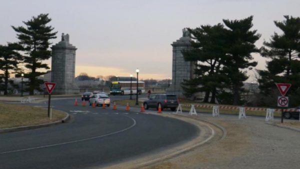
Transportation officials are proposing a host of safety improvements for Memorial Circle, a confusing confluence of roads connecting Arlington National Cemetery to the Arlington Memorial Bridge.
The circle has long been the site of all manner of dangerous crashes, particularly those involving cyclists and pedestrians looking to access the nearby Mt. Vernon Trail or cross into D.C. But the National Park Service has drawn up a series of changes for the roads in the area designed to address the issue, including traffic pattern changes to transform the circle into something more like a traditional roundabout.
“The project area is at a major convergence of regional roadways and modes that interact through a complex series of roadway merges (on-ramps), weaves, diverges (off-ramps), and intersections, resulting in traffic congestion and crashes,” NPS planners wrote in a November environmental assessment. “The proposed action would change the way area users access and circulate through the area by car, bicycle, or foot.”
Officials estimate that the area saw approximately 600 crashes between 2006 and 2012. Lawmakers previously secured some safety improvements for the G.W. Parkway and the circle to try to address the issue. The new NPS proposal would address not only the circle itself, but also the roads approaching the area from both the north and south: S. Arlington Blvd and Washington Blvd.
Perhaps the most substantial change park officials are proposing would be cutting back on one lane of traffic in the circle, in order to “allow the circle to function more like a modern roundabout,” the NPS wrote. That means that drivers in the circle would have the right of way, and anyone entering the circle would need to yield to them.
The NPS also plans to split up an island on the east side of the circle, near where it meets the Memorial Bridge, allowing two westbound lanes coming from the bridge to “bypass the circle and head north onto S. Arlington Boulevard” and one lane of traffic to proceed and enter the circle.
For roads north of the circle, officials are proposing some improved signage at the various intersections, including “fluorescent yellow advance pedestrian crossing warning signs” at some and “rapid flashing beacon” signs at others.
But they’re also envisioning more dramatic improvements, like reducing Washington Blvd down to one lane, and removing both the “existing southern exit ramp connecting S. Arlington Blvd and S. Washington Blvd” and “the existing far left exit lane of S. Arlington Blvd.”
As S. Arlington Blvd exits the circle, the NPS also envisions reducing the road from three lanes down to two leading up to the crosswalk. The existing far left lane leading onto a ramp to S. Washington Blvd is slated to be removed, as is the exit ramp itself.
The NPS is planning similar pedestrian sign improvements for intersections south of the circle, as well as other lane reductions.
One major change would be the construction of a new concrete island where Washington Blvd enters the circle to its south, allowing two lanes of the road to bypass the circle and reach the Memorial Bridge, and one lane to enter the circle. That would require a slightly widening of the road in the area, the NPS wrote.
The plans also call for Washington Blvd to be reduced from four lanes to three south of the circle “in order to simplify merging patterns,” while the G.W. Parkway would be widened “to add an acceleration lane allowing traffic from Arlington Blvd to enter the parkway in its own dedicated lane before merging onto the two-lane parkway.”
Additionally, the NPS envisions relocating two bike and pedestrians crossings south of the circle. One, located as a trail crossing Washington Blvd, “would be relocated closer to the Circle, to allow pedestrians and bicyclists to cross where vehicle speeds are slower and where drivers are anticipating conflicts.” The other, designed to help people cross the parkway to the southeast of the circle, would be moved slightly further north of the parkway.
The NPS traffic analysis of these proposed changes suggest they’d generate “an overall improvement” in congestion on the roads, in addition to substantial safety upgrades.
People in the bicycling community are pretty skeptical of the latter assertion, however.
Surprise! @NPSGWMP has proposed a few half-assed safety improvements to Memorial Circle. Read about 'em here and decide if you think they'll keep you safe in the crosswalk: #bikedc #bikearlington https://t.co/MZAdUCONY4
— Chris Slatt (@alongthepike) November 29, 2018
Thought 2 – If this were implemented tomorrow, I'd still insist that nobody walk or bike anywhere near it because the crossings aren't safe
— Garrett Hennigan (@gwhennigan) November 29, 2018
The NPS is accepting comments on the plans through Dec. 29.
Arlington Heights Gets New Stop Sign — “The Arlington Heights neighborhood became a safer place for students and other pedestrians on Oct. 30,” after the neighborhood got a new all-way stop sign at the intersection of 2nd Street S. and S. Irving Street. Residents collected some 500 petition signatures in support of adding the stop sign. [InsideNova]
Reminder: Daylight Saving Time — Early Sunday morning is the time to “fall back” as Daylight Saving Time ends and clocks get set back an hour. [USA Today]
Clean Air in N. Va. — “This past summer’s air was among the healthiest in memory across the commonwealth. The summer months were the cleanest in terms of ground-level ozone in at least 20 years, the Virginia Department of Environmental Quality reported on Oct. 31.” [InsideNova]
In past years, Arlington has been ranked as having some of the worst drivers in the nation. That doesn’t surprise Brian Meenaghan, who has started a Twitter account to document what he views as a never-ending parade of bad drivers on his block.
Meenaghan, an Arlington Heights resident, started the Twitter account @BadDriversof1stRdS at the end of April. The account focuses on the worst offenders on the 3600 block of 1st Road S., a one-way street located in a high traffic area around S. Glebe Road, Route 50 and the Thomas Jefferson middle school and community center.
“I started this account as a cathartic thing because we’ve had a lot of frustrations on our little block. We’re about 400-450 feet long as a block and we dead end at a middle school,” said Meenaghan. “We have people whipping up this block and people coming the wrong way from the middle school. Because of the oddity of the exit for Route 50 around Glebe Road, we also have a lot of people turning around in driveways and going back up the wrong way, trying to go back to 50.”
Meenaghan’s main concern is drivers going the wrong way on the one-way street (traffic is supposed to only flow from S. Glebe Road to Old Glebe Road). From cars to school buses and even Metrobuses, Meenaghan has caught all types of drivers driving the wrong way or speeding — or both — on the narrow street. Photos and video posted to the Twitter account document the broken traffic laws. (See some of the tweets, below.)
“I work downtown and I’m not here physically during the day all that much and I personally see three or four people turning around every day. I’m probably outside maybe 45 minutes to an hour before dinner with my daughter and I see in just that short amount of time a lot of people going the wrong way,” said Meenaghan.
The Twitter account is a joint venture with his neighbors, who often supply the photos he uploads to the website. Meenaghan said he and his neighbors have been trying for years to convince Arlington County to implement traffic calming measures on the block.
“My neighbors are all very involved in this,” said Meenaghan. “I’m not here that much so I’m not here to take a lot of these pictures. You miss a lot of them because they happen so quickly. Probably six of my neighbors have given me photos over the last couple of weeks. It’s kind of a group-wide effort.”
Part of the impetus for the effort is that the block is now chock full of children.
“We now have 15 kids on this block. There are only 23 houses and there are 15 kids under the age of 10. There have been five kids born in the last six months,” said Meenaghan. (One could perhaps see the block as a microcosm of the challenges with burgeoning enrollment facing Arlington Public Schools.)
Along with the kids living on the block, the presence of Thomas Jefferson Middle School at the end of the block means that there is a constant stream of kids on the block during the school year. It’s only set to become busier, with continued growth at the middle school and the construction of a new elementary school on the middle school’s former parking lot.
Suspicious Package Shuts Down Va. Square Metro — A suspicious package shut down the Virginia Square Metro station yesterday for part of the evening rush hour. The package was determined to be non-hazardous, according to police.
Traffic Calming Coming to Two Streets — Two Arlington streets — S. Hudson Street between Arlington Blvd and 2nd Street, and 7th Road S. between Carlin Springs Road and Greenbrier Street — will be receiving traffic calming measures. The measures include a narrowing of an intersection, a radar speed display, bike lane markings and additional signage, but no speed bumps. [Sun Gazette]
Sequester Could Be Costly for County — The federal budget sequester, set to take effect tomorrow, could cost Arlington County government between $2 and $3 million in direct federal aid. [Sun Gazette]
Support Website for Arlingtonian Accused of Murder — A support website has been set up for Chris Deedy, an Arlington resident and State Department security agent who is accused of second degree murder in the 2011 shooting of a man in McDonald’s restaurant in Hawaii. Deedy’s lawyer says his client was protecting others when he fatally shot the 23-year-old Hawaiian. “Law enforcement officers shouldn’t be treated like murderers when they protect the public,” says the website. [DeedySupport.com]
Interview with Kanninen — The Democratic website Blue Virginia interviewed Barbara Kanninen, who’s running for the Democratic endorsement for Arlington School Board against incumbent James Lander. Asked why she’s running, Kanninen said: “If we don’t have competition, we don’t have anyone even trying to prove that they’re going to be a good School Board member.” [Blue Virginia]
Two D.C. councilmembers are proposing that the speed limit on residential streets in the District be lowered from 25 miles per hour to 15 miles per hour.
The plan would make the streets safer for pedestrians and cyclists, while adding only a minute or two of travel time to most trips, advocates say.
Critics say such low speeds would be hard for motorists to maintain, would add to the District’s traffic woes and could actually increase incidents of aggressive driving and road rage.
Arlington has been especially conscientious when it comes to ‘traffic calming’ projects in residential neighborhoods. Should the county ask Virginia (a Dillon Rule state) to allow localities to post lower residential speed limits?
The Arlington County Board is set to vote this weekend on a plan to add three landscaped traffic circles to 16th Street S. in the Douglas Park neighborhood.
The $132,000 project — which also calls for the addition of curb extensions, textured pavement crosswalks and painted parking edge lines — is being recommended by the county’s Neighborhood Traffic Calming Committee, as a way to slow down traffic on 16th Street.
The street has “documented speeding problems,” county officials said in a staff report. According to county data, the average speed on 16th Street between S. Monroe Street and S. Quincy Street is 24 miles per hour, with 48 percent of traffic traveling faster than the posted 25 mile per hour speed limit and 15 percent of traffic traveling at 31 miles per hour or higher.
Speed humps were not considered for the traffic calming project, because the “85th percentile” speed required by law for speed hump projects is 32 miles per hour.
This summer, residents of homes along 16th Street were polled on the plan — to add “mini-traffic circles” to the intersections with S. Nelson, Oakland and Pollard Streets. Of those surveyed, 66 percent supported the plan, just above the 60 percent threshold for the project to proceed.
County Board Chairman Chris Zimmerman was likely among those who were polled. Zimmerman’s house is one block away from one of the proposed traffic circles.
(Residents will be asked to maintain the landscaping of the traffic circles.)
One 16th Street resident who opposes the project says she’s worried about the ability of emergency vehicles to navigate the traffic circles.
“My concern is that it’s an emergency response route,” the resident told ARLnow.com, adding that the county should “stop punishing 95 percent of the population for 5 percent — the speeders.”
The stretch of 16th Street in question is located south of Columbia Pike and just west of Glebe Road. The board is expected to vote on the traffic calming plan at its Saturday meeting.
Also on the board’s Saturday agenda is a traffic calming plan for 26th Street between N. Sycamore Street and N. Quantico Street in the East Falls Church neighborhood. The $92,000 project — for a stretch of road that has 71 percent of vehicles traveling above the speed limit — will include curb extensions (numbs) and one “speed cushion.”
Last month, with little fanfare, construction crews arrived in the Chain Bridge Forest neighborhood. By the time they left, the neighborhood’s main thoroughfare, N. River Street, had two new medians strips, two new speed humps and a trio of intersections enhanced with “nubs” that jut a few feet out into the street.
The changes, designed to slow down drivers on a wide, downhill portion of River Street, can hardly be described as “drastic.” But the two-plus year neighbor vs. neighbor vs. county battle that preceded it can be.
Emails obtained under the Freedom of Information Act by opponents of the traffic calming measures reveal that the fight got so nasty, the acrimony even spread to county staff.
“These people have got to get a life. ‘Inherently unfair.’ Seriously? My 6 year old used the unfair complaint the other night when whining about bedtimes,” a county transportation official said of the opposition’s complaints, in an internal email to a colleague. “I’m sure the residents of extreme North Arlington are routinely disenfranchised. Perhaps they should talk to the Department of Justice about election monitoring and human rights violations.”
But Chain Bridge Forest Homeowners’ Association president Terry Dean, who filed the FOIA request, insists that her group — representing 124 households — had legitimate concerns about being left out of the voting process that cleared the way for the traffic calming. In the end, only the 35 households closest to the River Street changes were asked to vote, instead of the neighborhood at large, Dean said.
“[Arlington County] didn’t believe in participatory democracy… basically, they wanted to do what they wanted to do, and it really didn’t matter what the neighborhood thought,” said Dean, a former congressional staffer. “You see that in banana republics, but it’s not supposed to be happening four miles from the Capitol.”
(Twenty-seven of the 35 households voted in favor of the changes, though Dean says a few votes were miscounted.)
Dean insists that from the outset, nobody was opposed to the idea of speed humps on River Street — the original plan when the neighborhood asked for traffic calming measures. It’s only when the county decided to take the traffic calming further — reconfiguring the entrance to River Street from Glebe Road while adding median strips and curb extensions in an effort to “define the travel lanes, slow traffic and improve pedestrian safety” — did the opposition start to organize.
County staff argued that River Street is too steep between 38th Place and 39th Street to install additional speed humps, and said that the reconfigured entrance off of Glebe Road was necessary to convey to drivers that they were entering a residential neighborhood. Opponents, meanwhile, started to question the necessity and nearly $200,000 cost of the changes, given that the average speed on River Street was clocked at 27 miles per hour. About 15 percent of cars were clocked going more than 32 miles per hour, and attempts at speed enforcement by police yielded only four tickets in five hours on one day, and not a single ticket on another day. One county employee referred to the latter enforcement effort as a “fishing expedition” in an email
Older residents worried that the changes would actually make River Street less safe, Dean said, especially during bad weather when navigation gets trickier.
“They are more concerned about these obstacles in the middle of the street” than they are speeding cars, she said. “I have no doubt someone’s going to hit that median once we have ice and snow on the ground… We hope and pray that nobody will get hurt.”
“From an aesthetic point of view it’s ugly as the dickens… a big, ugly mess,” Dean added.
Newly-narrowed South Joyce Street in Pentagon City is losing a few parking spaces to make way for trees.
Over the winter, crews narrowed the portion of Joyce Street from 15th Street to 16th Street. A sidewalk was added to the side of the road facing Virginia Highlands Park, and the width of the street was reduced from 40 feet to about 35 feet.
The changes were intended as traffic calming measures. Narrower streets, the county says, encourage drivers to slow down.
To slow traffic down even more, Arlington has added six car-length planters — three on either side of the street. Trees will be planted in the planters, which each take up what was once a parking space.
“They serve to visually narrow the roadway on a very long stretch that is not interrupted by intersections,” said Traffic Engineering and Operations Bureau Chief Wayne Wentz.
Wentz said that while one side of the street has cars parked on it throughout the day, the other side sometimes lacks parked cars. The empty parking spaces, in turn, make the street appear wider and result in people speeding up. The planters, Wentz said, will do the job of calming traffic even when parked cars aren’t present.
Wentz noted that the roadwork actually added two parking spots to South Joyce Street, so the net loss of parking is only four spots. But one resident worried that park-goers may soon be forced to leave their cars in the adjacent neighborhood.
“Those barriers on the side take up parking spots that fill up quickly during softball season!” said the resident. “I live at South Joyce and 20th and you can bet neighbors will be complaining about increased parking in their neighborhood.”
The construction was paid for by money set aside by the developer of the nearby Pentagon Row shops.
“The changes to Joyce Street were actually development conditions of Pentagon Row,” Wentz said.
Wentz expects the trees to be planted by mid-April. The county’s arborist will decide which type of tree will be planted. In addition to the six planters on the side of the road, road crews also added a planter in the middle of the road at a pedestrian crossing.