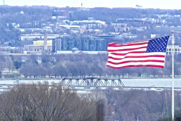
Join Club

Strong wind gusts have brought down trees and knocked out power in parts of Arlington tonight.

More than 3,500 Dominion customers were without power in Arlington as of 10:45 p.m. The power company’s outage map shows sizable outages in the following local areas:

  • Long Branch Creek, including the intersection of S. Glebe Road and S. Arlington Ridge Road
  • Glebewood and Waverly Hills, along N. Glebe Road just south of Langston Blvd, where ARLnow observed power crews and a tree down
  • Old Glebe, Chain Bridge Forest and Rivercrest in far northern Arlington, along the N. Glebe Road corridor

There were also smaller outages in the Dominion Hills and Bluemont neighborhoods. Estimates of when the power would be back on were not available on Dominion’s website.

The outages come amid wind gusts of up to 60 mph in the D.C. metro area, which is under a High Wind Warning. National Airport recorded a 60 mph gust around 10 p.m., according to the National Weather Service.

Damaging winds are expected to continue through about midnight, forecasters said.

Throughout Northern Virginia, Dominion reported more than 43,000 customers without power.

https://twitter.com/PeggyDomEnergy/status/1642354836413767680

14 Comments
Flags blowing in the wind at Arlington County government headquarters (staff photo by Jay Westcott)

(Updated at 9:15 a.m.) Batten down the hatches, it’s going to get pretty windy Saturday.

The National Weather Service has upgraded the earlier High Wind Watch for Arlington to a High Wind Warning, in effect Saturday from noon to midnight.

Forecasters say gusts of up to 60 mph could fell trees, knock out power to parts of the area, and make travel treacherous.

More from NWS:

…HIGH WIND WARNING REMAINS IN EFFECT FROM NOON SATURDAY TO MIDNIGHT EDT SATURDAY NIGHT…

* WHAT…Southwest winds 20 to 30 mph with gusts up to 50 mph Saturday afternoon, becoming northwest 25 to 35 mph with gusts up to 60 mph Saturday evening.

* WHERE…Portions of central and northern Maryland, The District of Columbia, and northern Virginia.

* WHEN…From noon Saturday to midnight EDT Saturday night. The strongest winds are expected Saturday evening.

* IMPACTS…Damaging winds will blow down trees and power lines. Widespread power outages are expected. Travel will be difficult, especially for high profile vehicles.

The expected weather is already postponing outdoor events, like National Landing’s Pink in the Park event.

More via social media:

https://twitter.com/NationalLanding/status/1642125435403218949

0 Comments
Flags on cars for sale flap in the strong winds at a dealer on Columbia Pike (staff photo by Jay Westcott)

Arlington County and surrounding areas, including D.C., are currently under a Wind Advisory.

Gusty winds are expected to persist throughout the day an into the overnight hours Wednesday. With gusts of up to 50 mph, downed trees and power outages are possible.

More from the National Weather Service.

523 AM EDT Tue Mar 14 2023

…WIND ADVISORY NOW IN EFFECT FROM 9 AM THIS MORNING TO 2 AM EDT WEDNESDAY…

* WHAT…Northwest winds 25 to 35 mph with gusts up to 50 mph expected.

* WHERE…Portions of central, north central, northeast, northern and southern Maryland, The District of Columbia and northern and northwest Virginia.

* WHEN…From 9 AM this morning to 2 AM EDT Wednesday.

* IMPACTS…Gusty winds could blow around unsecured objects. Tree limbs could be blown down and a few power outages may result.

PRECAUTIONARY/PREPAREDNESS ACTIONS…

Use extra caution when driving, especially if operating a high profile vehicle. Secure outdoor objects.

2 Comment
Flags blowing in the wind at Arlington County government headquarters (staff photo by Jay Westcott)

Arlington County is under a Wind Advisory for much of the day on Saturday.

Rain showers will give way to fog tonight (Friday) before the clouds clear Saturday and the wind starts blowing. Gusts of up to 50 mph are expected.

The gusty wind combined with waterlogged ground could topple trees and cause power outage.

More, below, from the National Weather Service.

256 PM EST Fri Mar 3 2023

…WIND ADVISORY REMAINS IN EFFECT FROM 10 AM TO 3 PM EST SATURDAY…

* WHAT…West to northwest winds 20 to 30 mph with gusts up to 50 mph expected.

* WHERE…Portions of central, north central, northern and southern Maryland, The District of Columbia and northern Virginia.

* WHEN…From 10 AM to 3 PM EST Saturday.

* IMPACTS…Gusty winds could blow around unsecured objects. Tree limbs could be blown down and a few power outages may result.

PRECAUTIONARY/PREPAREDNESS ACTIONS…

Use extra caution when driving, especially if operating a high profile vehicle. Secure outdoor objects.

0 Comments
Flags blowing in the wind at Arlington County government headquarters (staff photo by Jay Westcott)

Get ready for a particularly breezy afternoon and evening.

Arlington and much of the D.C. region will be under a Wind Advisory, starting at 1 p.m. today (Tuesday).

…WIND ADVISORY IN EFFECT FROM 1 PM THIS AFTERNOON TO 7 PM EST THIS EVENING…

* WHAT…West winds 20 to 30 mph with gusts around 50 mph expected.

* WHERE…The Washington and Baltimore Metropolitan areas, northern and central Virginia, and eastern West Virginia.

* WHEN…From 1 PM this afternoon to 7 PM EST this evening.

* IMPACTS…Gusty winds could blow around unsecured objects. Tree limbs could be blown down and a few power outages may result.

PRECAUTIONARY/PREPAREDNESS ACTIONS…

Use extra caution when driving, especially if operating a high profile vehicle. Secure outdoor objects.

Although some overnight rain dampened the ground, low humidity this afternoon may enhance the risk of wildfires.

Arlington is not immune from such risks and typically sees a few small brush fires each year.

…ENHANCED THREAT FOR THE SPREAD OF WILDFIRES THIS AFTERNOON…

West winds of 20 to 30 mph will gust to 40 to 50 mph will develop this afternoon into early this evening across central Virginia, northern Virginia, and the Shenandoah Valley. These westerly winds will be accompanied by minimum relative humidity values of 20 to 30 percent. Although fuels are relatively damp owing to recent rainfall, they will quickly dry out, leading to an enhanced threat for the spread of wildfires.

Outdoor burning is strongly discouraged during this time. Please refer to your local burn permitting authority on whether you can burn. If you do burn, use extreme caution and ensure fire suppression is readily available.

Also today, there’s a chance of thunderstorms with the passing of a cold front in the early afternoon.

Some of the isolated storms may cross the immediate D.C. region.

0 Comments
Flags blowing in the wind at Arlington County government headquarters (staff photo by Jay Westcott)

If you haven’t noticed, it’s really windy outside — and that has prompted what we believe is the first Wind Advisory of the year for Arlington.

Forecasters caution that downed tree limbs and power outages are possible. Currently, no outages are being reported in Arlington by Dominion, but the power company is reporting nearly 3,600 customers without power in neighboring Fairfax County.

From the National Weather Service:

321 PM EST Fri Feb 17 2023

…WIND ADVISORY IN EFFECT UNTIL 7 PM EST THIS EVENING…

* WHAT…Northwest winds 20 to 35 mph with gusts up to 50 mph.

* WHERE…Northern and central Maryland, the Washington and Baltimore Metropolitan areas, northern Virginia,the Blue Ridge Mountains, and the eastern Panhandle of West Virginia.

* WHEN…Until 7 PM EST this evening.

* IMPACTS…Gusty winds could blow around unsecured objects. Tree limbs could be blown down and a few power outages may result.

PRECAUTIONARY/PREPAREDNESS ACTIONS…

Use extra caution when driving, especially if operating a high profile vehicle. Secure outdoor objects.

0 Comments
Power outage in Arlington as of 10 a.m. (via Dominion)

Update at 3:05 p.m. — Numerous small, scattered outages have been reported around Arlington. The number of Dominion customers in the dark is now down to just over 800, with the larger earlier outage since largely resolved.

Earlier: Today’s frigid wind storm is just getting underway — complete with a recent bout of snow flurries — but many are already without power in Arlington.

As of 10 a.m., more than 1,500 Dominion customers are in the cold, according to the power company’s website.

The following outages were reported on Dominion’s map.

  • 718 customers, in Penrose and Lyon Park
  • 715 customers, between Ballston and Westover
  • 114 customers, in Glebewood
  • At least two smaller outages in Bellevue Forest and Ashton Heights

The Penrose outage has closed Arlington’s Dept. of Human Services offices at Sequoia Plaza, the county announced this morning.

“Dominion Energy continues to closely monitor the extremely cold, windy weather and its potential to impact our Virginia and North Carolina service territory,” the company said in a statement today. “Our crews are positioned and ready to respond to any damage or power outages that may be caused as a result of the ice storm.”

“If you experience a power outage, please make sure you report it to Dominion Energy immediately,” the company added. “Please stay at least 30 feet away from all downed wires and damaged equipment. If you need to report an emergency or a downed wire, please call us at 1-866-DOM-HELP (1-866-366-4357)… We appreciate your patience.”

The county is under both a Wind Advisory and a Wind Chill Advisory today. More outages are possible throughout the day, with 50 mph wind gusts expected.

0 Comments
An icy rail in the Shirlington area (Flickr pool photo by Erinn Shirley)

(Updated at 7:35 a.m.) Arlington will be under both a Wind Advisory and, later, a Wind Chill Advisory on Friday.

The wind is expected to whip up starting Friday morning, then temperatures will plummet throughout the day. The combination will lead to dangerous conditions for anyone outside.

To make matters worse, the strong winds — gusts of up to 50 mph are expected — may knock out power and leave some locals in the cold.

From the National Weather Service:

737 PM EST Thu Dec 22 2022

…WIND ADVISORY REMAINS IN EFFECT FROM 8 AM TO 2 PM EST FRIDAY…

* WHAT…West winds 20 to 30 mph with gusts up to 50 mph expected.

* WHERE…Portions of central, north central, northeast, northern and southern Maryland, The District of Columbia and central and northern Virginia.

* WHEN…From 8 AM to 2 PM EST Friday.

* IMPACTS…Gusty winds could blow around unsecured objects. Tree limbs could be blown down and a few power outages may result.

* ADDITIONAL DETAILS…Bitterly cold wind chills will be ongoing during the time of this high wind event. It is essential to make preparations now for extreme cold conditions with the potential for loss of power.

PRECAUTIONARY/PREPAREDNESS ACTIONS…

Use extra caution when driving, especially if operating a high profile vehicle. Secure outdoor objects.

Also from NWS:

725 PM EST Thu Dec 22 2022

…WIND CHILL ADVISORY REMAINS IN EFFECT FROM 7 PM FRIDAY TO 10 AM EST SATURDAY…

* WHAT…Very cold wind chills expected. Wind chills as low as 10 below zero.

* WHERE…Portions of central, northeast, northern and southern Maryland, The District of Columbia and central and northern Virginia.

* WHEN…From 7 PM Friday to 10 AM EST Saturday.

* IMPACTS…The cold wind chills could result in hypothermia if precautions are not taken.

* ADDITIONAL DETAILS…The highest wind speeds will be Friday into Friday evening. Affects from the extreme cold could be made worse due to power outages.

PRECAUTIONARY/PREPAREDNESS ACTIONS…

Use caution while traveling outside. Wear appropriate clothing, a hat, and gloves.

Meanwhile, icy roads are possible due to a rapid freeze of wet surfaces following the passing of an arctic front, forecasters say.

Flickr pool photo by Erinn Shirley

0 Comments
Heavy rain along the Potomac River, with Rosslyn in the background (staff photo by Jay Westcott)

The remnants of Hurricane Nicole are heading our way, meaning a soggy and stormy Veterans Day is on tap.

The rain will start falling early Friday morning. Downpours and gusty winds are expected to follow as the day goes on, before the skies clear Saturday.

Officials are encouraging local residents to get ready now, clearing leaves from storm drains and gutters.

The storm will make for some large, soggy leaf piles on the side of the road. Arlington County does not start its vacuum leaf collection process until next week.

So far, no watches or warnings have been issued for the county. Nicole is packing a threat of localized flooding and isolated tornadoes, but Arlington is outside of the zones where those threats are most likely.

More via Twitter:

https://twitter.com/readyarlington/status/1590724482364100609?s=46&t=bbAwMb2Xxziyg8Pqu9b9ww

5 Comments
Rains from Hurricane Ian approaching the D.C. area (via National Weather Service)

Rain and wind associated with Hurricane Ian are expected to ramp up tonight in the D.C. area, but the biggest local impacts might be on your weekend plans.

Already a number of Arlington events have been modified or rescheduled, including:

No land-based watches or warnings have been issued for Arlington ahead of the storm, so far, but a Gale Warning has been issued for watercraft on the Potomac. Wind gusts of up to 40 mph are expected between 8 p.m. tonight and 6 a.m. Saturday, according to the National Weather Service.

Rain from the storm system could last all weekend and drag into Tuesday, but after an extended stretch of dry weather little to no flooding is expected locally.

Still, authorities are asking Arlington residents to be prepared just in case.

https://twitter.com/ReadyArlington/status/1575573149550518273

0 Comments
Power outage in Clarendon (map via Dominion)

(Updated at 2:05 p.m.) More than 800 Dominion customers are without power in parts of Clarendon, Lyon Village and Cherrydale.

The outage was reported around 1:30 p.m. Police are on scene along Wilson Blvd in Clarendon, helping to direct traffic that backed up as a result of stop lights going dark.

Dominion says the cause of the outage is a “circuit out.”

Rain and wind have been picking up this afternoon, ahead of potential severe weather later today. The National Weather Service has now issued both a Severe Thunderstorm Watch and a Wind Advisory for Arlington — as well as much of the region.

Forecasters say that wind gusts up to 50 mph may bring down trees and large branches. From NWS:

141 PM EDT Thu Mar 31 2022

…WIND ADVISORY IN EFFECT UNTIL 8 PM EDT THIS EVENING…

* WHAT…South winds 15 to 25 mph with gusts up to 50 mph expected.

* WHERE…District of Columbia, and portions of central, northern and southern Maryland, central and northern Virginia and panhandle West Virginia.

* WHEN…Until 8 PM EDT this evening.

* IMPACTS…Gusty winds could blow around unsecured objects. Isolated tree damage and a few power outages may result.

PRECAUTIONARY/PREPAREDNESS ACTIONS…

Use extra caution when driving, especially if operating a high profile vehicle. Secure outdoor objects.

Peggy Fox, a spokeswoman for the power company, said this morning that residents should charge their mobile devices in anticipation of the expected windy weather.

0 Comments
×

Subscribe to our mailing list